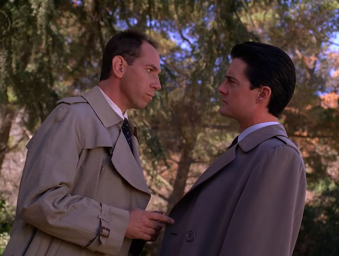
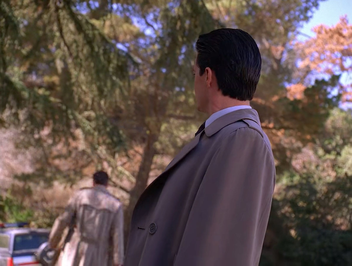
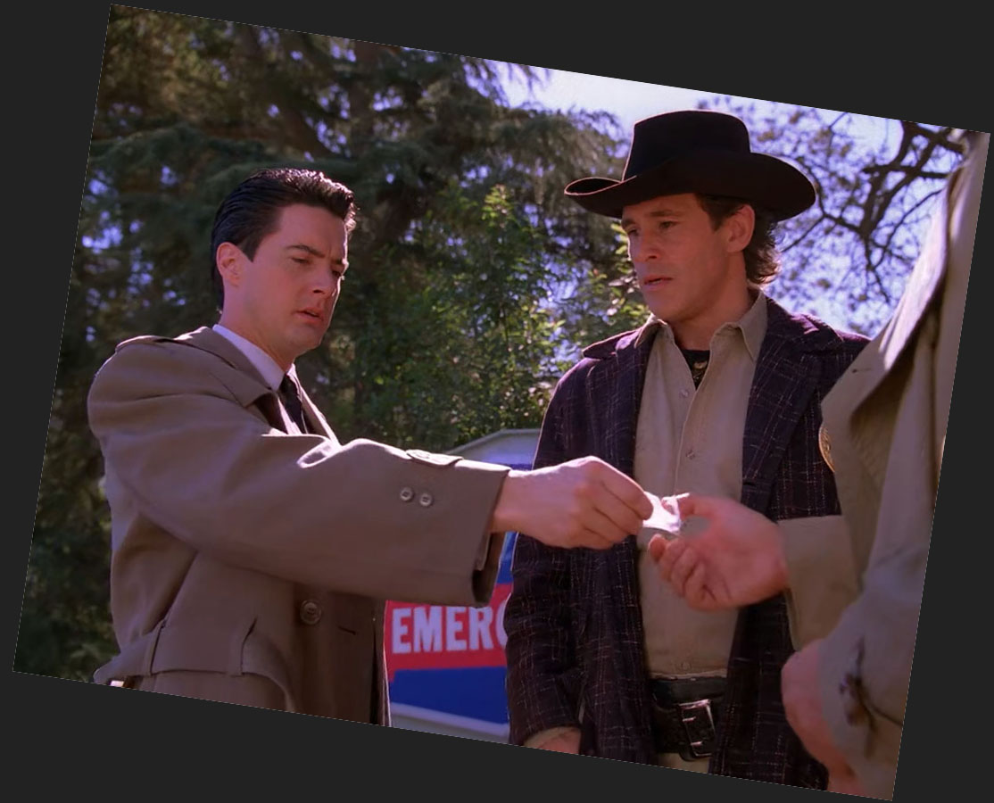
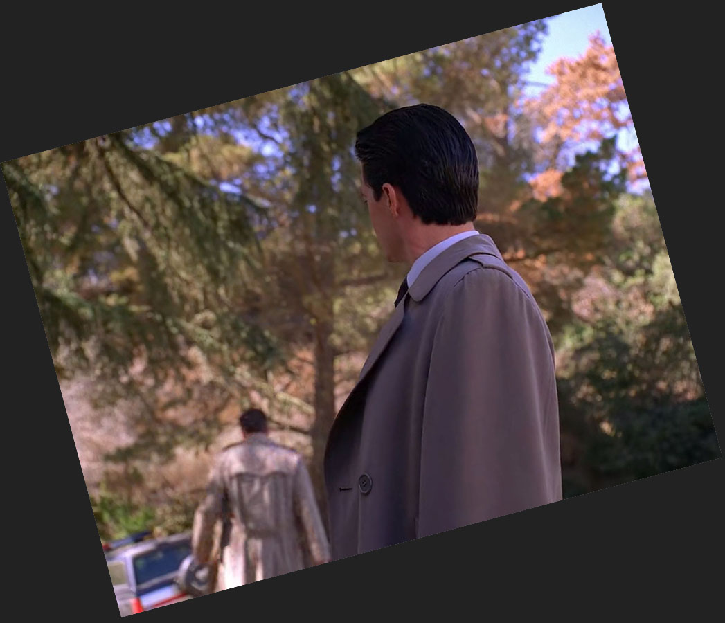
At the beginning of Episode 2009, Agents Rosenfield and Cooper join Sheriff Truman and Deputy Hawk for a walk to discuss the latest clues from Maddy Furgeson’s death. The scene is supposed to take place outside Calhoun Memorial Hospital (more on that in a minute). In reality, the crew shot this scene at the popular Twin Peaks film location, Franklin Canyon Park in California.
FINDING THE LOCATION
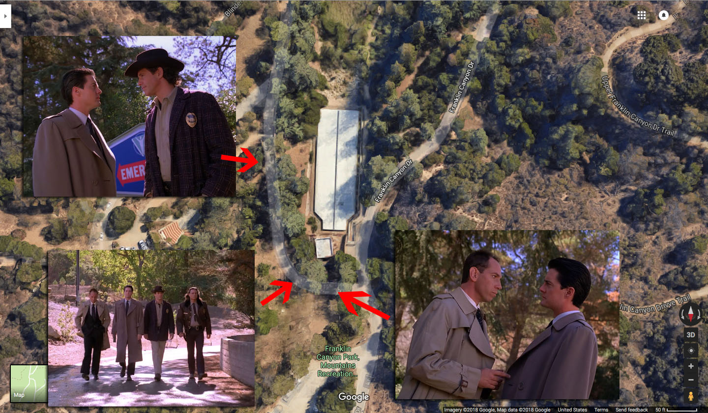
Franklin Canyon Park is located around 2600 Franklin Canyon Drive in Beverly Hills, California. It served as the backdrop for several scenes including Windom Earle’s cabin, Audrey Horne and John Justice Wheeler’s picnic and Glastonberry Grove.
The map above shows where several scenes from Episode 2009 took place. The approximate coordinates are 34°07’21.7″N 118°24’33.6″W.
OFFICERS WALKING
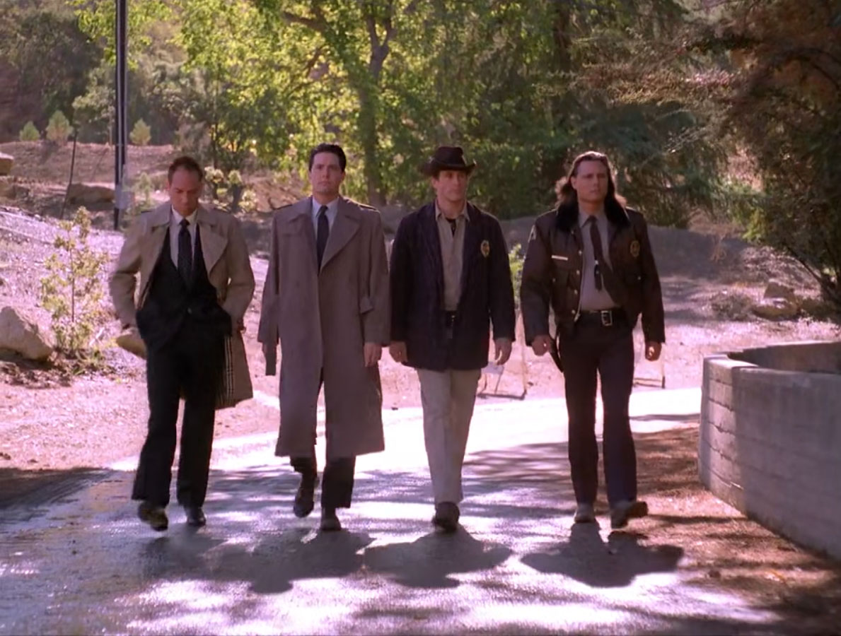
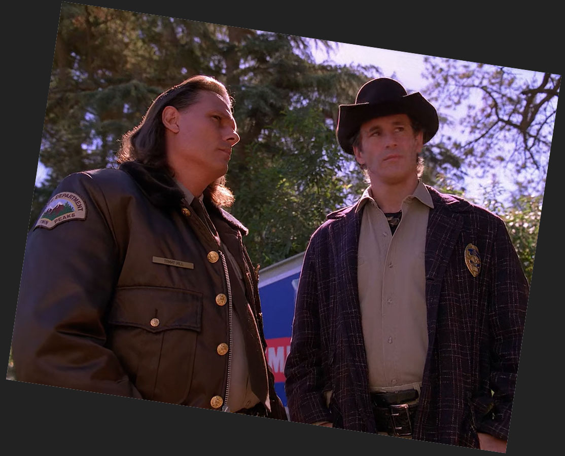
Let’s start with the image of the four law enforcement officers walking.
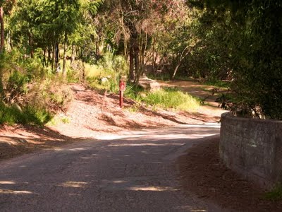
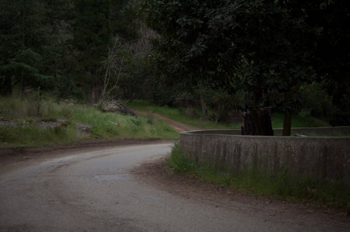
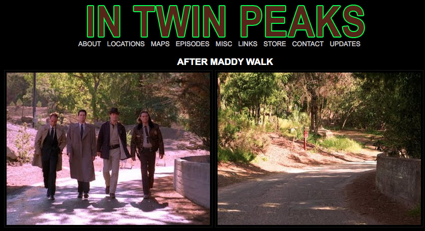
I give credit once again to Charles from the former InTwinPeaks.com website who first posted about the location. Above are two images from his site, one from the late 2000s and one from April 6, 2011.
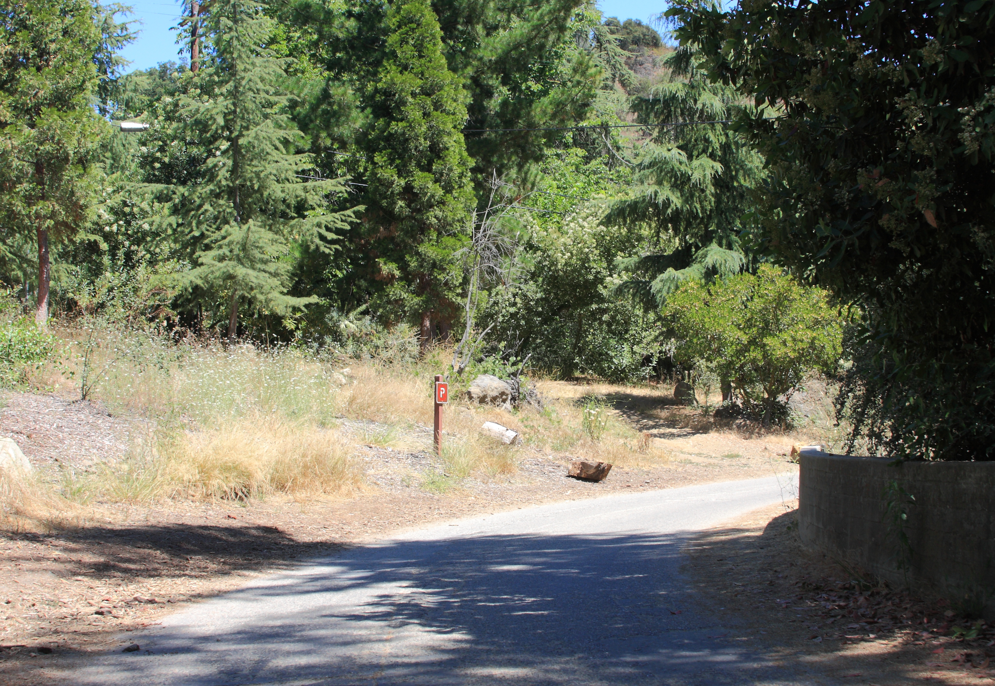
I first visited the location on July 13, 2010 and took the above image.
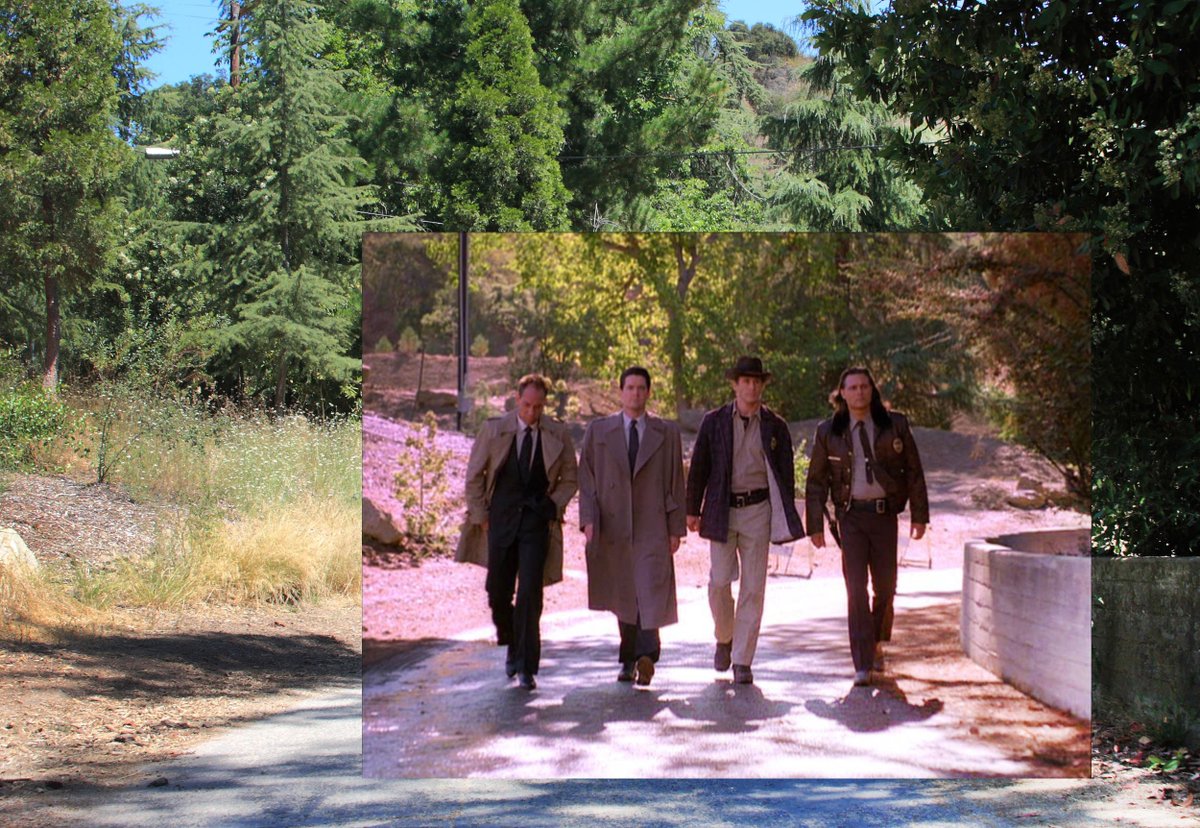
I then placed the image of the four men walking over the image I took to see if I could get things to line up. Clearly the area has changed since the episode first aired on December 1, 1990.
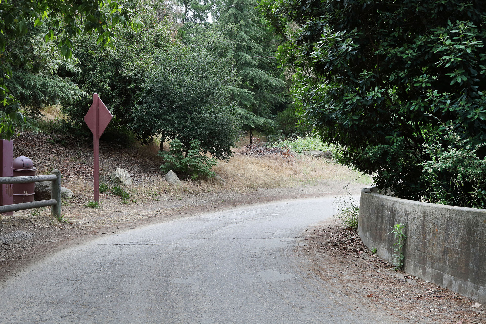
A more recent photo from May 26, 2019 shows even more growth in the area.
While Charles only posted the iconic spot where the four men walk, I explored the scene a little more to uncover additional details.
MORE TO EXPLORE
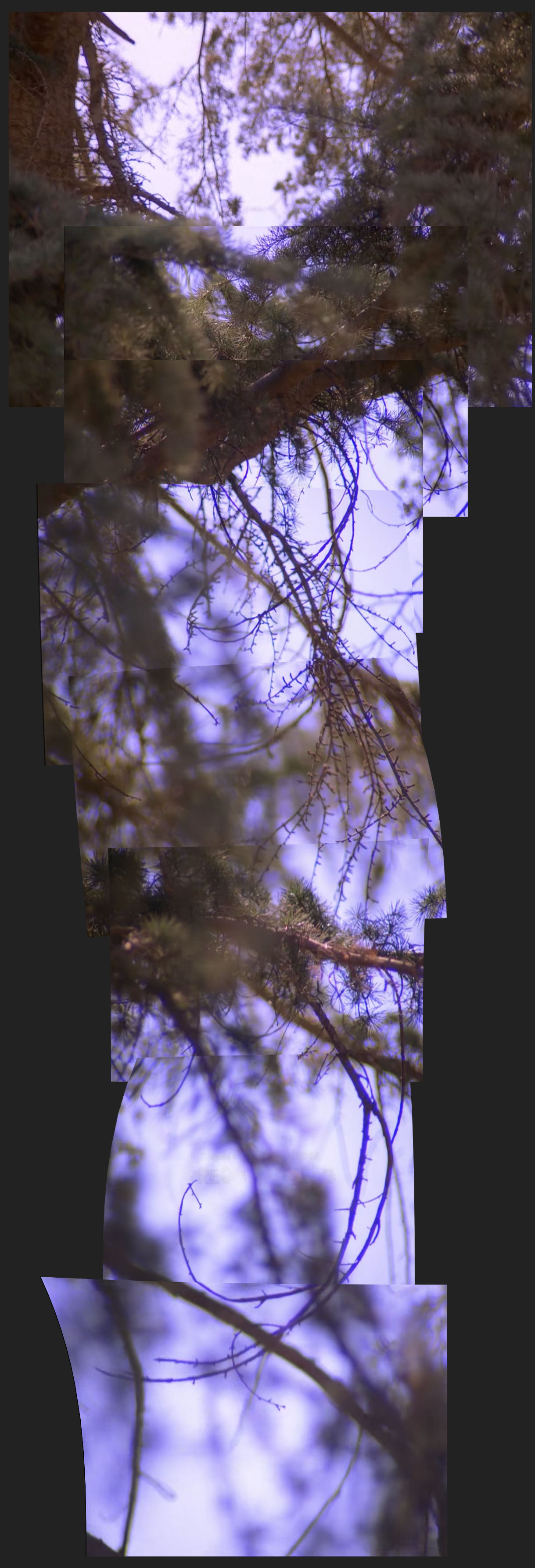
The first thing I did was create a collage of the zoom and pan of the tree. It’s difficult to say which tree was used for this particular scene. When I visit the location again I’m determined to find it.
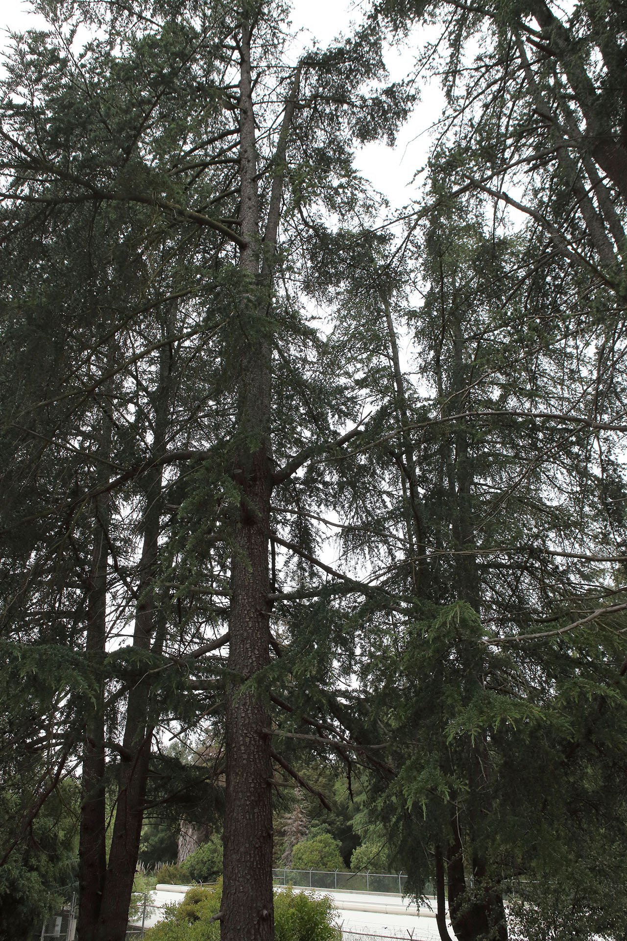
I returned to the park on May 26, 2019. While I’m still not 100% certain where to find the tree used in the collage, these trees could be candidates. They were located near where the scenes below were shot. It wouldn’t have been difficult for the camera operator to turn and shoot a close up.
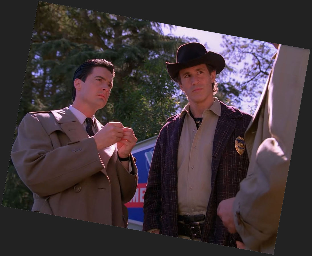
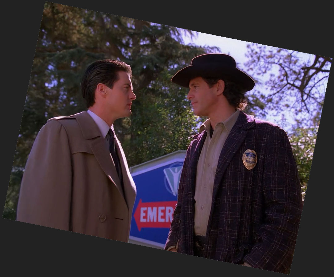
EMERGENCY SIGN
Another interesting detail is the “Emergency” sign behind Cooper and Truman.
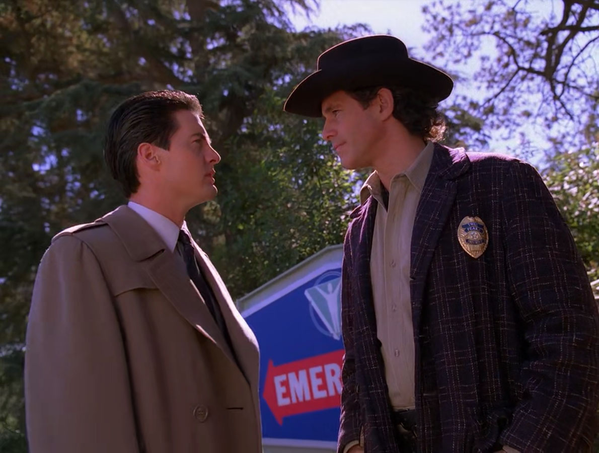
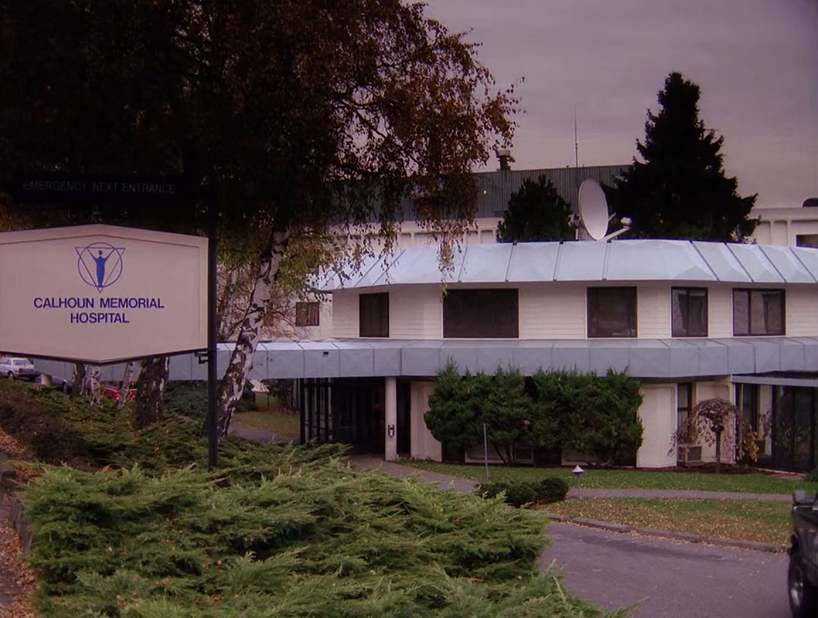
It’s supposed to be a sign from Calhoun Memorial Hospital (notice the logo). This episode is the final time that an exterior location for the hospital is seen in the series.
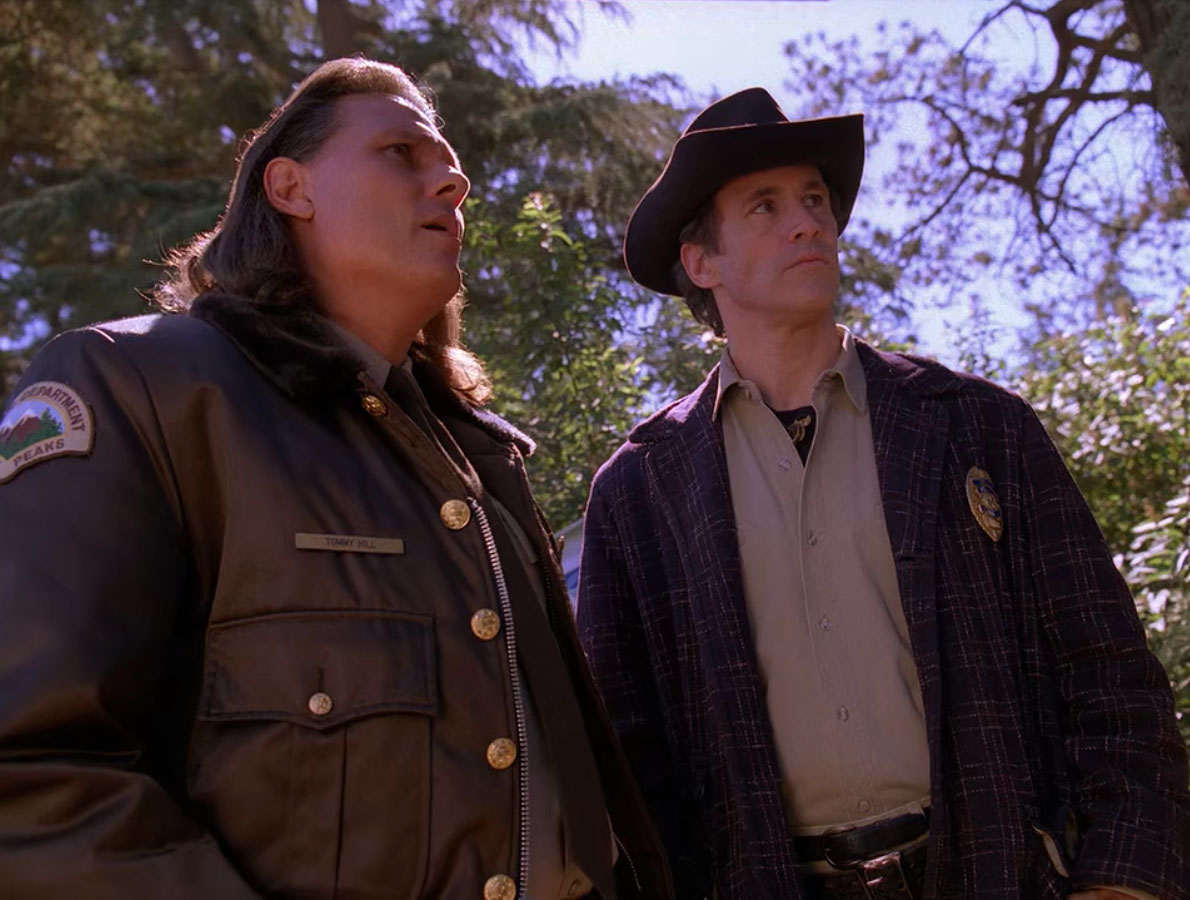
Toward the end of the scene, Hawk and Truman stand in front of the sign. This helped me identify the location where the sign was placed. Notice the tree in the upper right corner.
The tree appears similar to the one seen on the right side of the image above. It also looks like a tree that was probably present during filming in the 1990s is missing from the area.
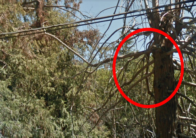
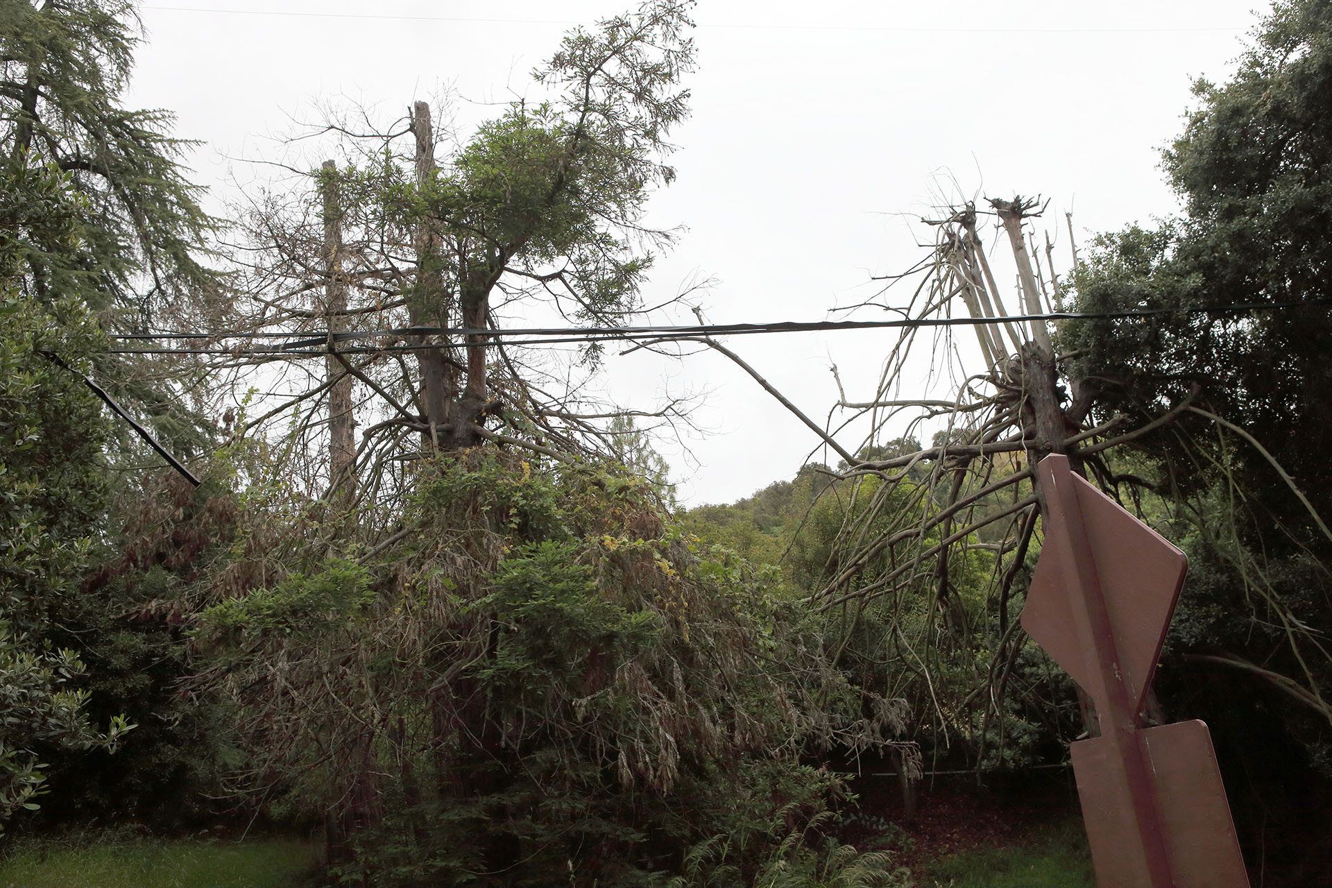
The circled area is the spot that looks like it matches the scene. The tree bark and branches are quite unique. The positioning of the sun and shadows also convinced me this is the spot where the “Emergency” sign was placed.
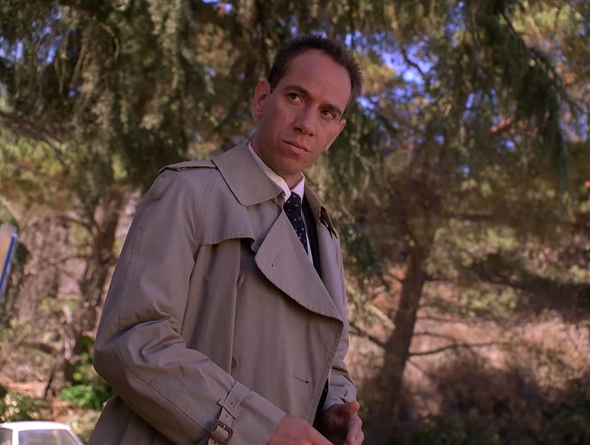
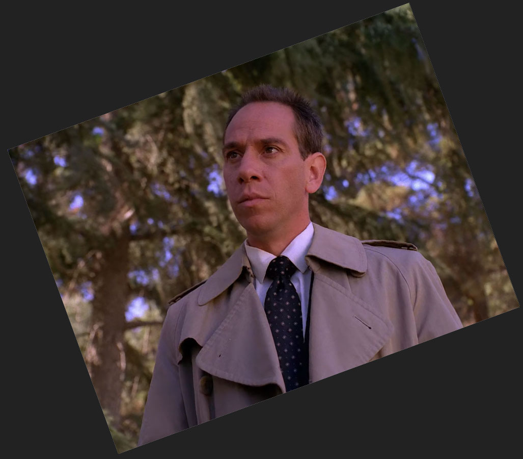
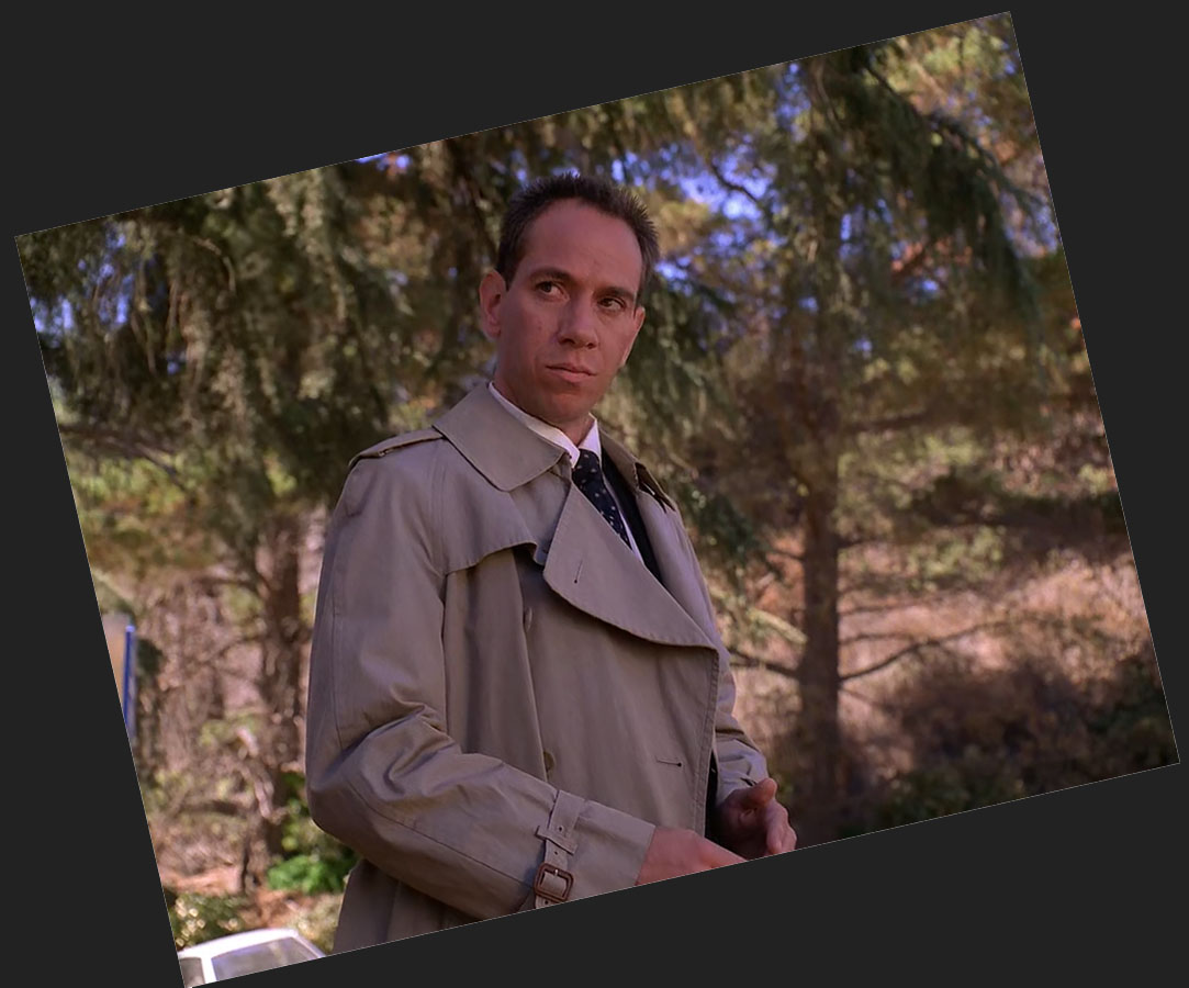
Additional scenes, like the one of Albert Rosenfield, above were shot on the opposite side of the park. Oddly there appears to be a car (crew?) and part of a sign in the background of this shot. We never get a good look at either of those objects.
I believe this spot is on the opposite side from the “Maddy’s Walk” area for two reasons – the shade and the slope.
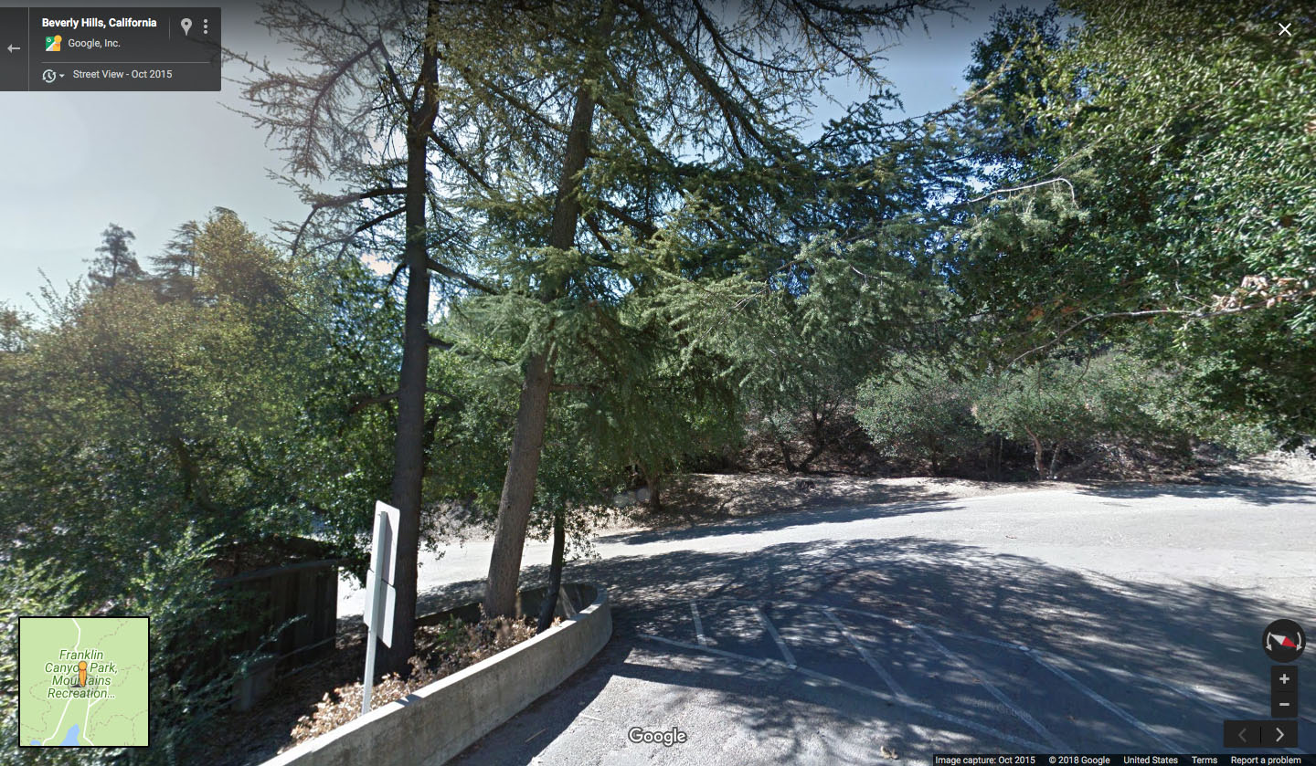
This spot appears to be the only location with a downhill slope to the left. According to Google Maps Street View, it also appears some trees are missing in the area. There was one in the center of this image and another to the left next to the road sign. This would have provided significantly more shade which is seen in the episode.
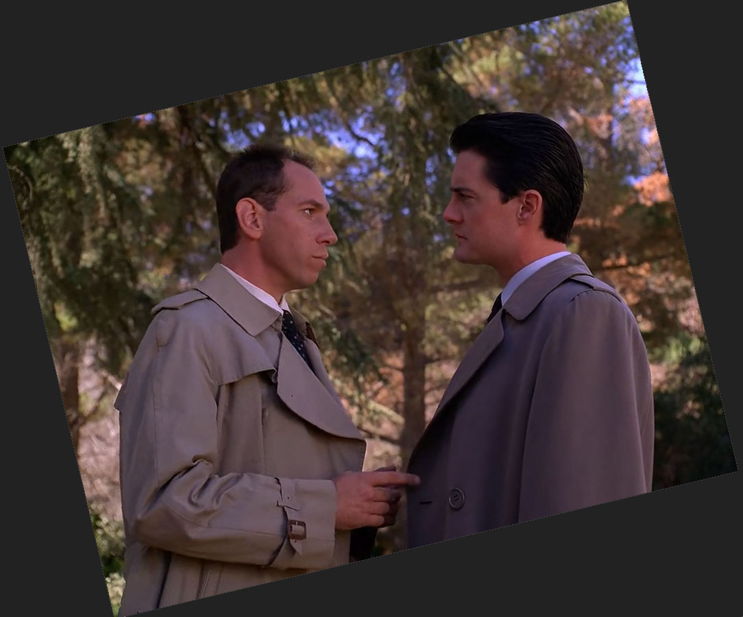
UN-DUTCH ANGLES
One final thing that has bugged me for years was the use of Dutch angles in this scene. I understand why director Tim Hunter incorporated them as these tilted images convey a sense of uneasiness.
I attempted to “un-Dutch” several images below, yet they still appear crooked as I didn’t want to crop the images too much. Nevertheless, it was a fun experiment.
Author
Discover more from TWIN PEAKS BLOG
Subscribe to get the latest posts sent to your email.