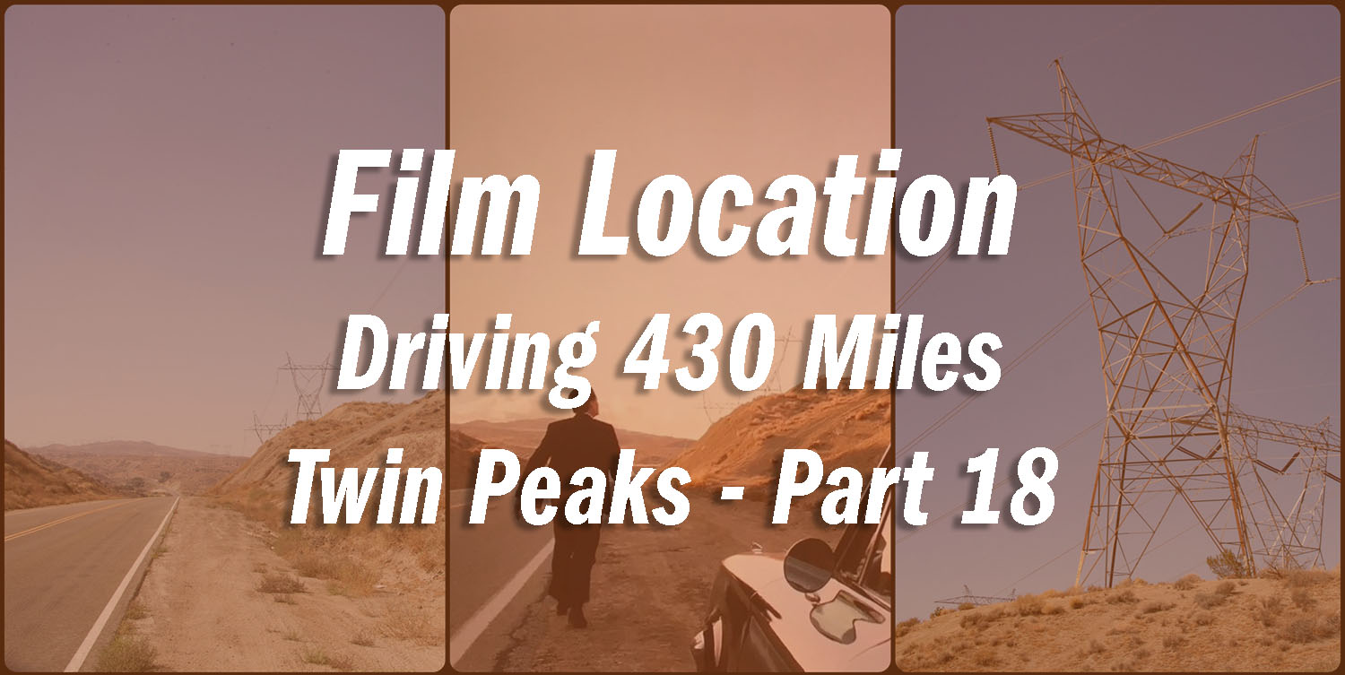
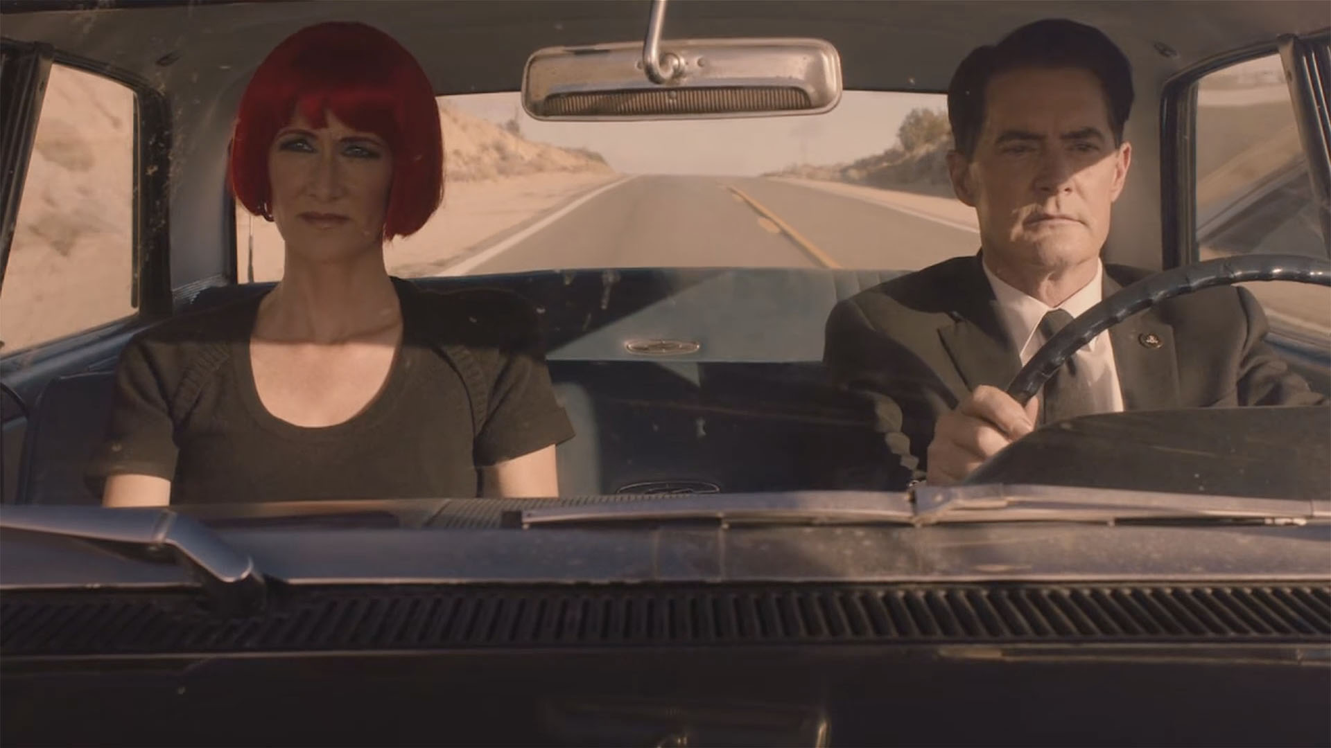
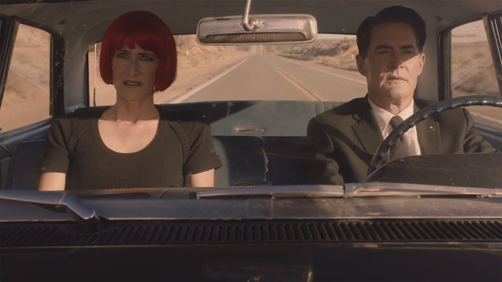
In Twin Peaks Part 18 on Showtime, Dale Cooper and Diane Evans drive 430 miles to a spot in the desert. I found the location on the morning of September 4, 2017, the day after Part 18 first aired. This location was easy to find thanks to a previously identified film location. More on that in a moment.
REMEMBER 430

About five minutes into Part 1, the Fireman asks Dale Cooper to “Remember 430.” Throughout the summer, there was much speculation as to what “430” meant. Was it a time? Was it an address? Was it a badge number of a deputy from Twin Peaks Sheriff’s Department?
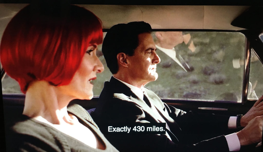
The answer was given about 12 minutes into Part 18.
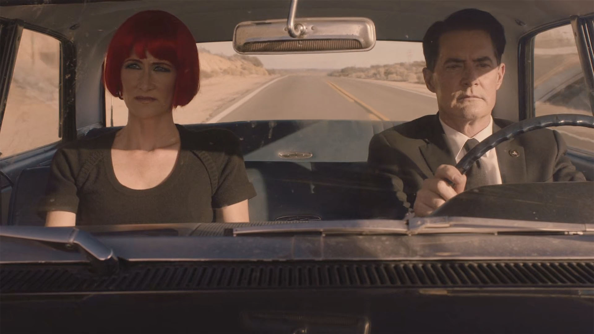
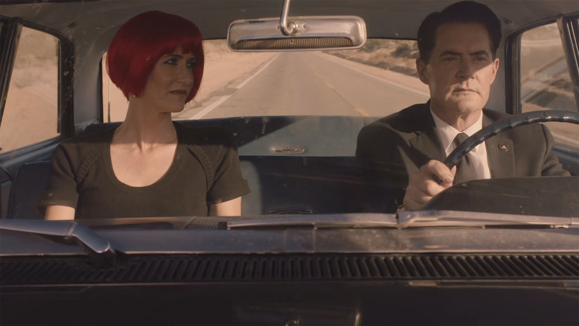
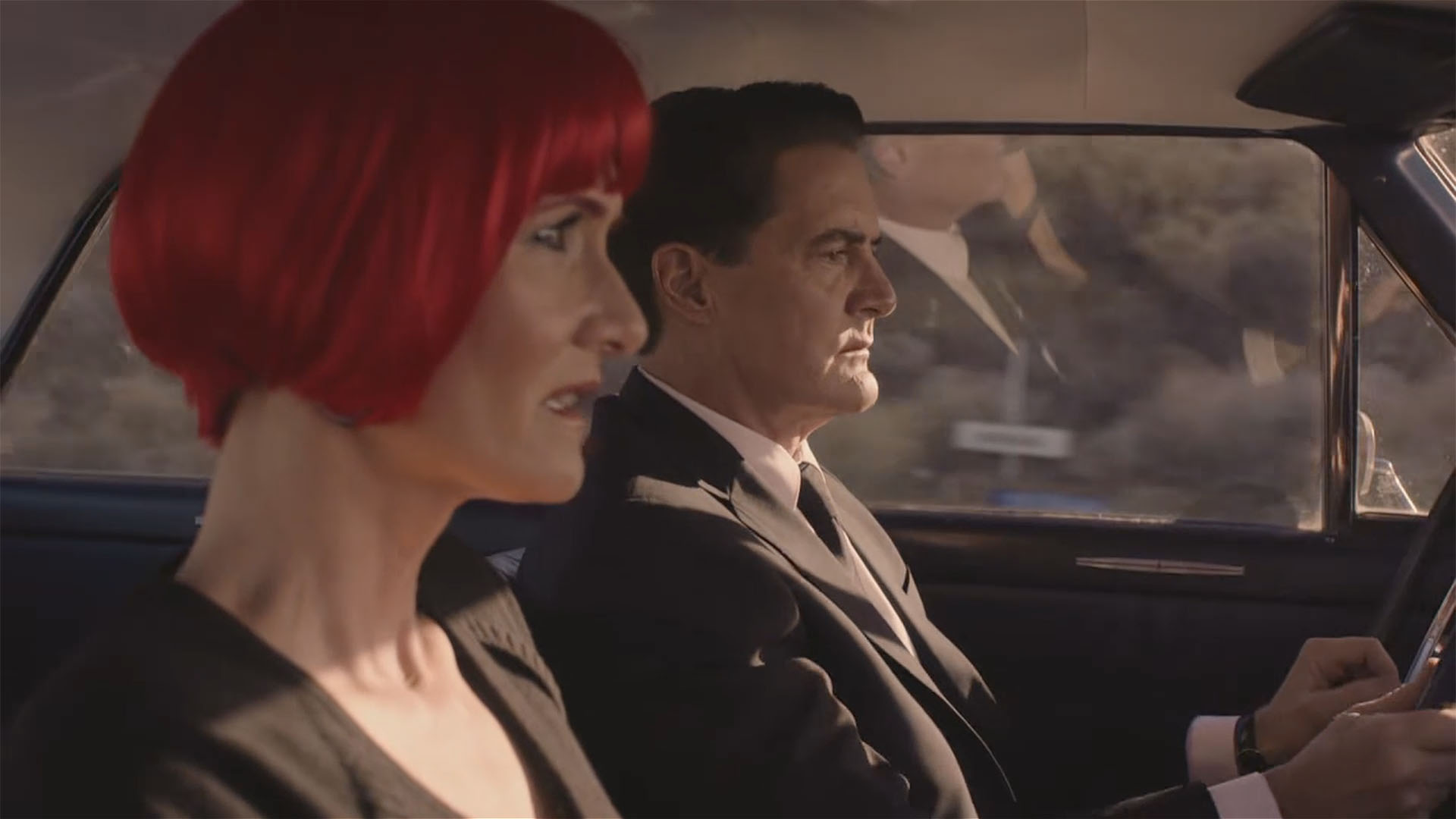
After being reunited, Dale Cooper and Diane Evans drive exactly 430 miles to an area in the desert surround by transmission towers.
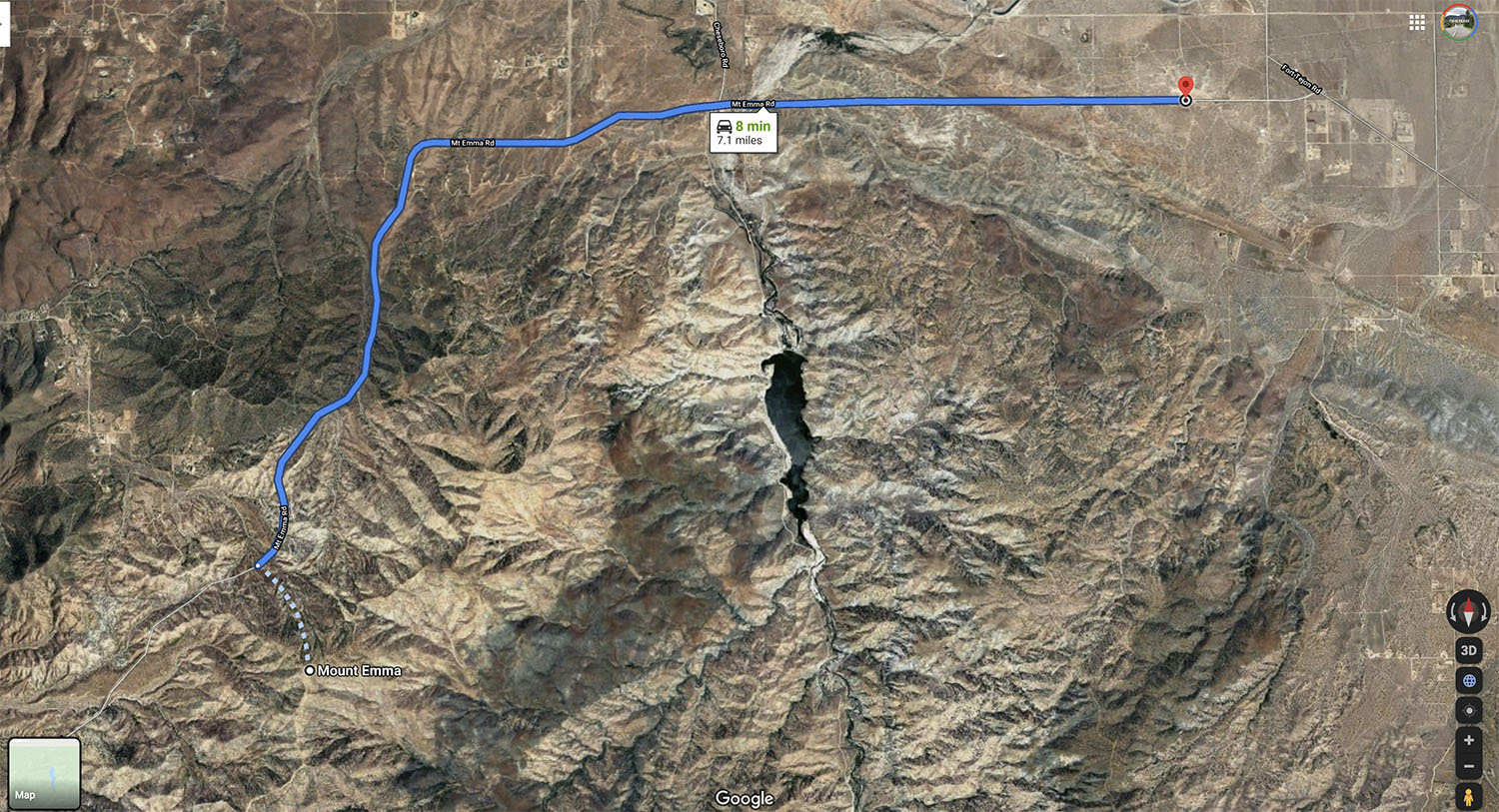
MAP TO 430 MILES
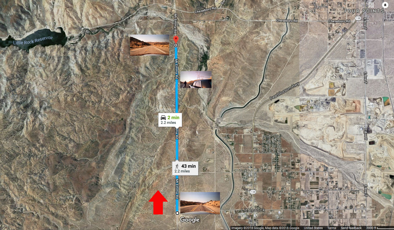
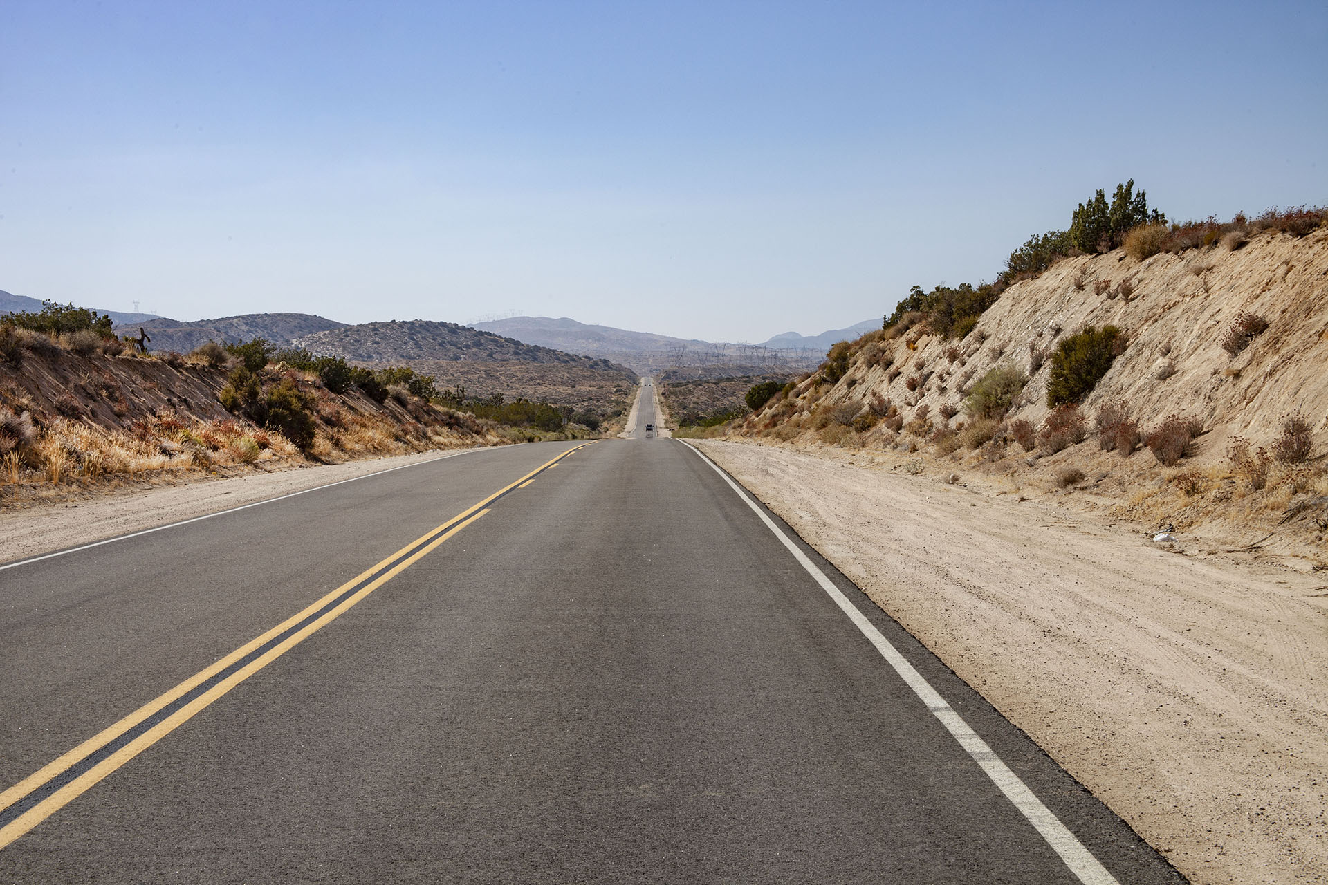
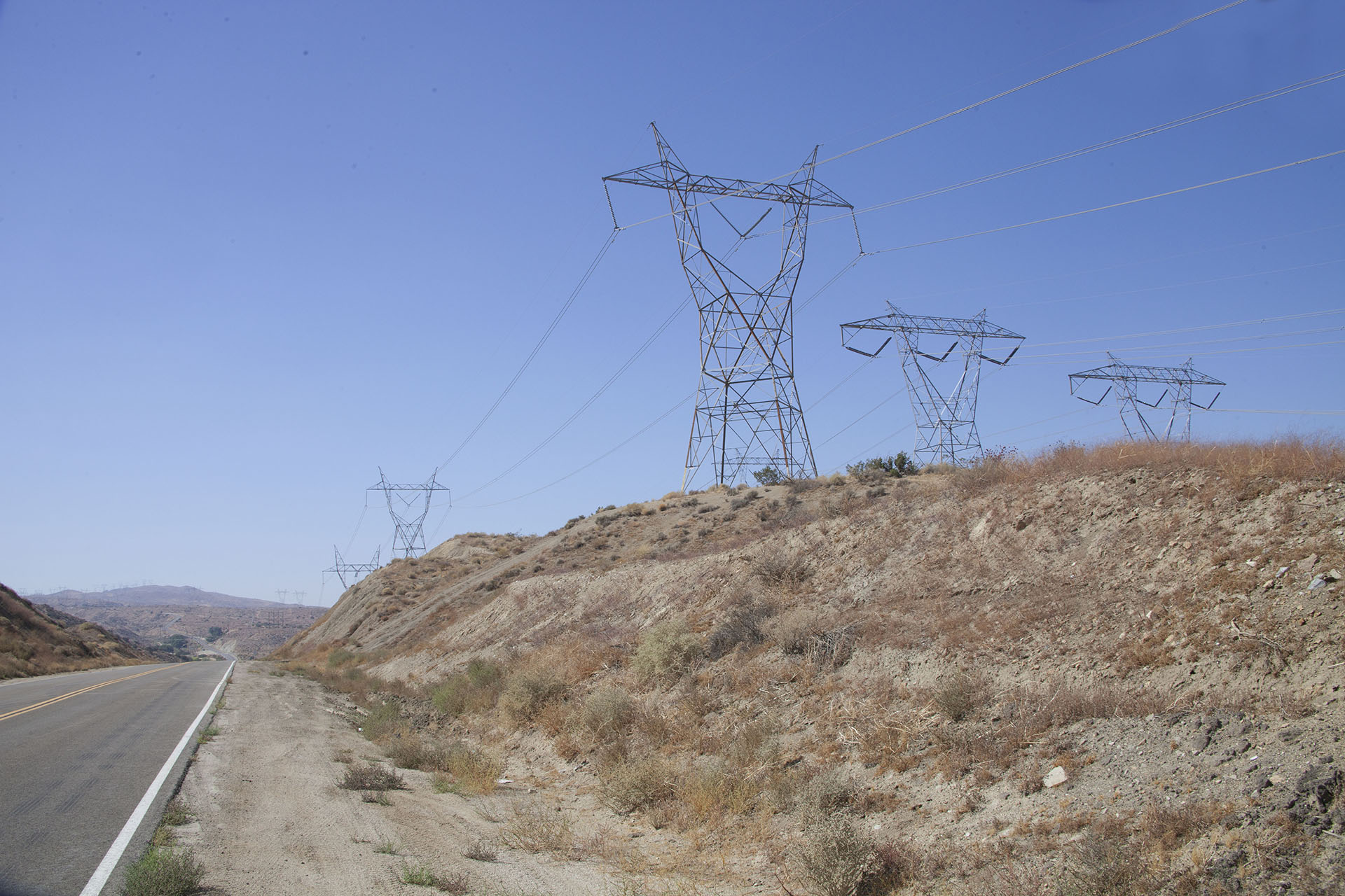
In reality, the location was film on Mt. Emma Road outside Littlerock, CA.
- Drive begins: 34°30’23.7″N 117°58’59.7″W
- Cooper exits the vehicle: 34°30’23.6″N 118°00’57.0″W
- Scene beyond the utility towers: 34°30’22.8″N 118°01’18.2″W
I recreated their drive in this short video on my YouTube channel.
FINDING THE LOCATION
The funny thing is I found the location in June 2017 when I was looking for Mr. C’s car crash location. When looking for that site in early June 2017, I remember finding an area filled with transmission towers.
I quickly returned to Google Maps and followed transmission towers until I located a long stretch of highway that I thought could serve as the film location. Google Street View confirmed my thinking.
The interesting thing about this scene is it’s slightly edited out of order. There is an area with lots of transmission towers that appears after the 430 mile mark in the show.
VISITING THE SPOT
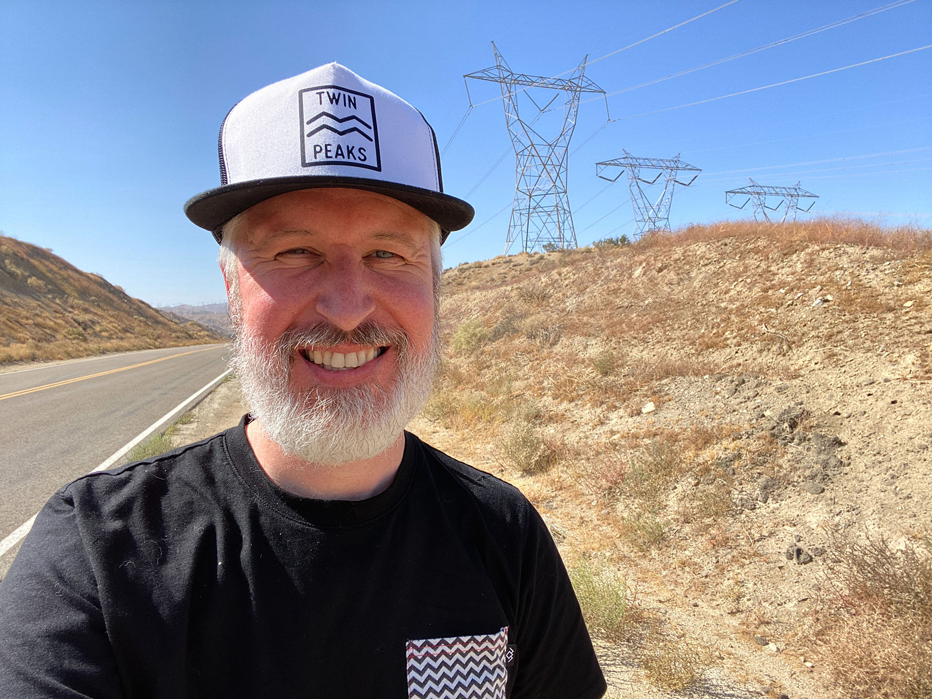
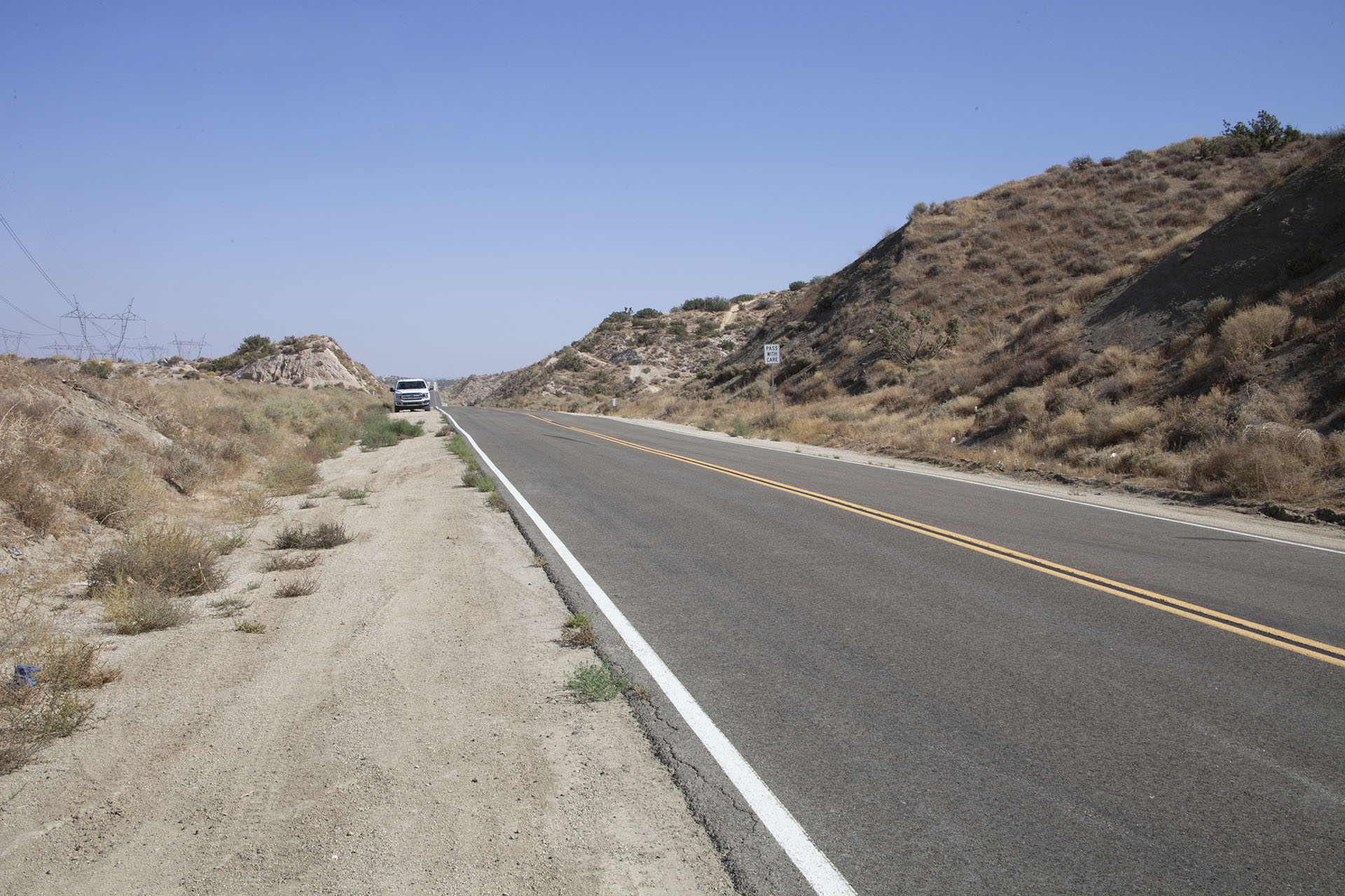
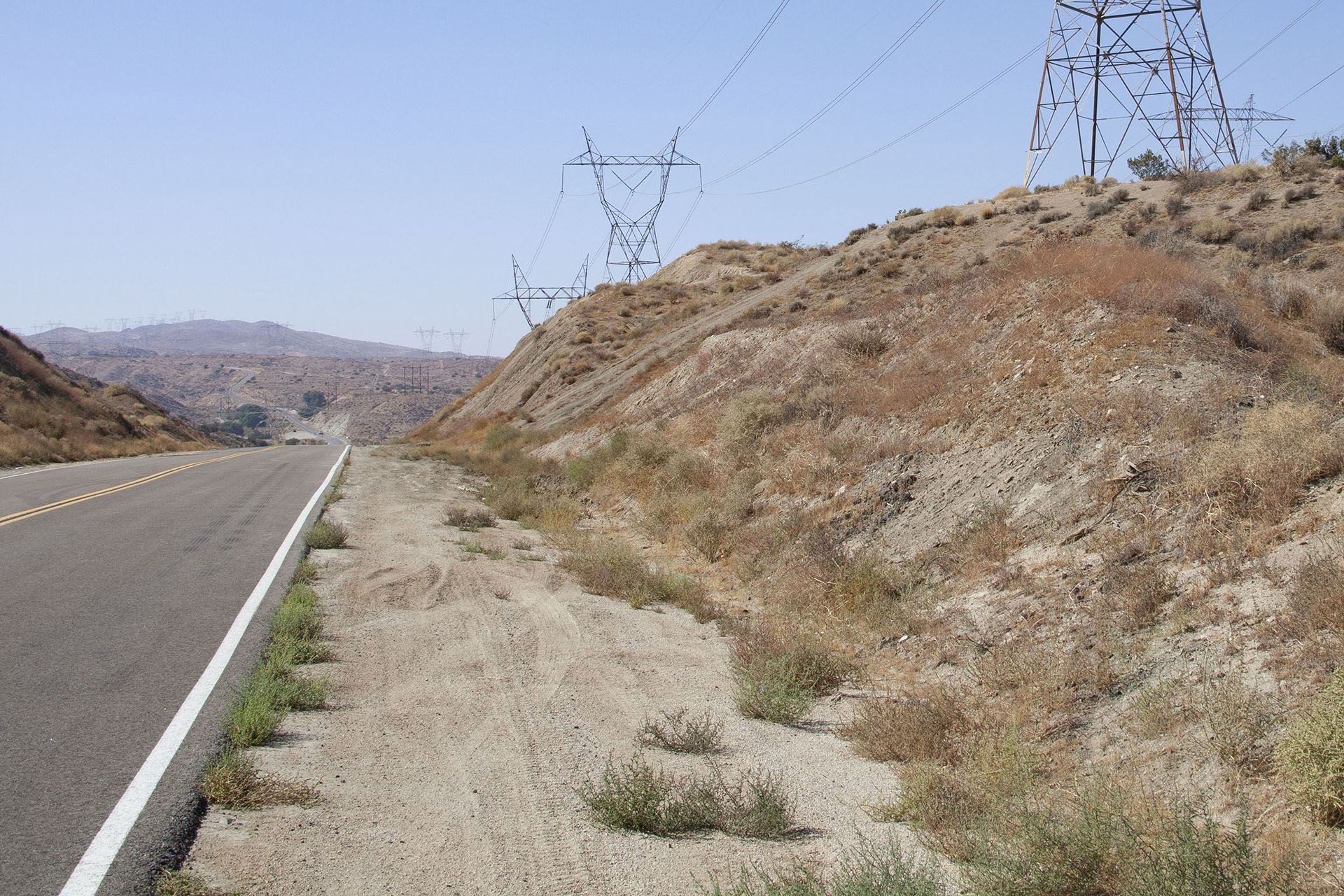
I attempted to visit the location in mid-September 2020. Due to the wildfires in the area, the road leading to the towers was blocked. About a month later on October 14, I finally made it.
The weather was warmer than I anticipated and I was surprised at how many cars traveled this road. The crew would have definitely needed controlled access when these scenes were originally shot on December 14, 2015.
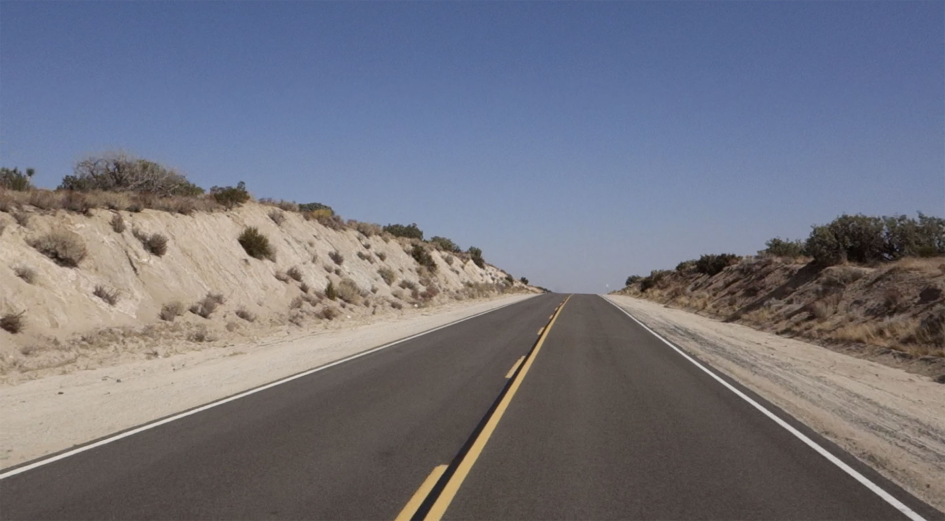
THE DRIVE BEGINS
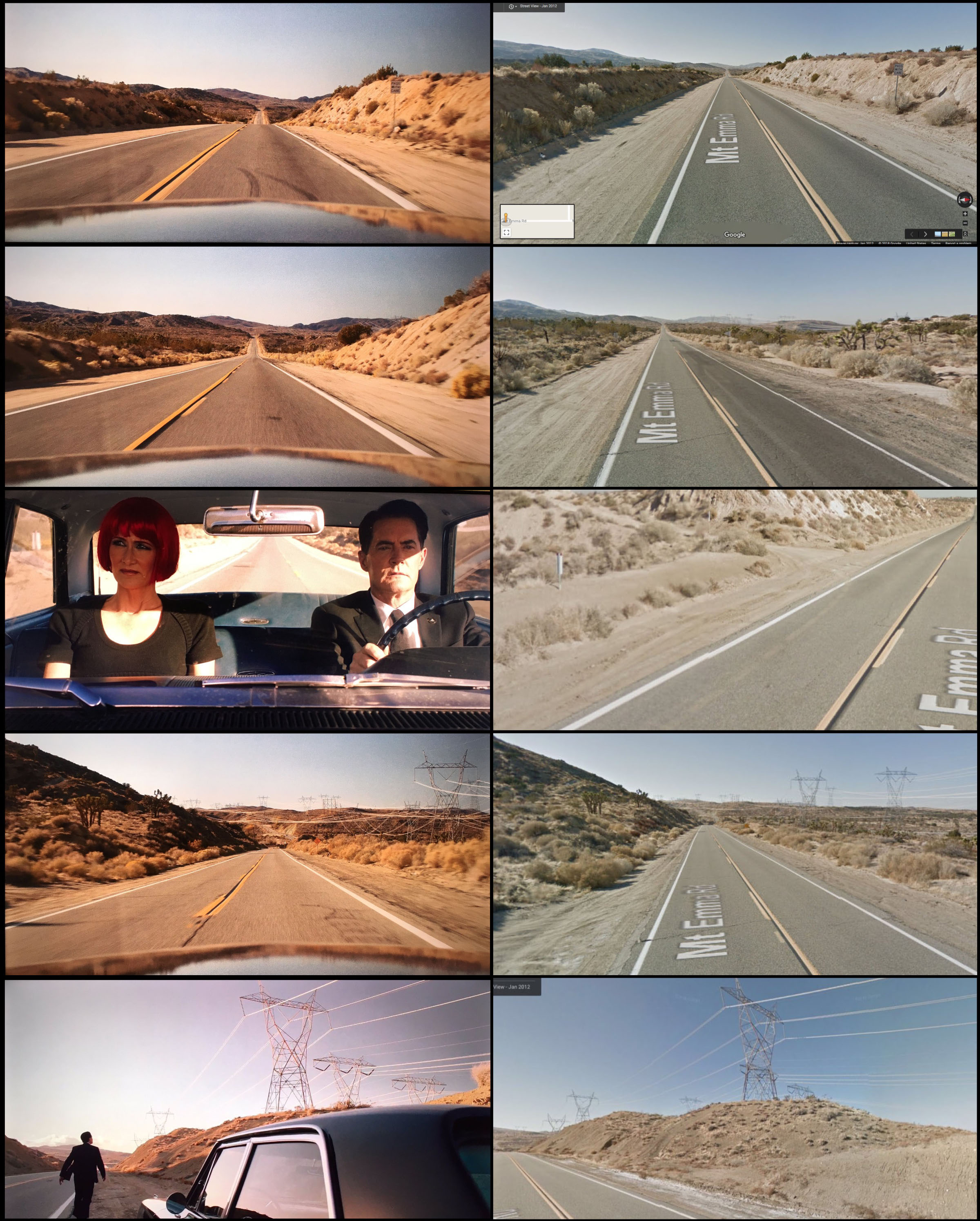
See a breakdown below of individual scenes compared to their map locations.
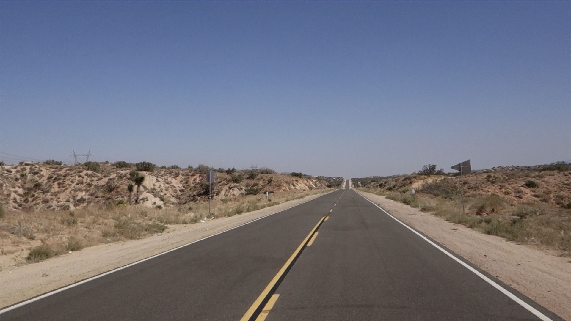
The scene begins with Cooper and Diane driving along a desert road. In the previous scene, they were in Glastonbury Grove at night. I’m assuming they drove all night to get to the 430 mile spot.
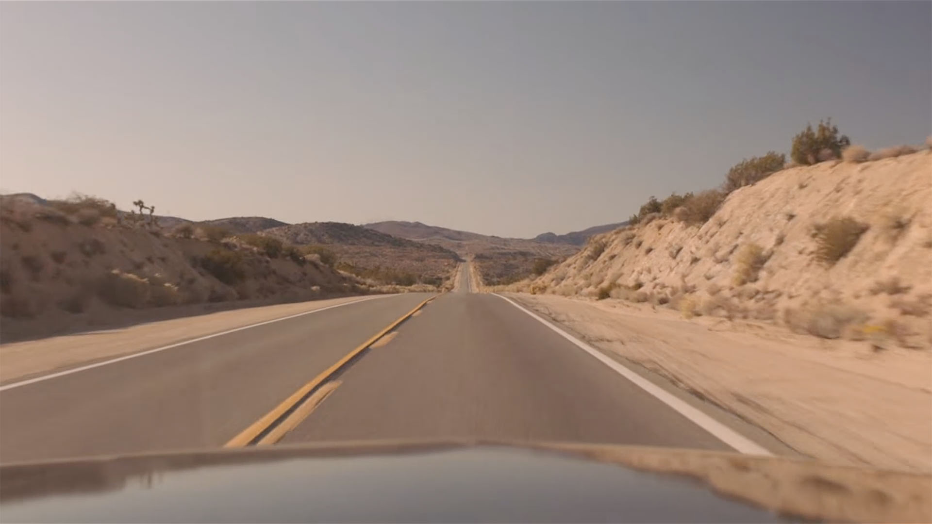
Cooper and Diane’s drive begins here on Mt. Emma Road – 34°30’23.7″N 117°58’59.7″W.
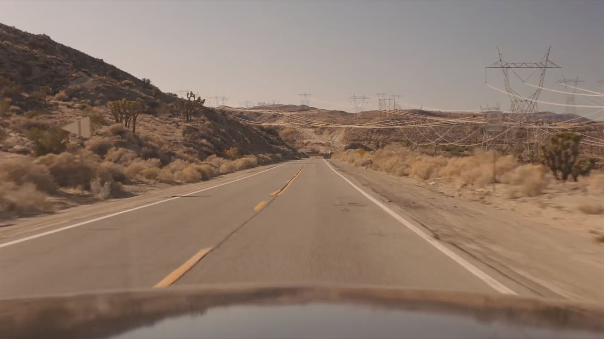
APPROACHING THE TOWERS
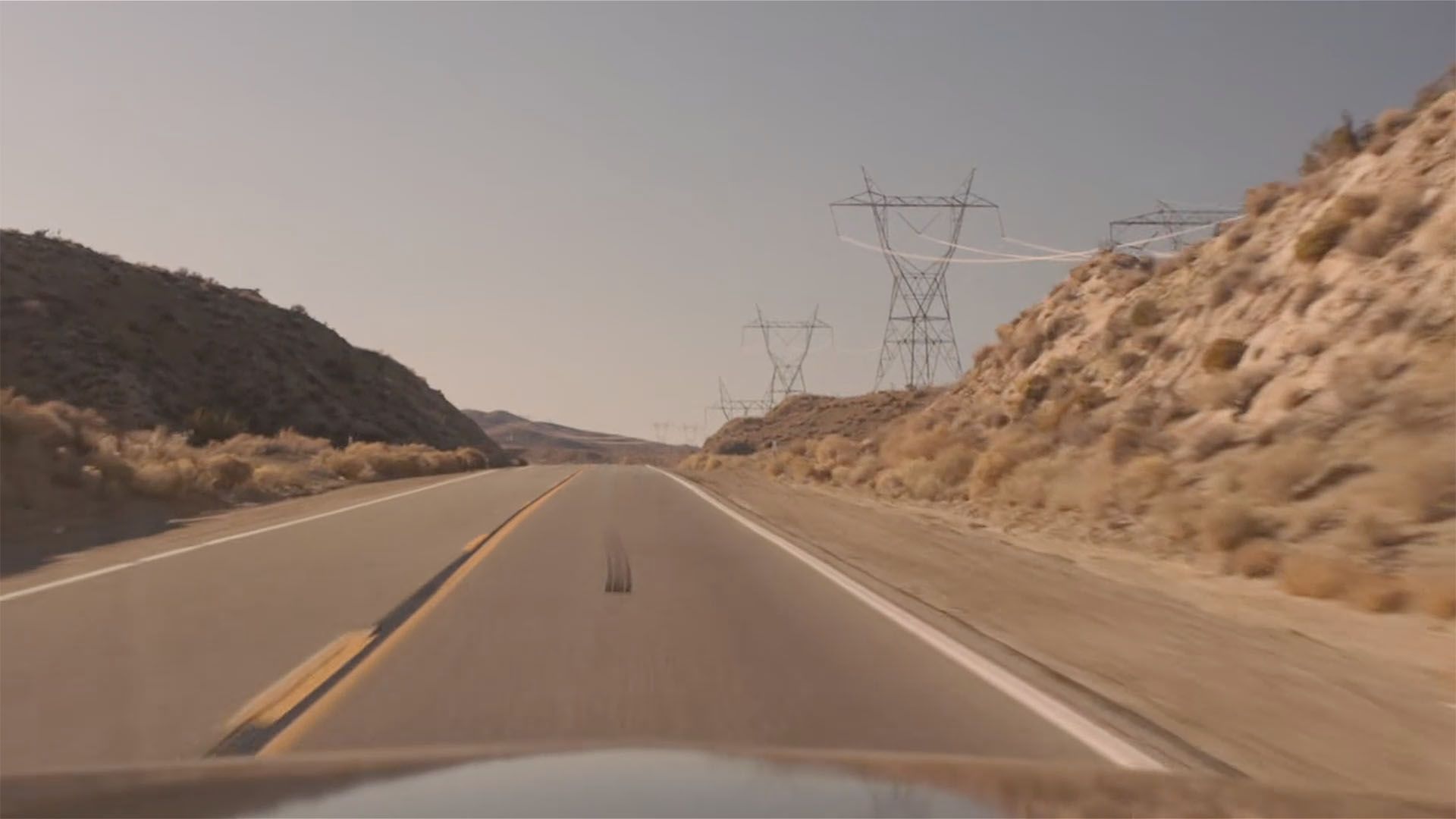
Diane watches Cooper barrel down the road.
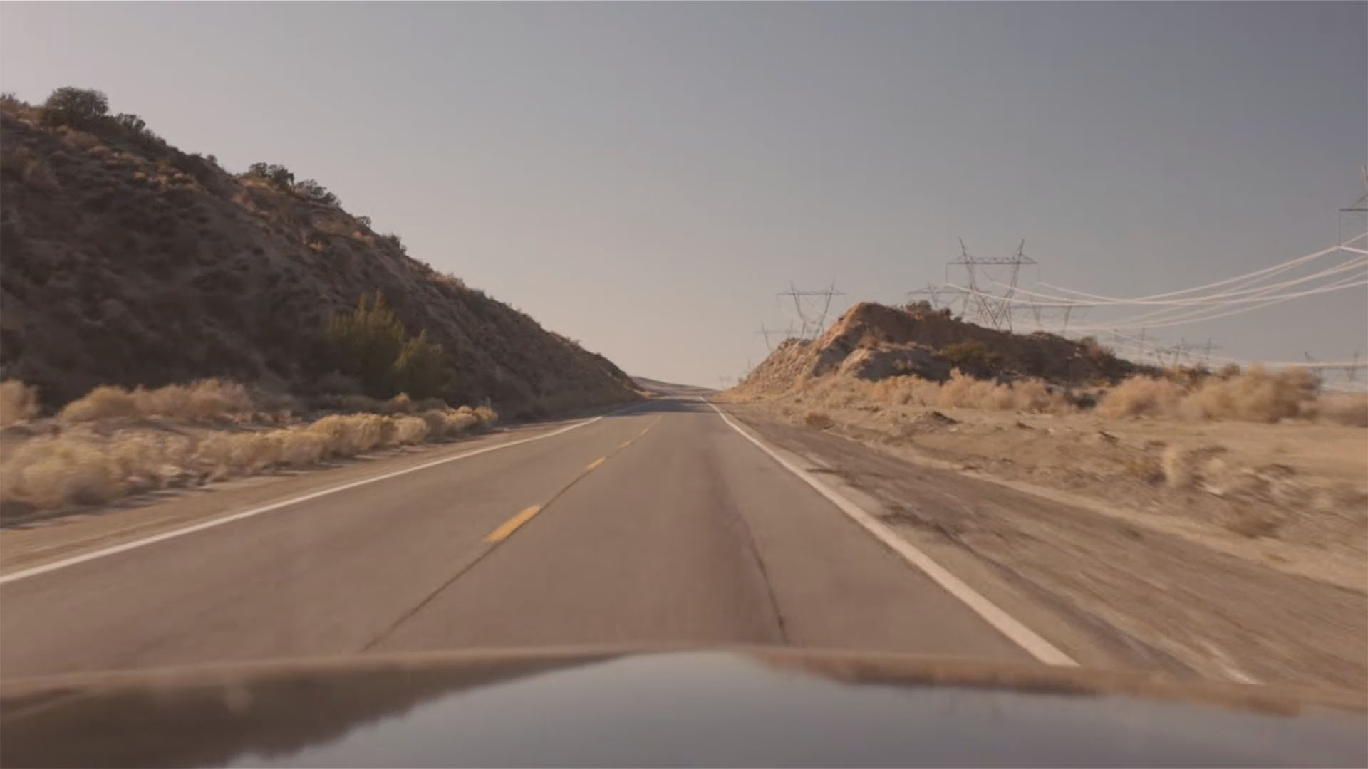
When the camera cuts back, they are already approaching the cluster of transmission towers.
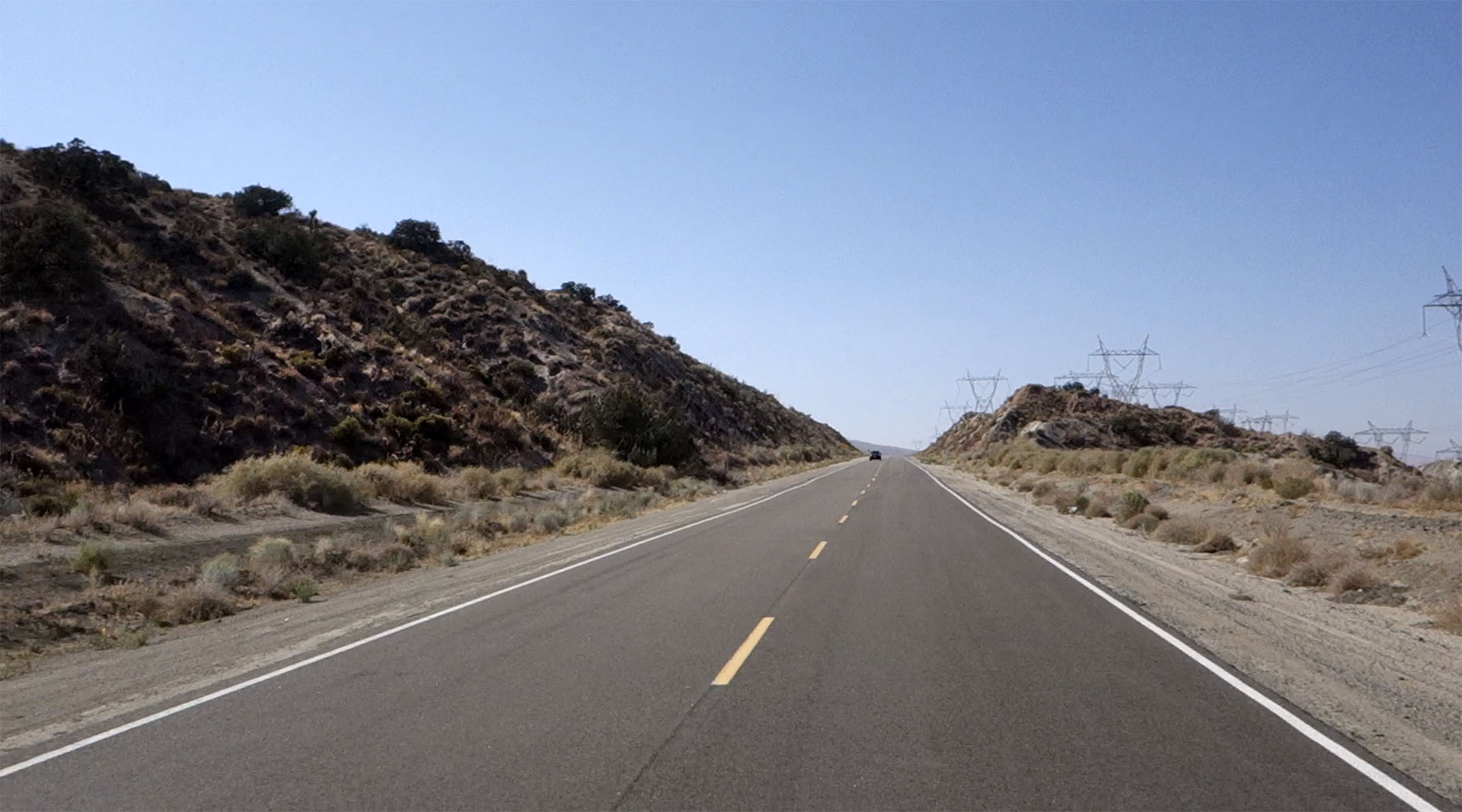
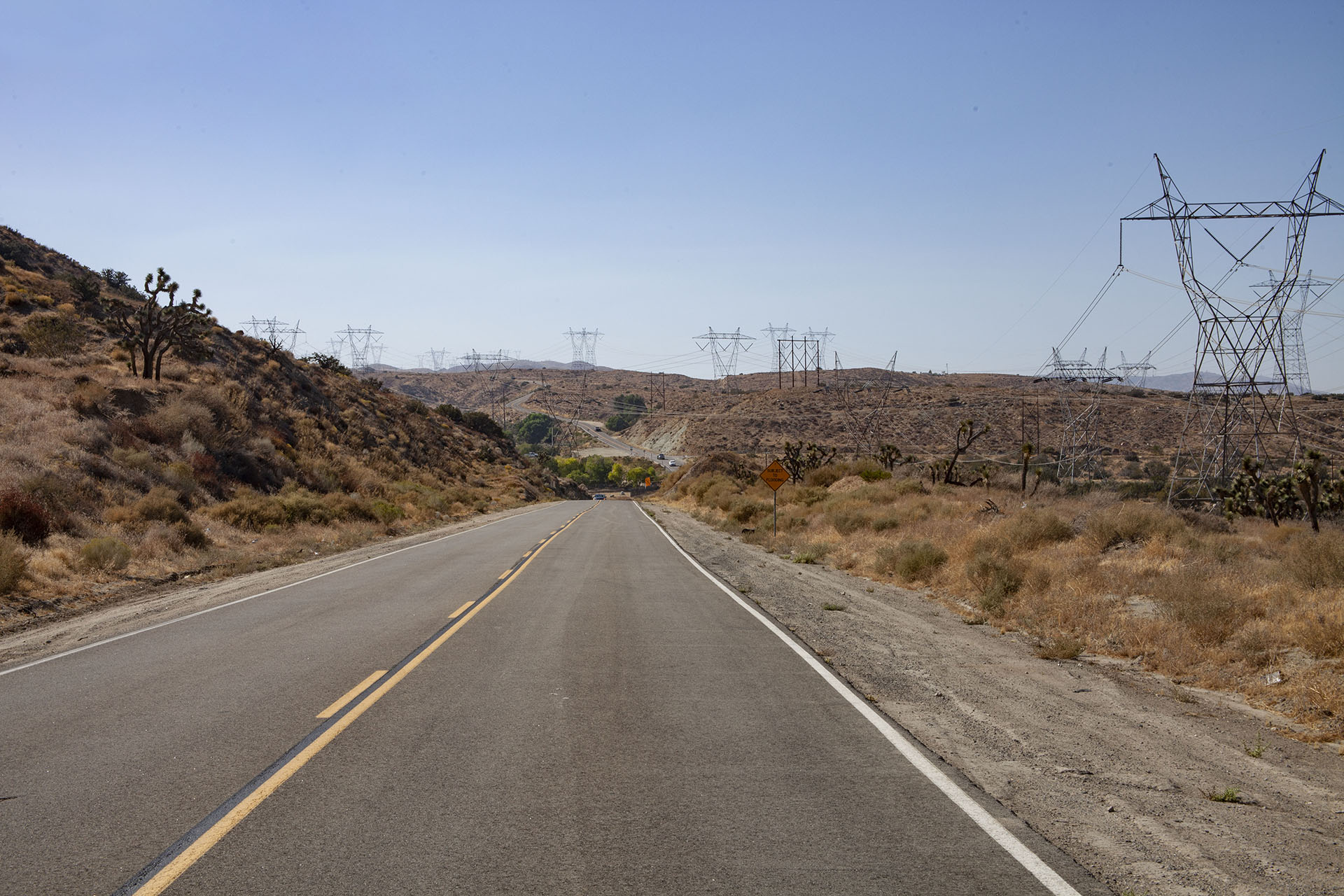
A similar view of the road and transmission towers.
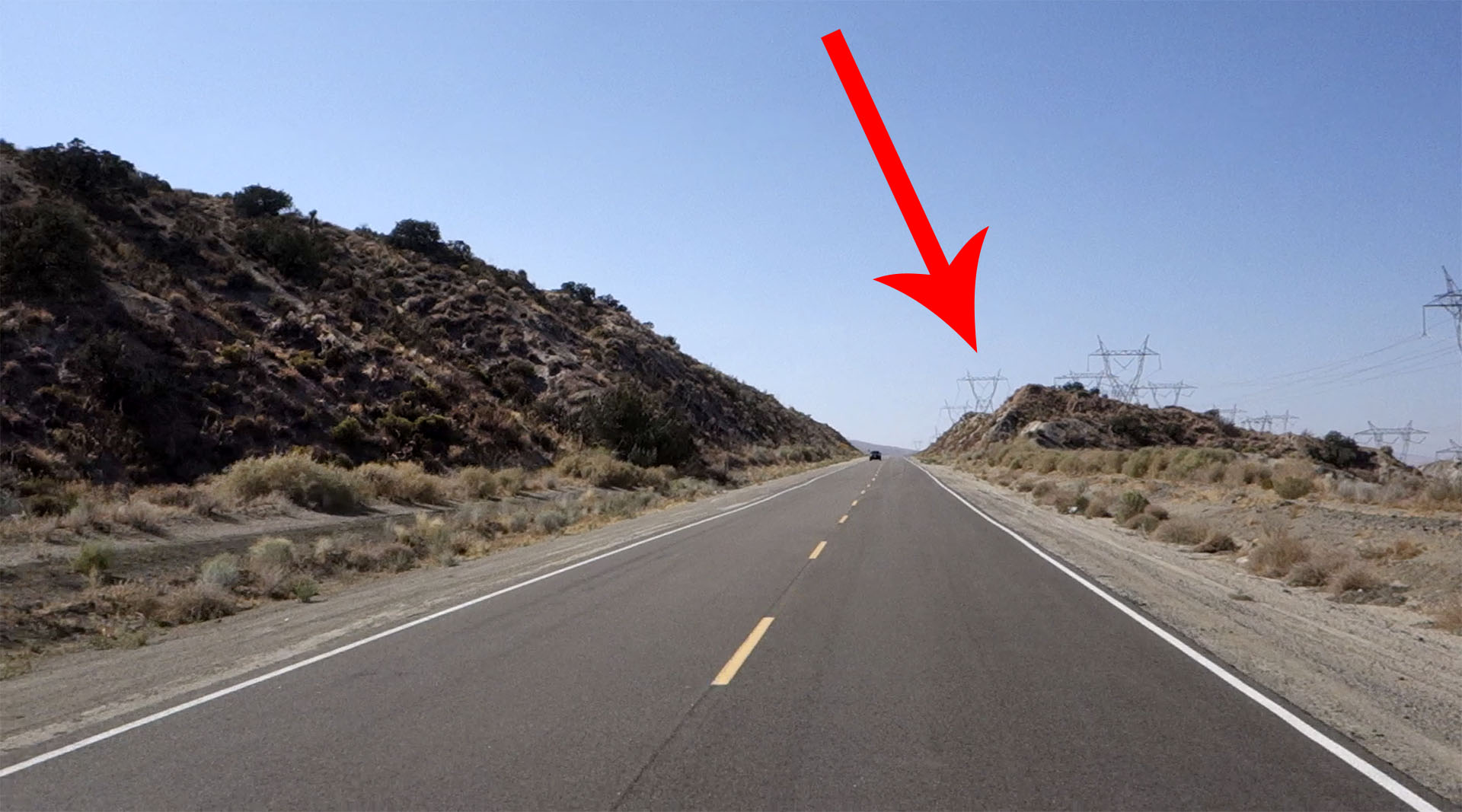
The red arrow indicates the tower that will be featured on screen later during the episode.
STARTING POSITION
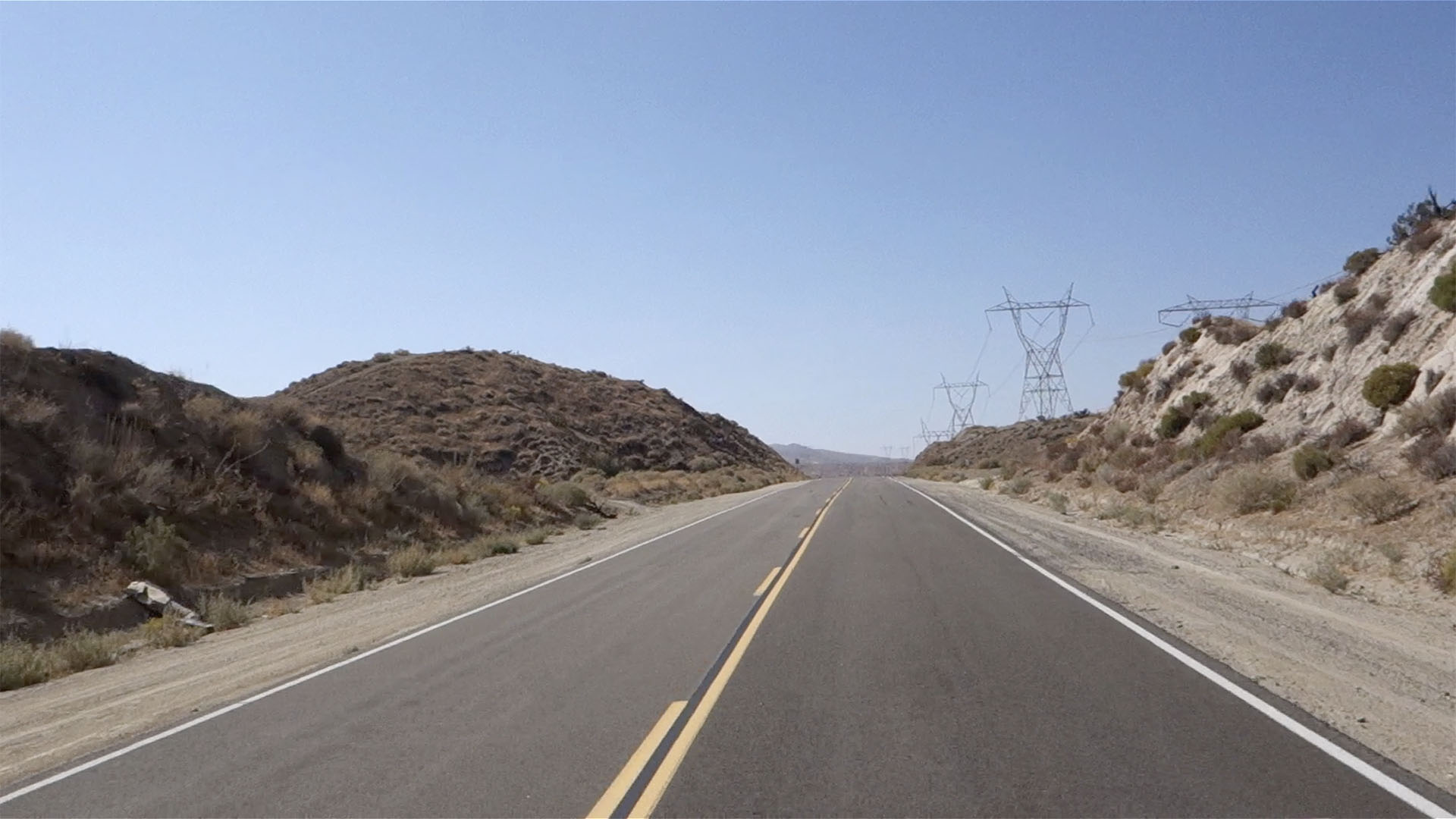
The camera again cuts back to Cooper and Diane inside the car. The background indicates that they haven’t really left their starting position. This isn’t surprising as they probably used multiple takes from different angles during the editing process. When assembled, you believe they have traveled far.
TOWERS BEYOND
Speaking of editing, when the camera cuts back to a view outside Cooper’s vehicle, we see a location that is actually beyond the 430 mile spot.
The location of this scene is around 34°30’22.8″N 118°01’18.2″W.
APPROACHING 430 MILES
Another cut back to inside the car as the pair slowly approaches the 430 mile mark. Looking out the rear window, you can see where the single dashes turn to a straight line on the road.
We then see the towers at the 430 mile spot in the distance. They are getting closer.
As the car slows, we see Diane and Cooper from the passenger side window. They pass what appears to be a roadside memorial or some kind of mark along side Mt. Emma Road.
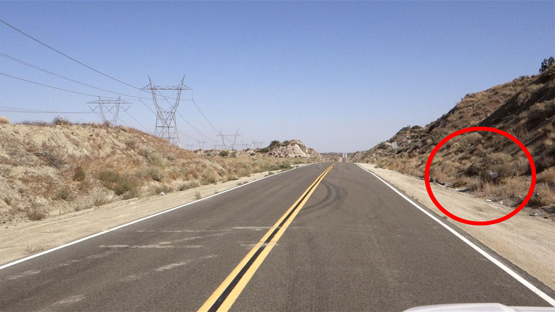
That marker appears to still be by the road today (see the red circled area).
ARRIVED AT 430 MILES

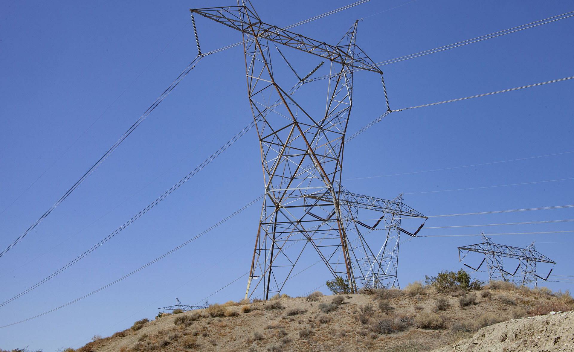
Cooper parks at exactly 430 miles and exits the car leaving Diane alone.
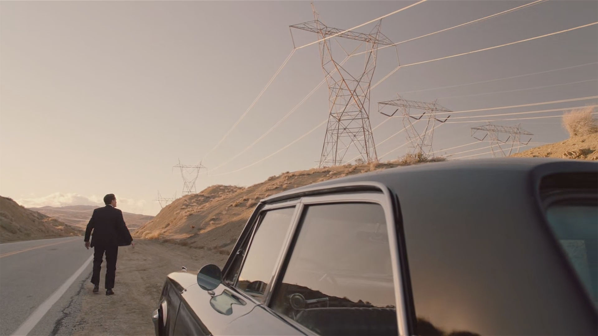
The coordinates for when Cooper gets out of the car are 34°30’23.6″N 118°00’57.0″W. He approaches the transmission towers with the sound of electricity filling the air.
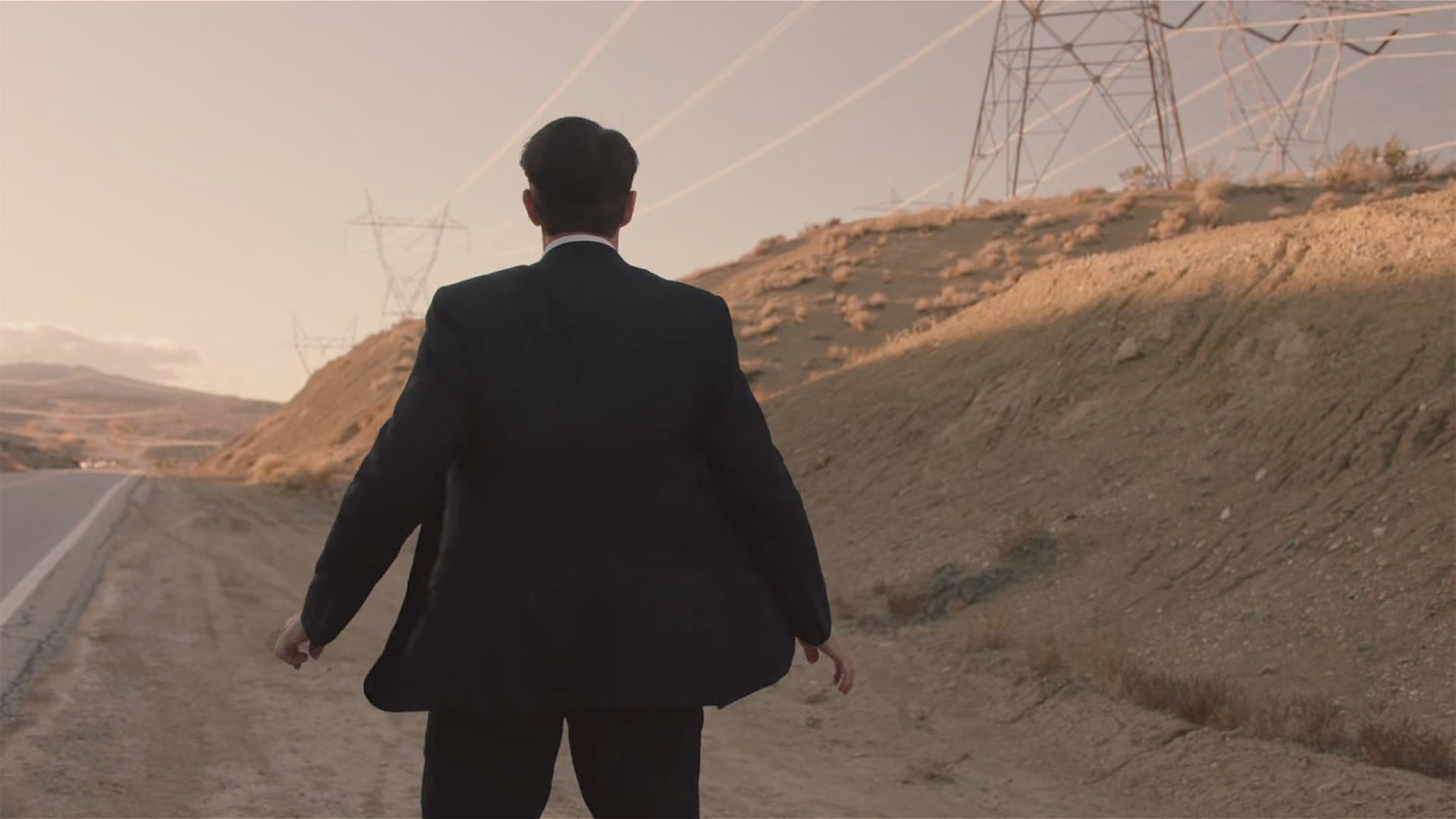
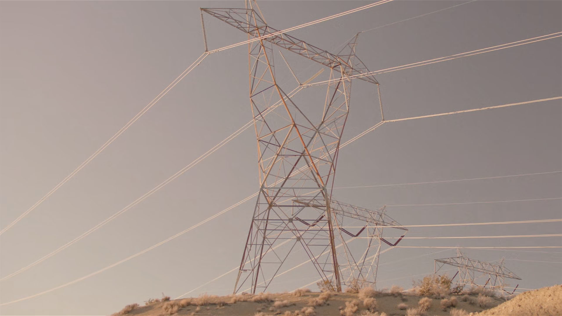
The camera cuts to a medium shot of Cooper reacting to the area near the towers.
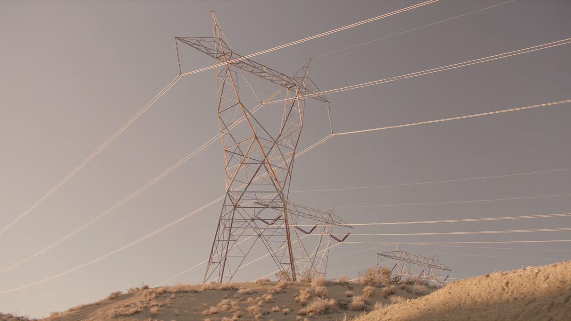
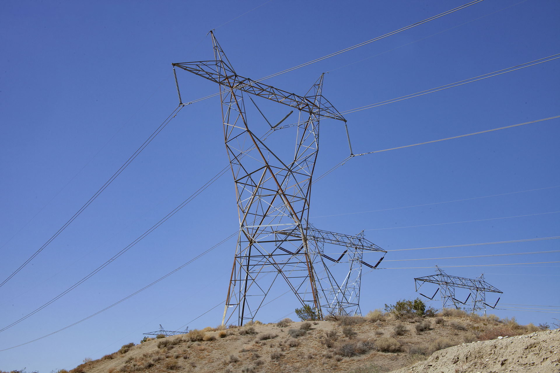
A look at the transmission towers which look like perched owls to me.
A closer shot of the transmission towers at the 430 mile marker.
Here is a video of the transmission towers from my visit.
HIKING MOUNT EMMA
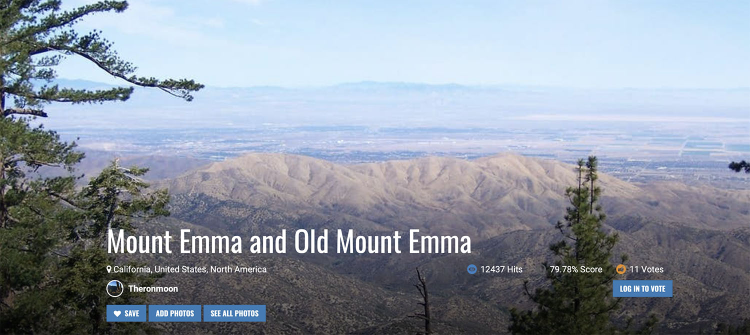
Mt. Emma Road is named for the nearby Mount Emma (5,273ft.) and Old Mount Emma (5,063ft.) that are part of the last northwest reach of the San Gabriel Mountains into the western Mojave desert.
The mountains were named around 1900s for Emma Pallett, the beautiful daughter of a local rancher. The Pallett family established a ranch at Big Rock Creek in the 1890s. Old Mount Emma got its name from being mislabeled as the peak on early maps. There is a mountain and creek in the region also named for the Pallett family.
The trail entrance is about an 8-minute car ride from the spot where Cooper and Diane begin their drive. Located at 34°27’37.4″N 118°04’08.4″W. You will need a Adventure Pass for parking at the turnout.