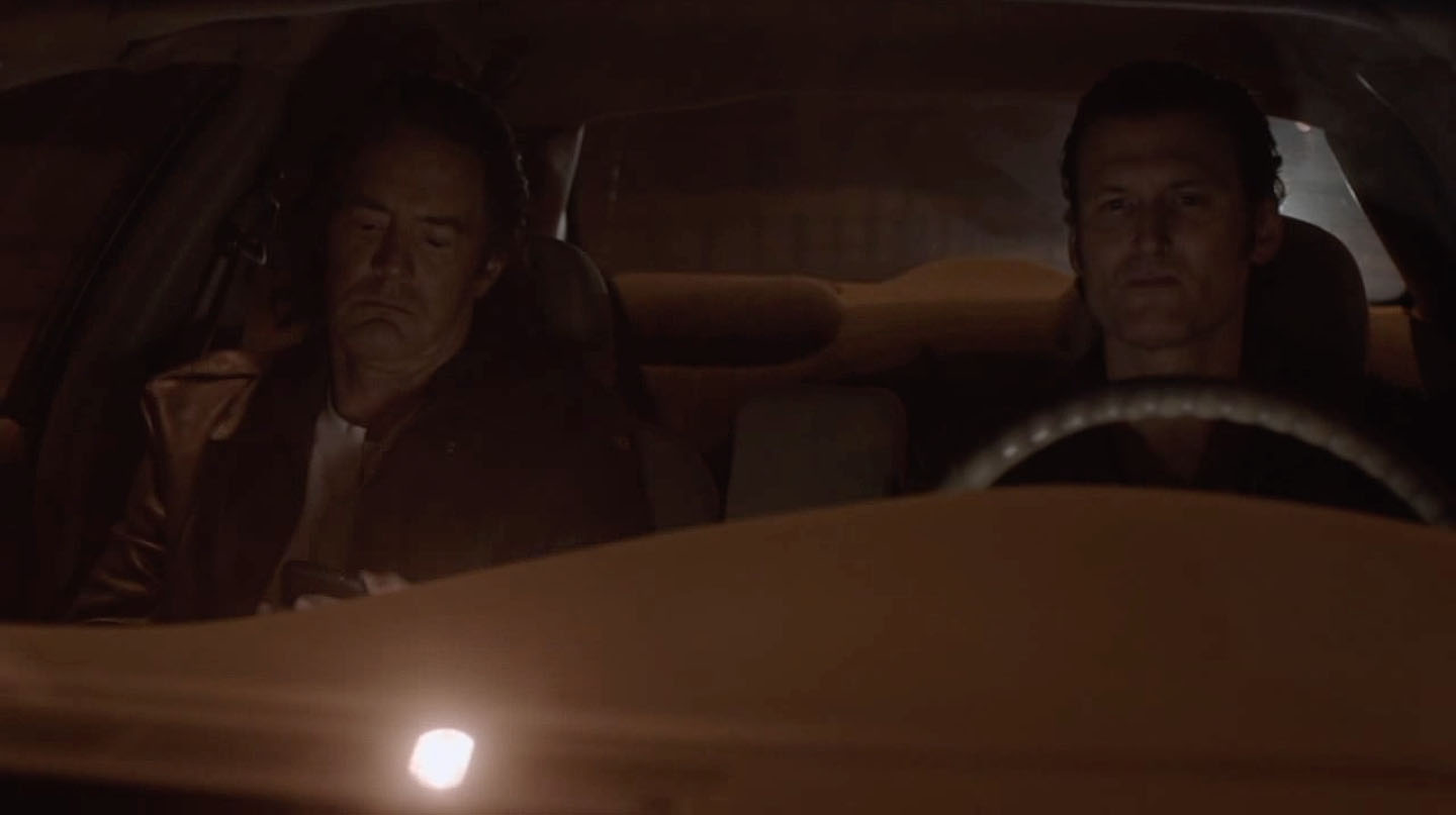
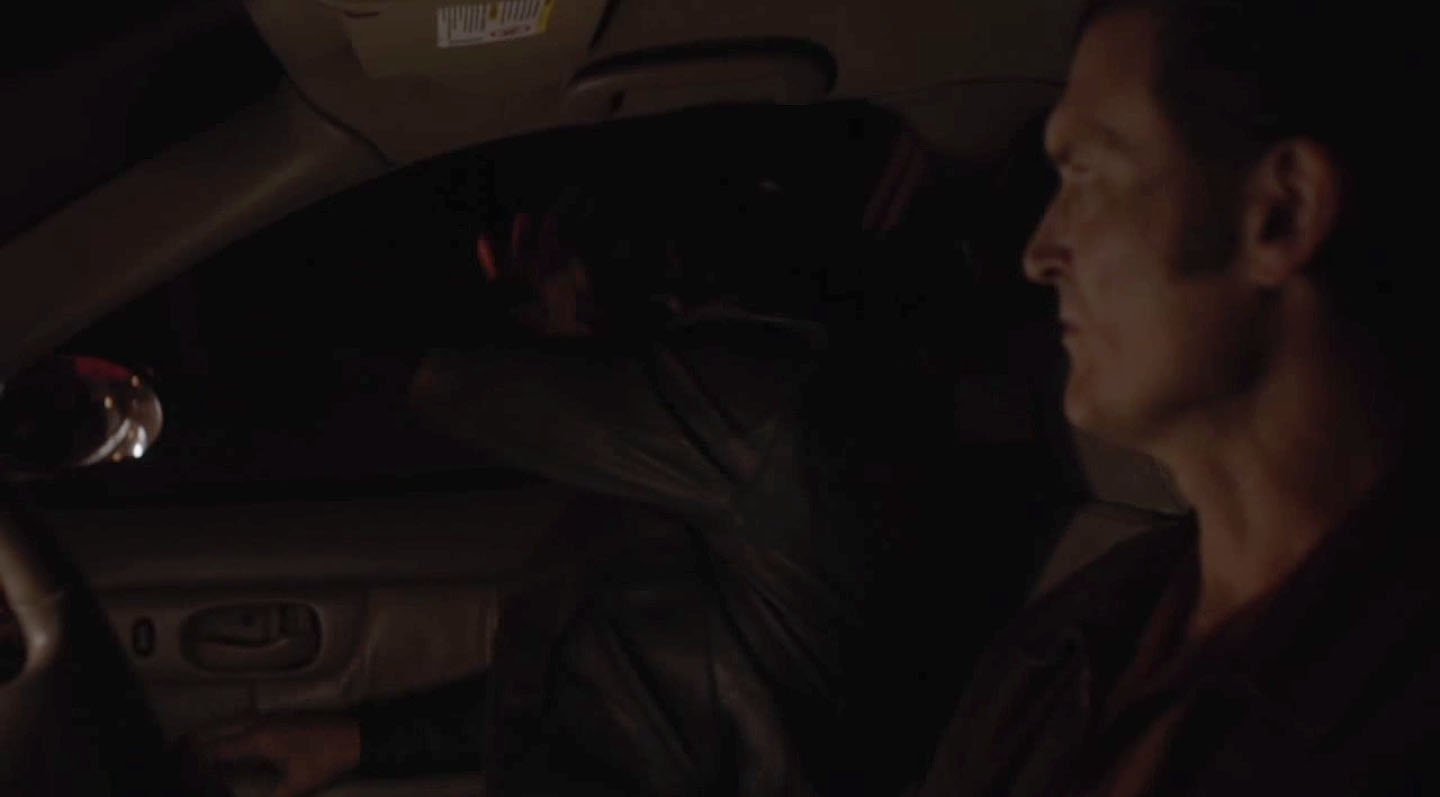
Twin Peaks Part 8 on Showtime opens with Ray Monroe and Mr. C driving. after leaving Yankton Federal Prison. Unlike the 1989 comedy-drama that inspired the title of this article, Ray and Mr. C are on their way to the Farm. I stumbled onto the location where this scene was filmed by accident. I had been researching the Twin Peaks Sheriff Station and caught a glimpse of a sign from this scene. It lead me down a road (ha!) which took all day. The final destination, however, was another Twin Peaks film location revealed.
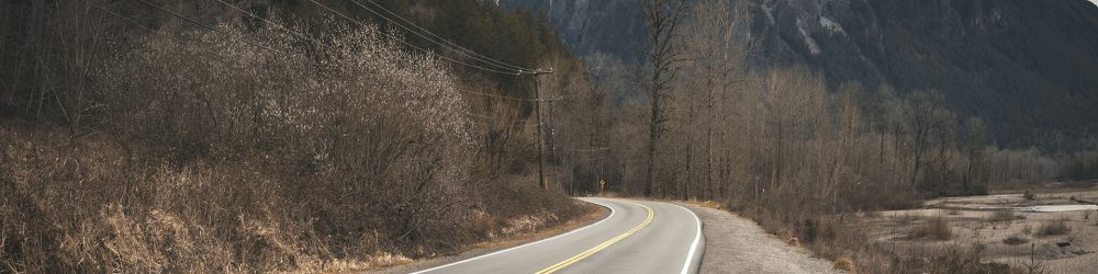
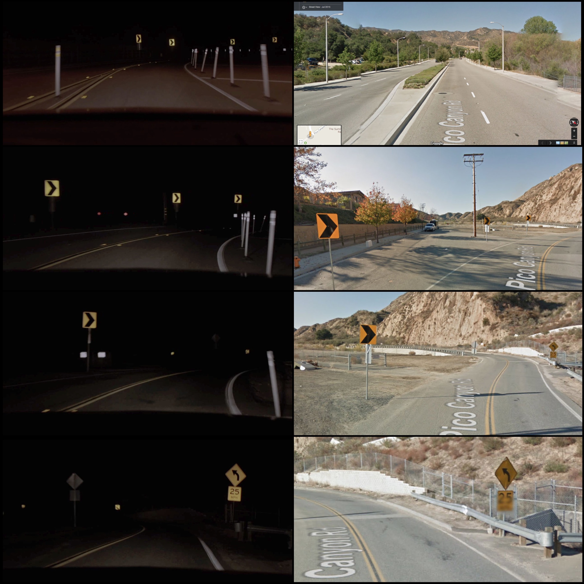
The majority of the scene was filmed along Pico Canyon Road in Stevenson Ranch, California. Thanks to Duwayne Dunham’s editing, the scene appears longer than it actually is. The area highlighted in red is where the scenes were shot.
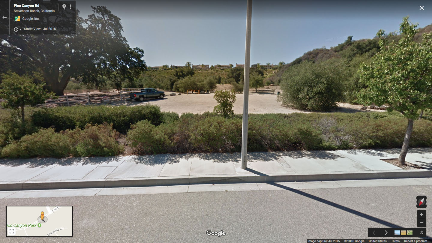
Similar to other driving scenes I’ve identified (see Agent Cooper’s Drive into Twin Peaks or Richard and Carrie Leaving Odessa) , I matched the background images with landmarks seen on Google Street View. This journey began by identifying the illuminated sign for Pico Canyon Elementary School.
I could clearly see the first word on the sign was “Pico,” but it took a frame-by-frame analysis to reveal the second word, “Canyon.” Once I had the name, a quick search revealed the location on Google Maps. I proceeded to watch the scene, capturing every background detail possible. From what I could tell, there were two parts edited together – the POV of the car and the interior scenes of Ray and Mr. C talking. This footage was seamlessly edited together to create the final on screen version. At this point, you should buckle up as it’s a wild ride!
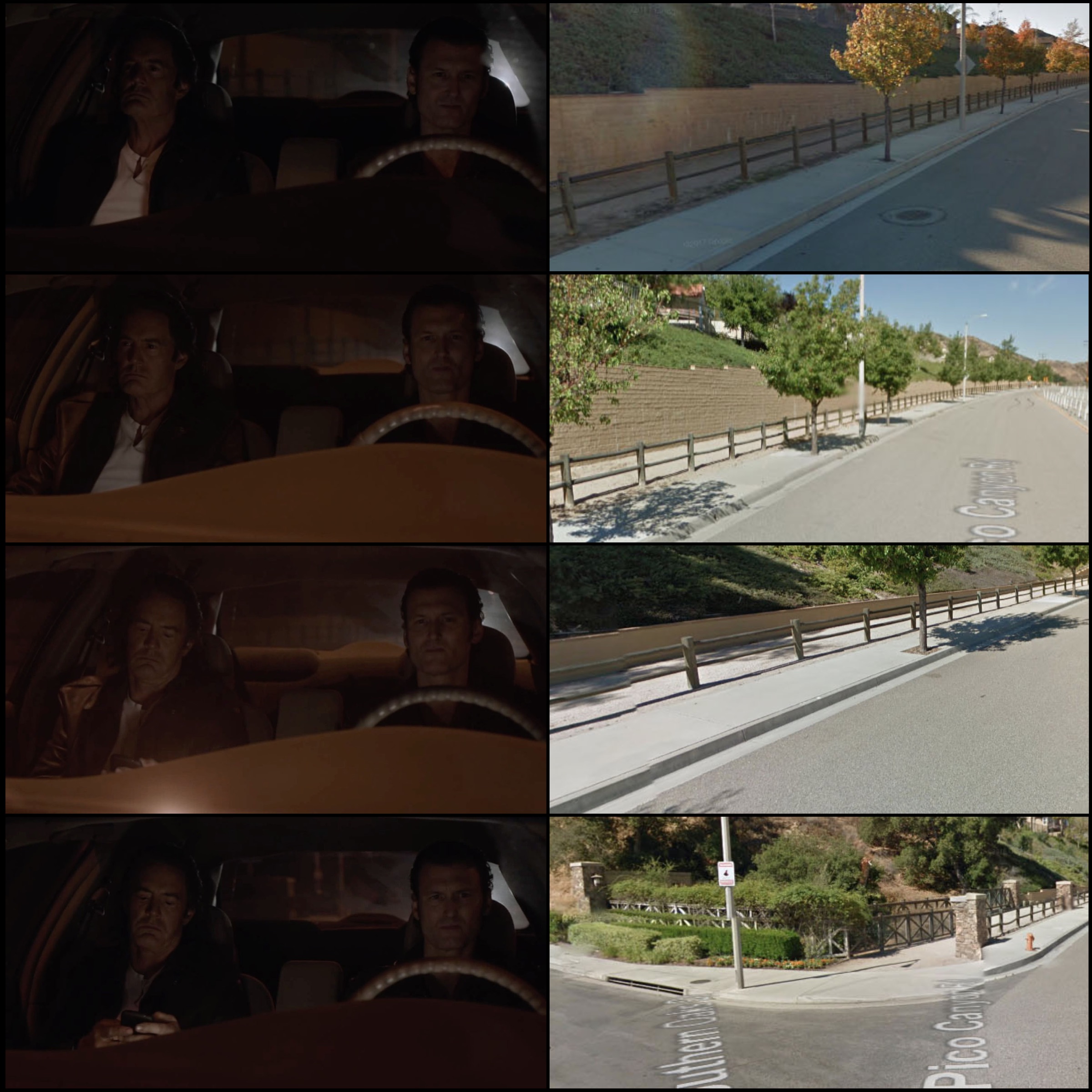
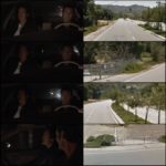
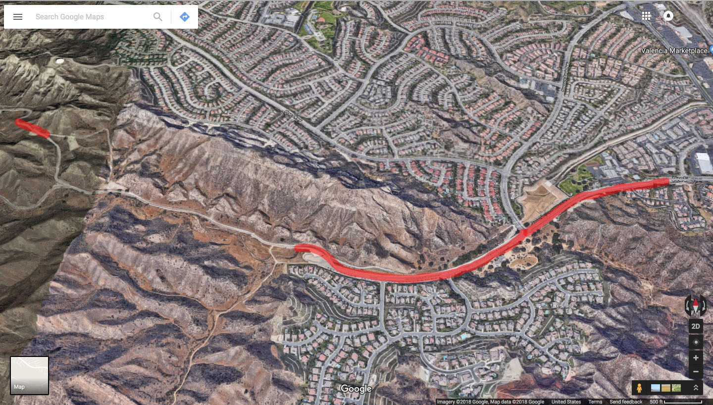
To start, I created these collage images that matched the scene with images I found on Google Maps. This meant toggling between the image capture and the Google Maps Street View to ensure the locations lined up. In total, there are ten of these collages – the first five are above and the remaining five are below (click on each image to enlarge).
Once the collages were complete, I wanted to show how the footage was edited together. So I used a zoomed out image from Google Maps of the area and placed the scene captures in the order they were shown. The collage images above contain more images than what I used on the maps below.
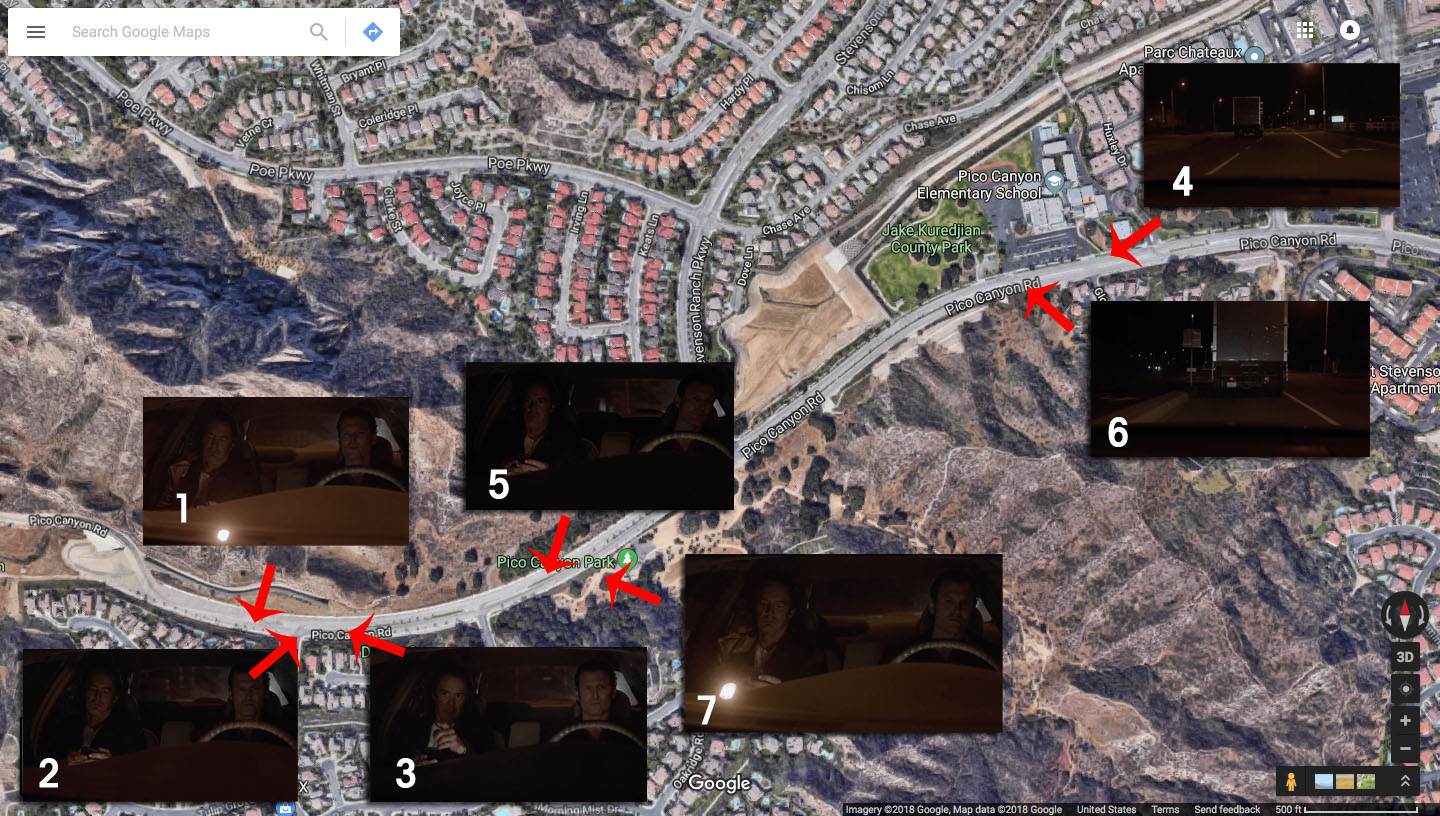
The scene starts with Ray Monroe and Mr. C headed northeast on Pico Canyon Road toward Stevenson Ranch Parkway. That’s scenes 1-3 where Mr. C deactivates tracking devices on their car.
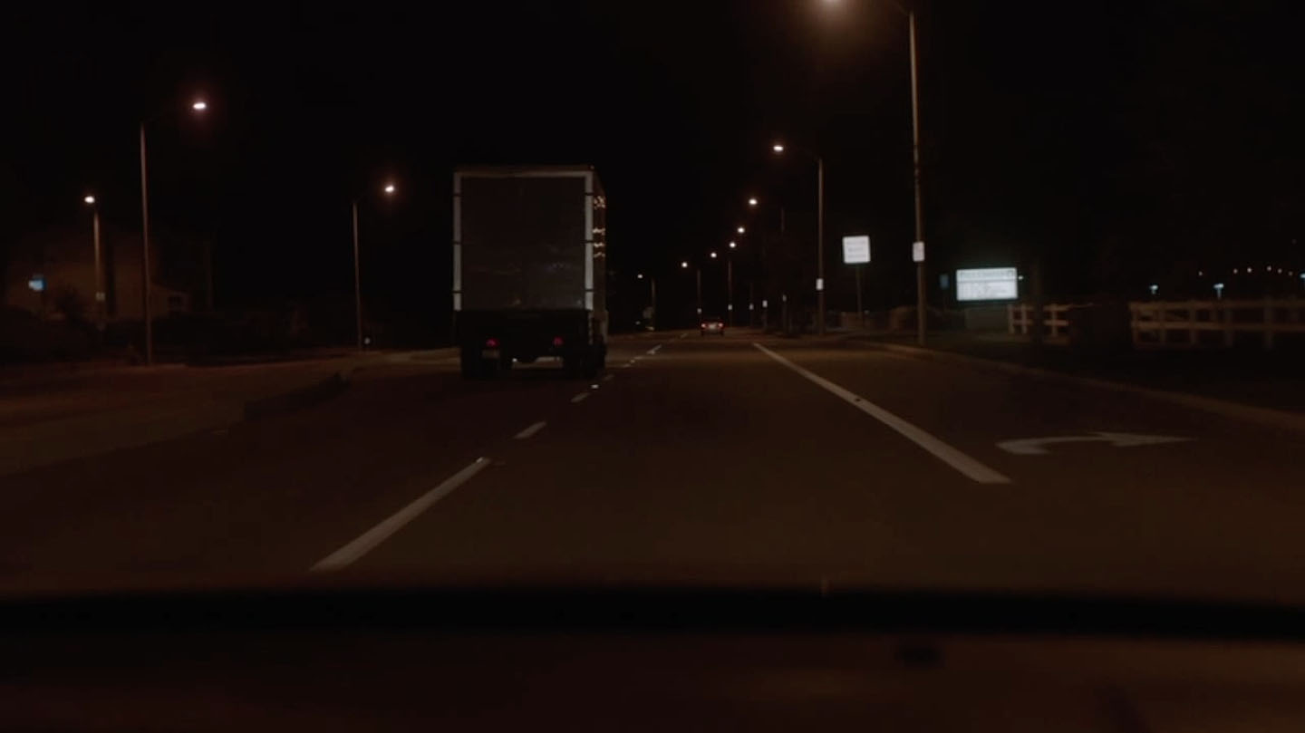
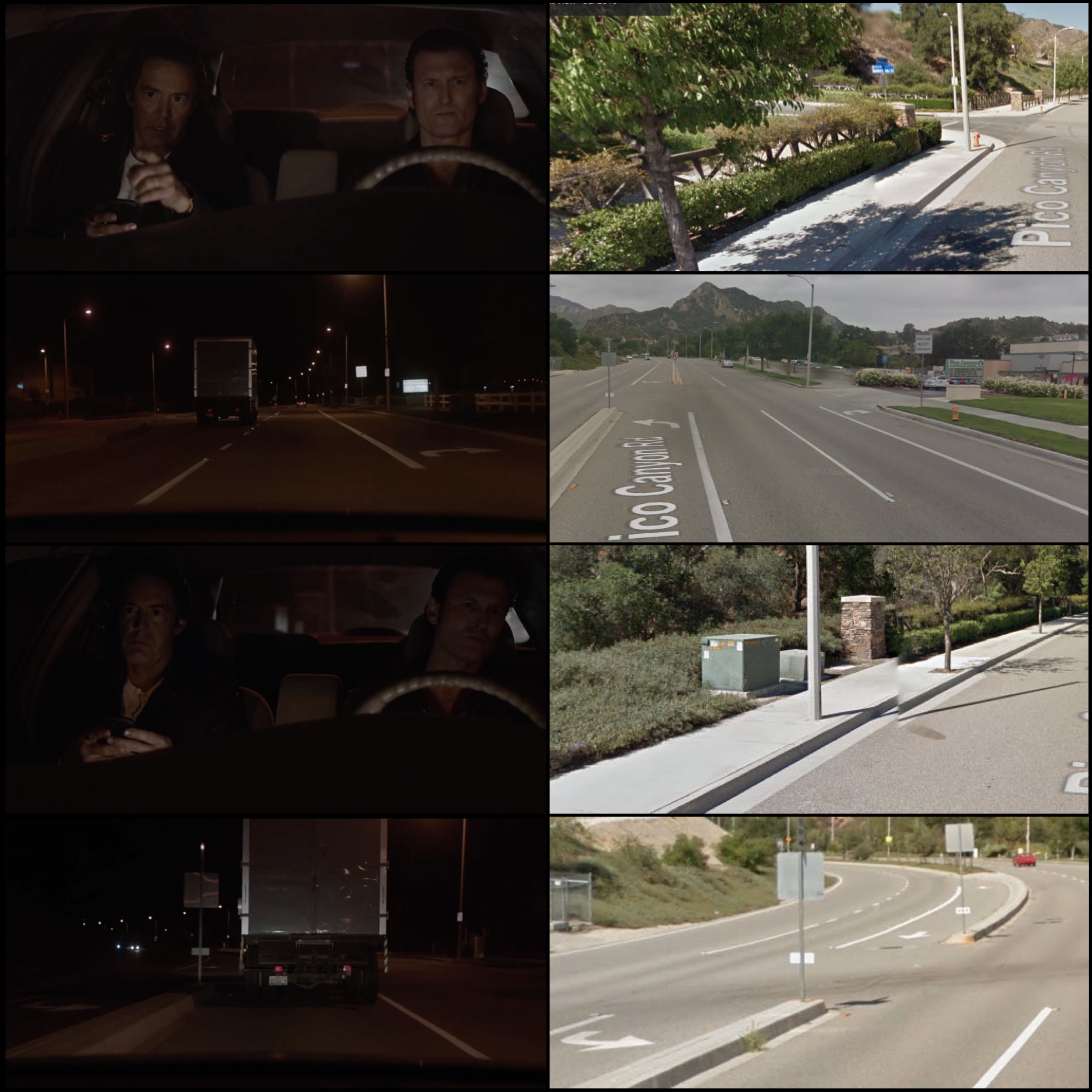
The scene cuts then to number 4 of a truck near Pico Canyon Elementary school driving west. Then back to scene 5 where Mr. C transfers the tracking information to the truck.
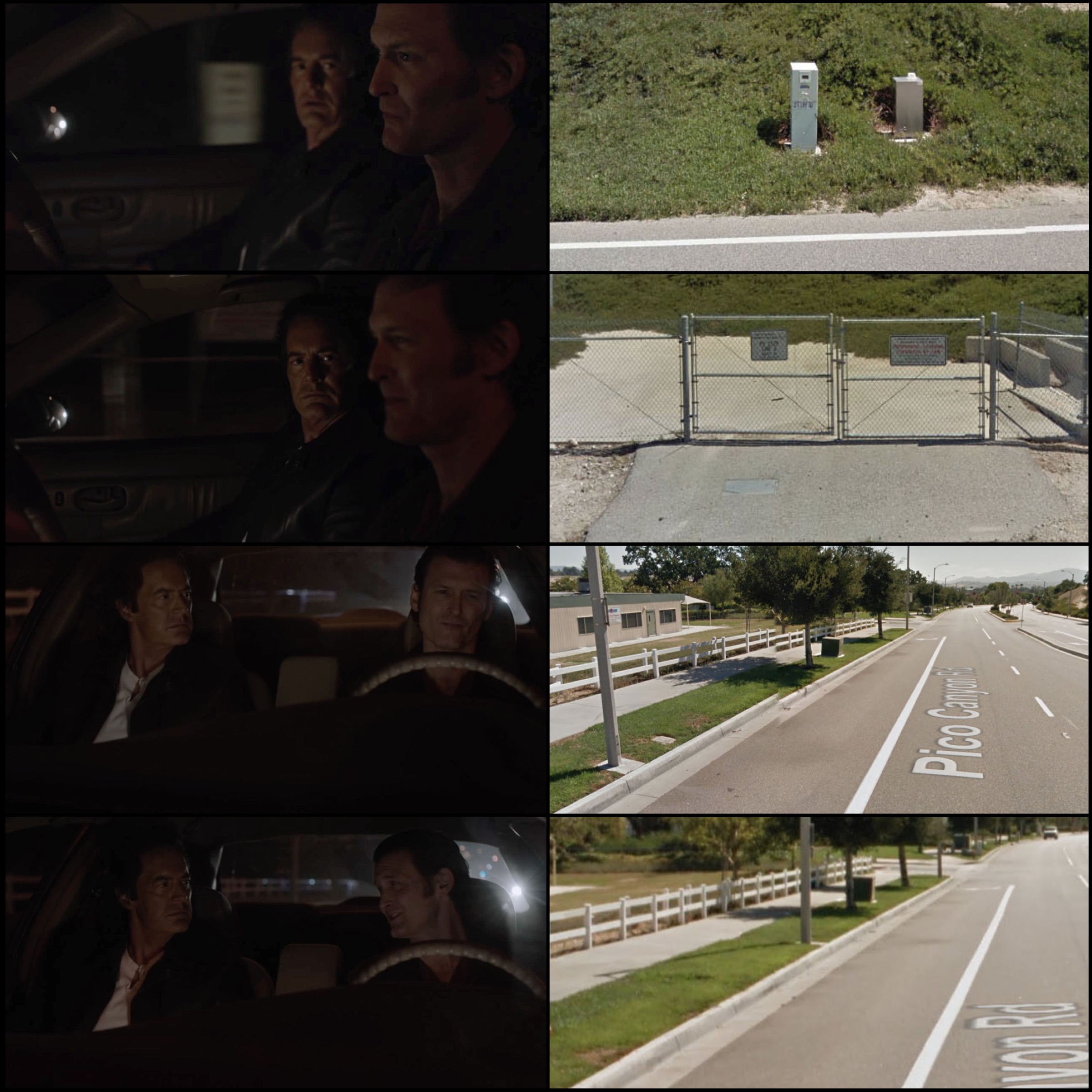
Another cut to scene 6 which has a close up shot of the truck headed west on Pico Canyon Road. One final cut to Ray and Mr. C starting to pass Pico Canyon Park.
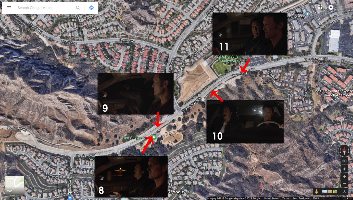
Scenes 8-11 are shot with the duo headed northeast on Pico Canyon Road.
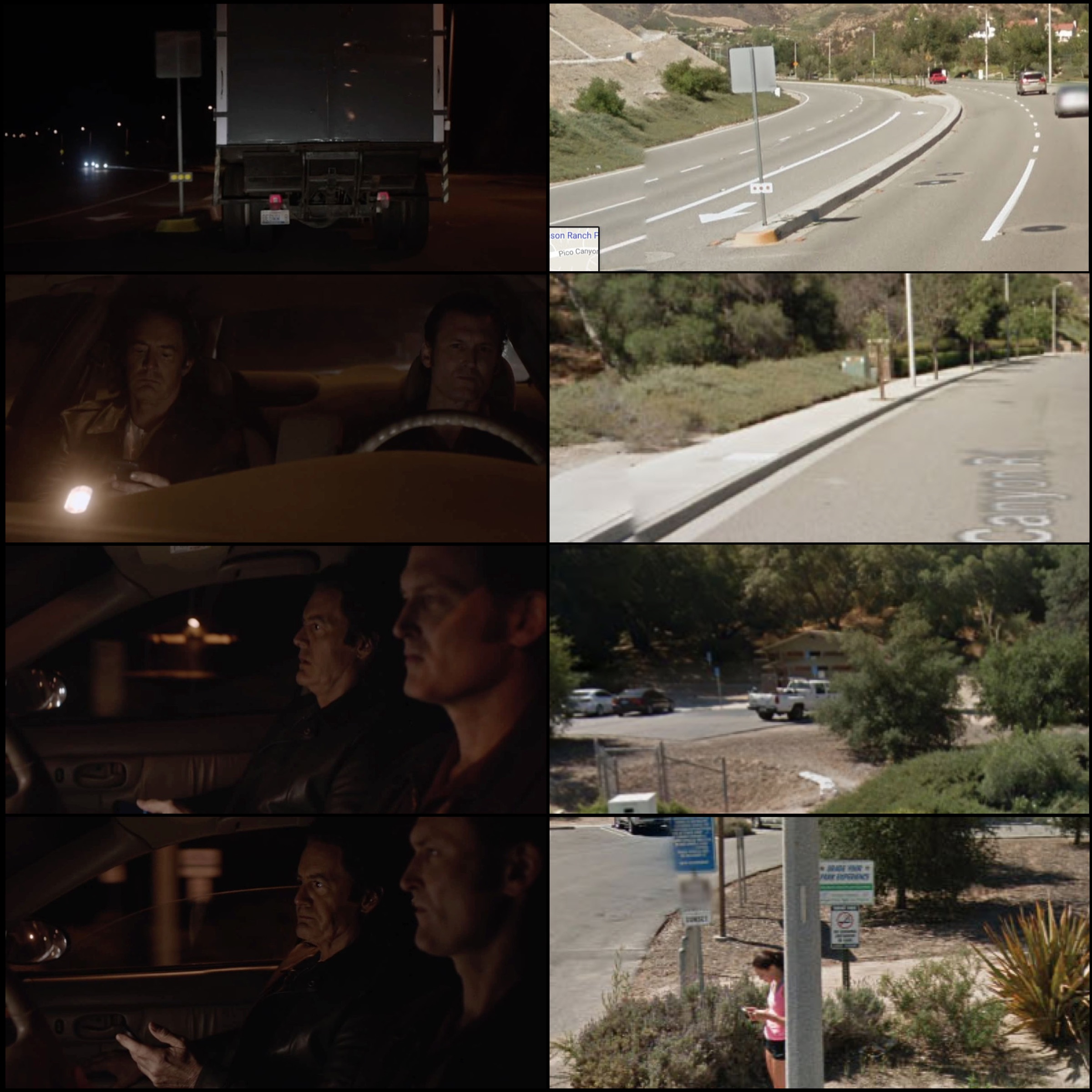
Scene 9 is around the spot that Mr. C throws his mobile phone out the window. It’s near Pico Canyon Park which is home to a magnificent transplanted Oak tree popularly known as “Old Glory.”
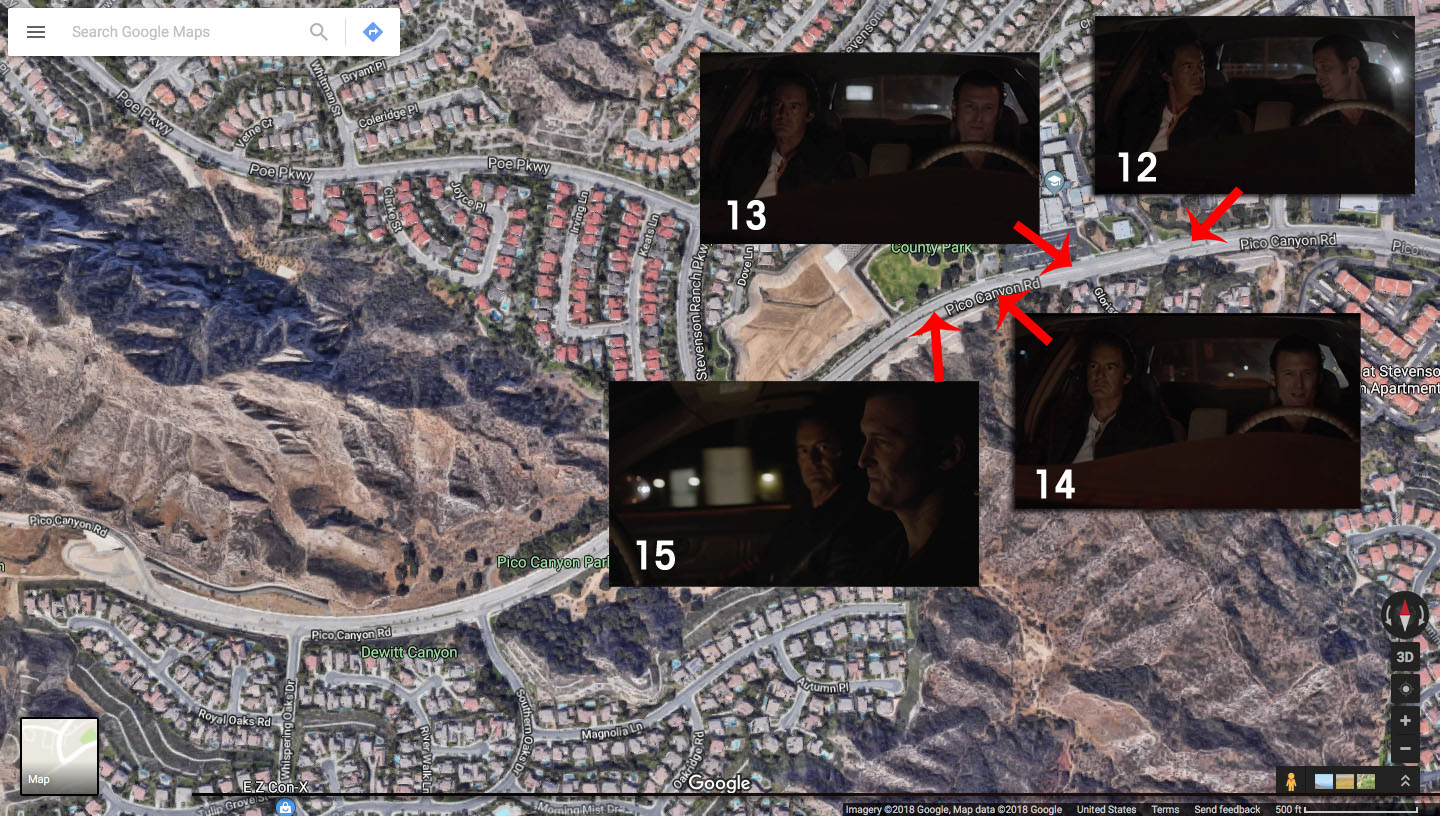
Scenes 12-15 are where the magic of editing takes over. Ray and Mr. C are now headed west on Pico Canyon Road. You can see the Elementary School sign behind them in Scene 13 above. In Scene 15, they pass Jake Kuredijan County Park.
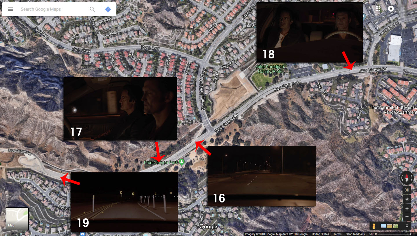
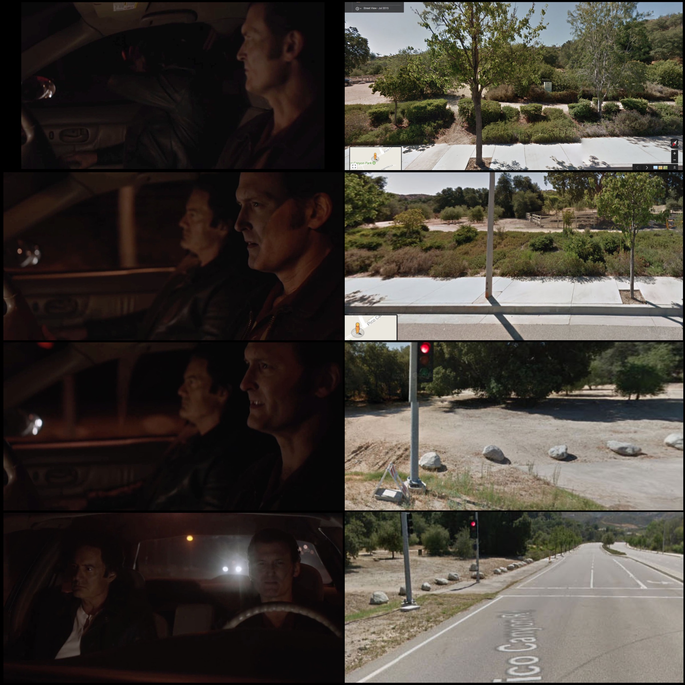
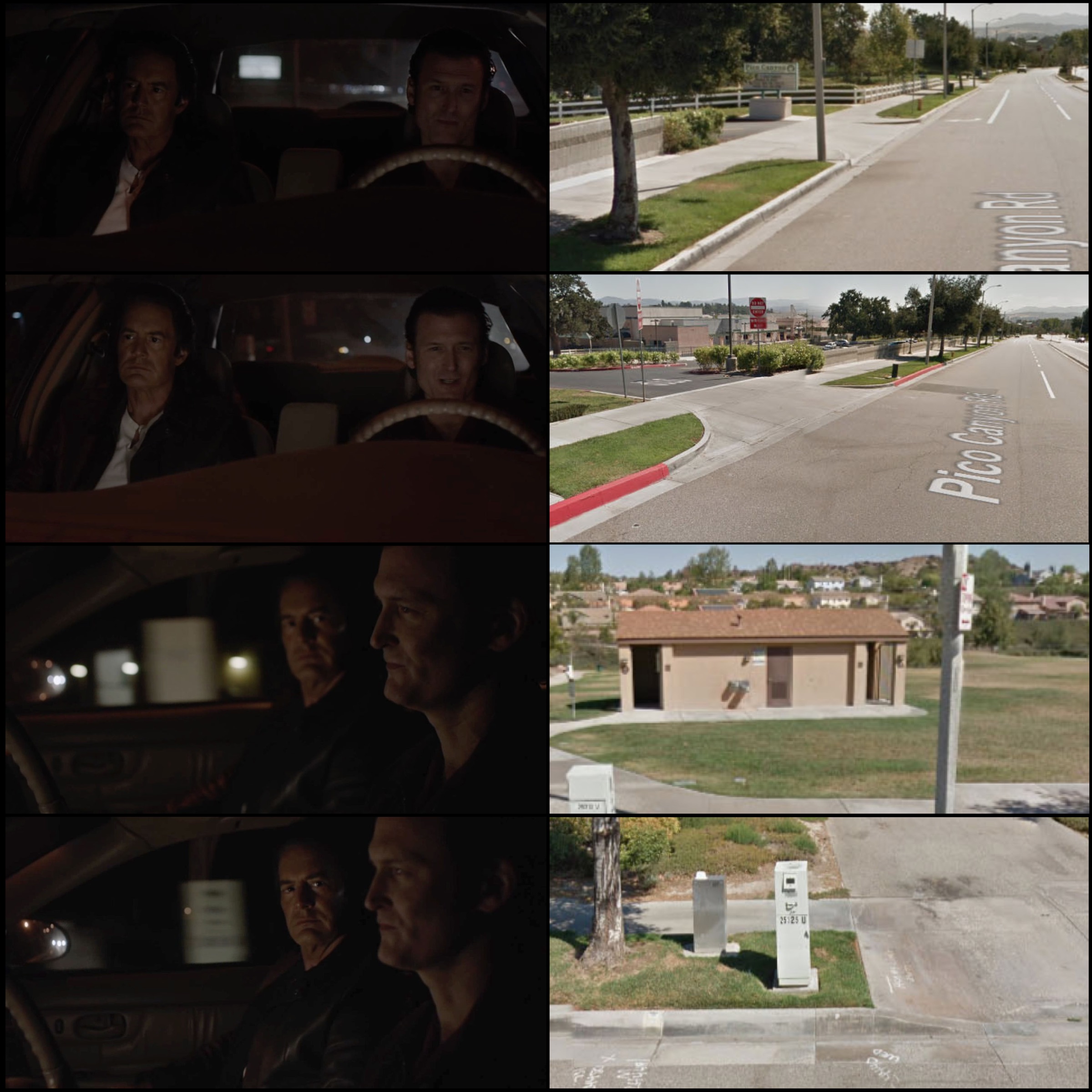
For Scene 16, 17 and 19, the two of them are still driving West. Scene 18 mysteriously shows them at a spot before even passing the Pico Canyon Elementary School.
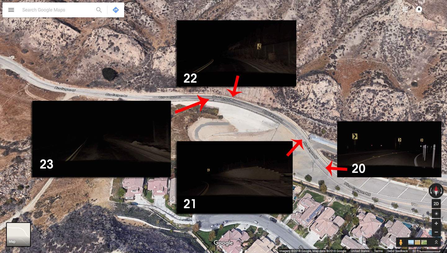
Scenes 20-23 are from the far western edge of Pico Canyon Road.
I love Google Maps and Street View! There are, however, limitations to the website. The majority of Street View scenes above were captured in July 2015.
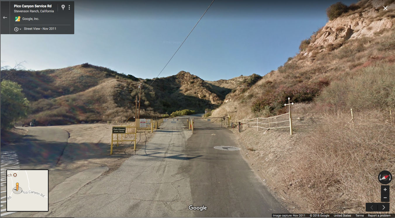
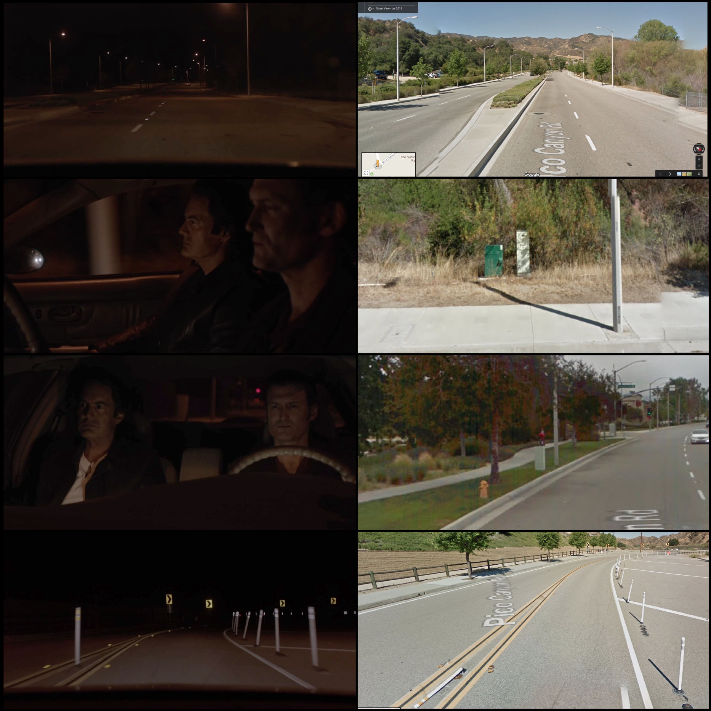
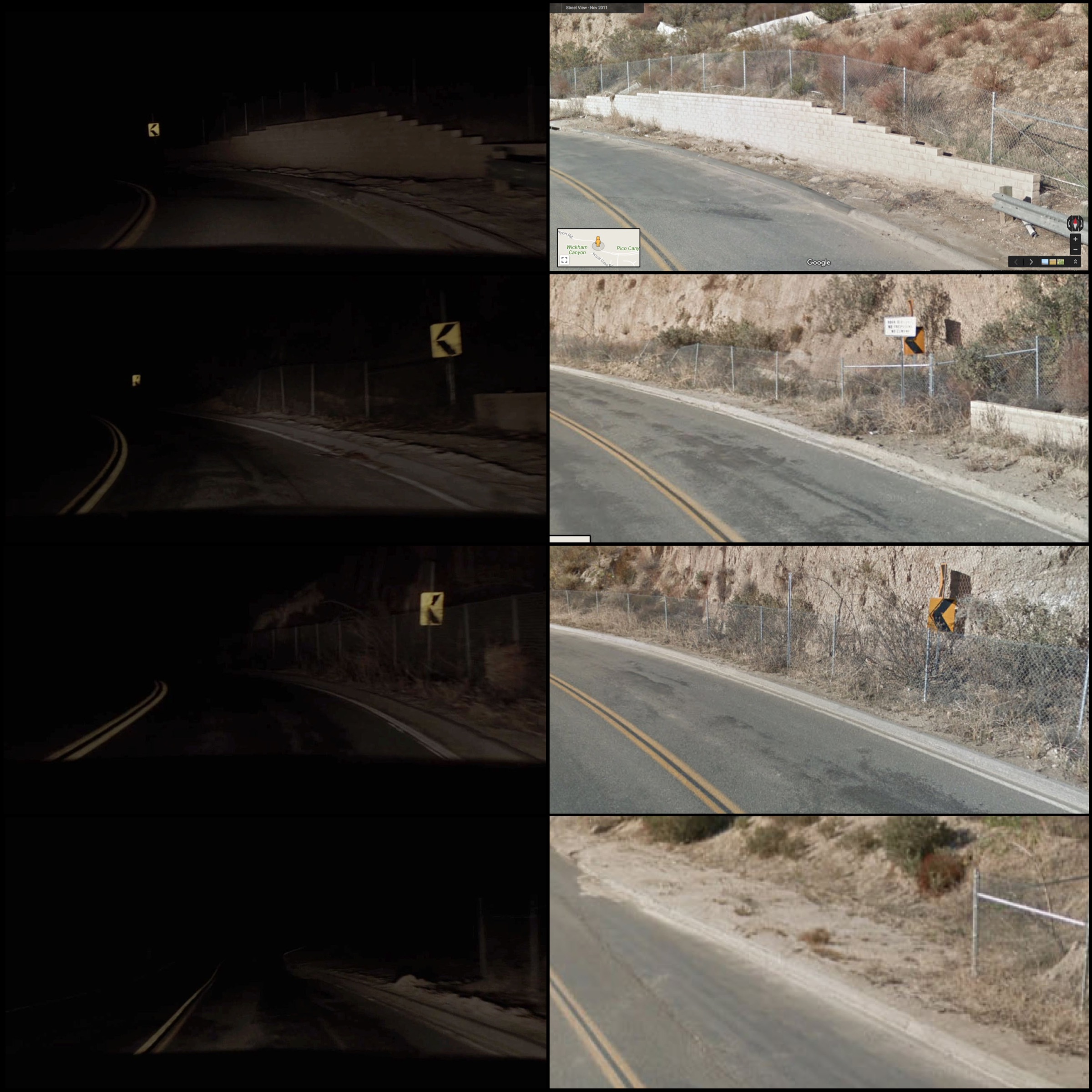
Once headed out beyond Scene 23 above, the Street View scenes were from November 2011. Unfortunately, there is a point where the road is closed and I was unable to see Street View beyond this point.
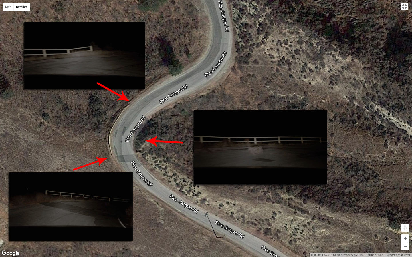
I was, however, able to determine that part of the POV car scenes was shot on Pico Canyon Road. Look at the road detail in the bottle left image and match it with the satellite image.
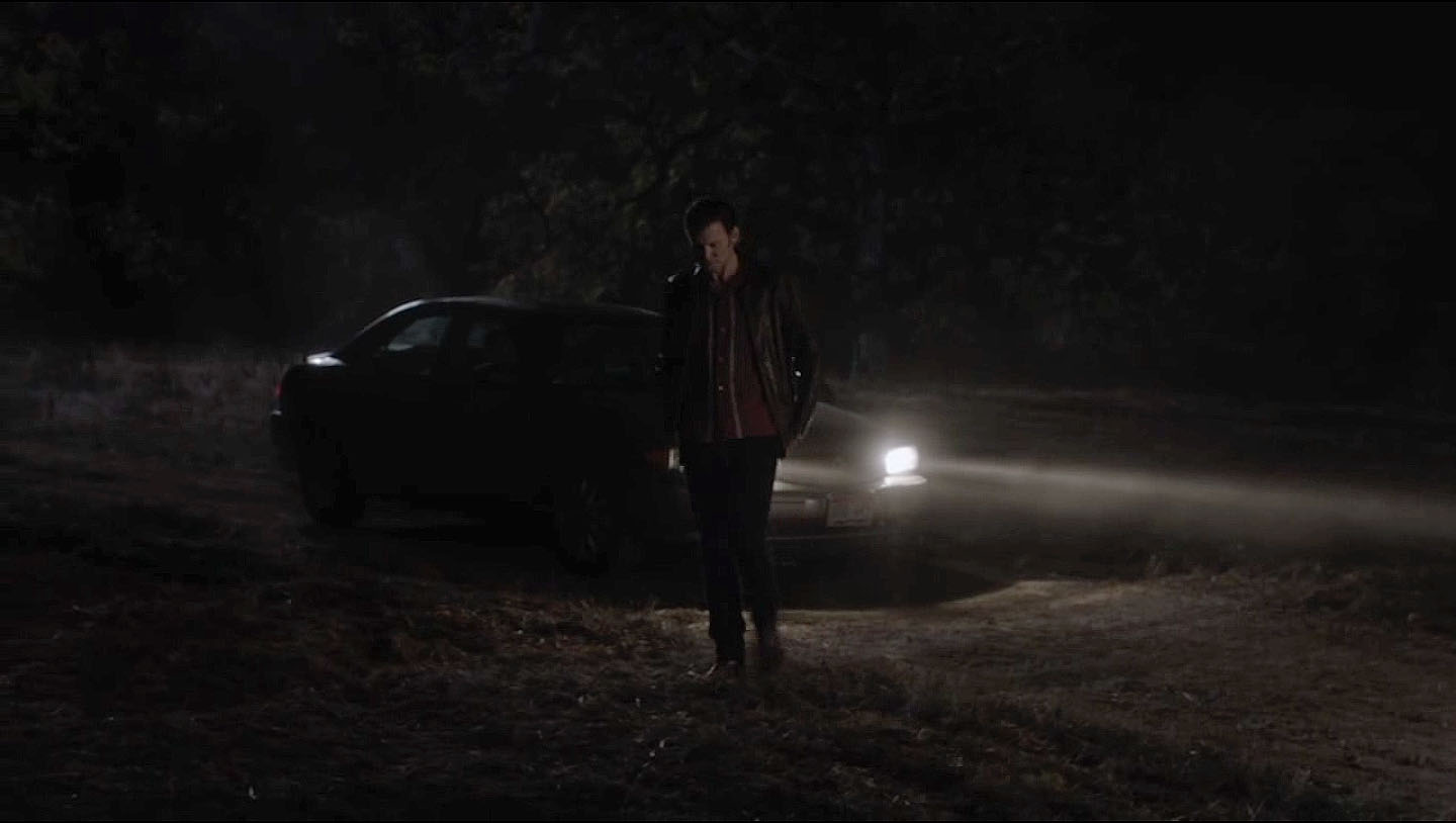
After traveling down a non-paved road, the scene ends with Ray pulling over to relieve himself. It is unclear if the rest of this scene was shot in Mentryville Park or if it was shot in another location.
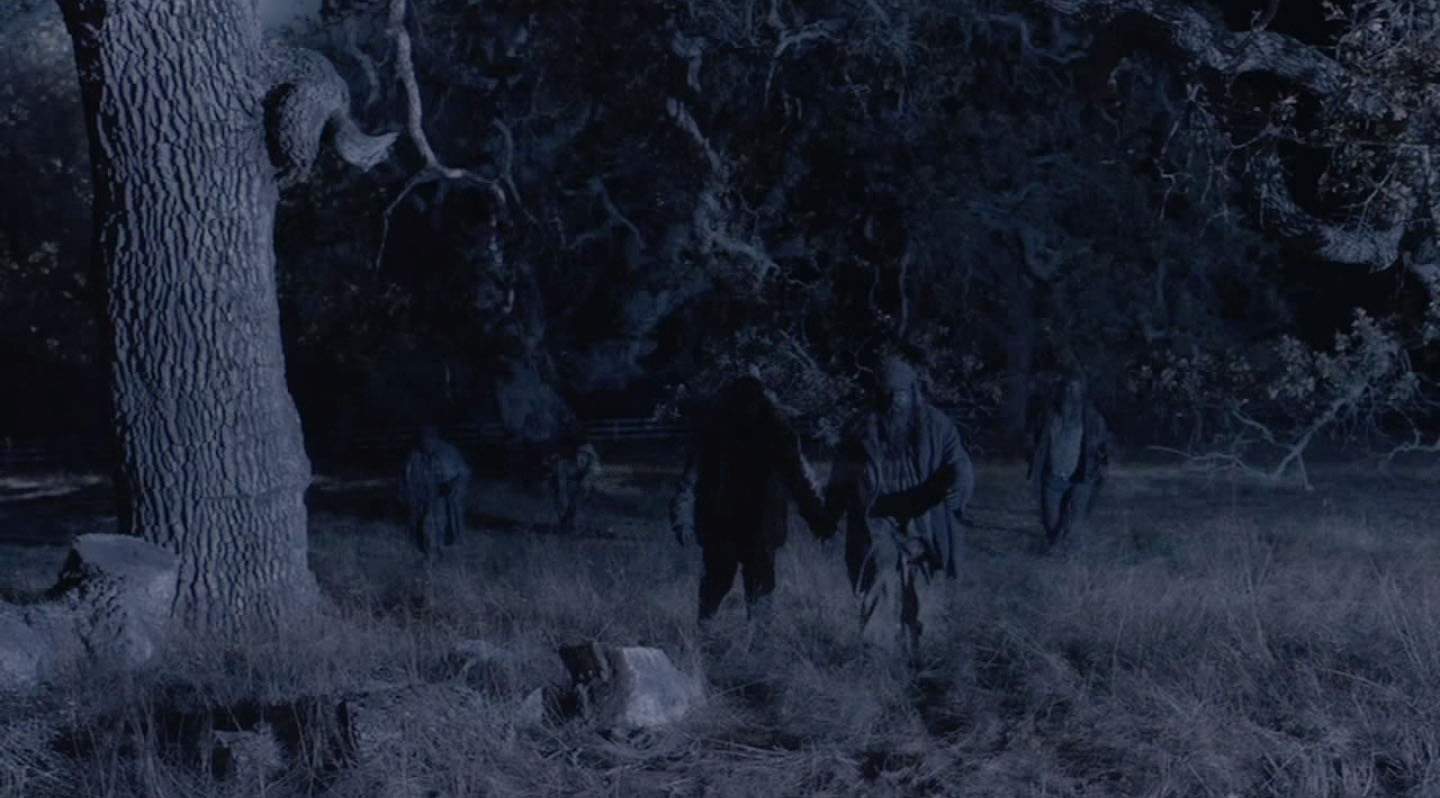
Part of me believes this sequence was shot in a different location based on the white fence seen in the distance. Looks like I need to head back on the road to find it!
Author
Discover more from TWIN PEAKS BLOG
Subscribe to get the latest posts sent to your email.
Damn, deep detail! Good job. Very enlightening…