[Cue “Deer Meadow Shuffle”]
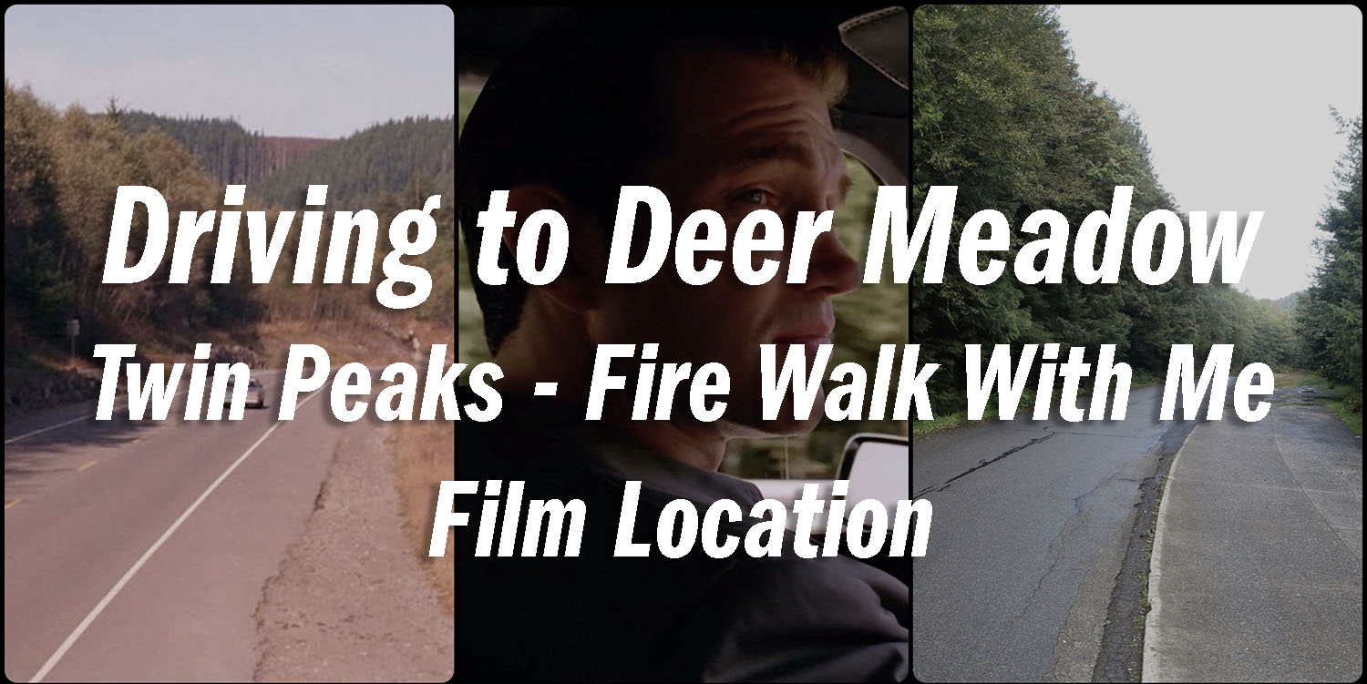
I’ve previously shared how much I love for the first 30 minutes of Twin Peaks: Fire Walk With Me. There is something mesmerizing about the interactions between FBI Agents Chester Desmond and Sam Stanley. Shortly after Gordon Cole introduces them, the Agents head toward Deer Meadow, Washington to examine the body of Teresa Banks. This article examines the actual location where they shot the driving scene in Washington state. I wrote this article on July 28, 2018, and updated it on May 27, 2020 with location photos from my September 2019 visit.
HISTORY OF THE ROAD
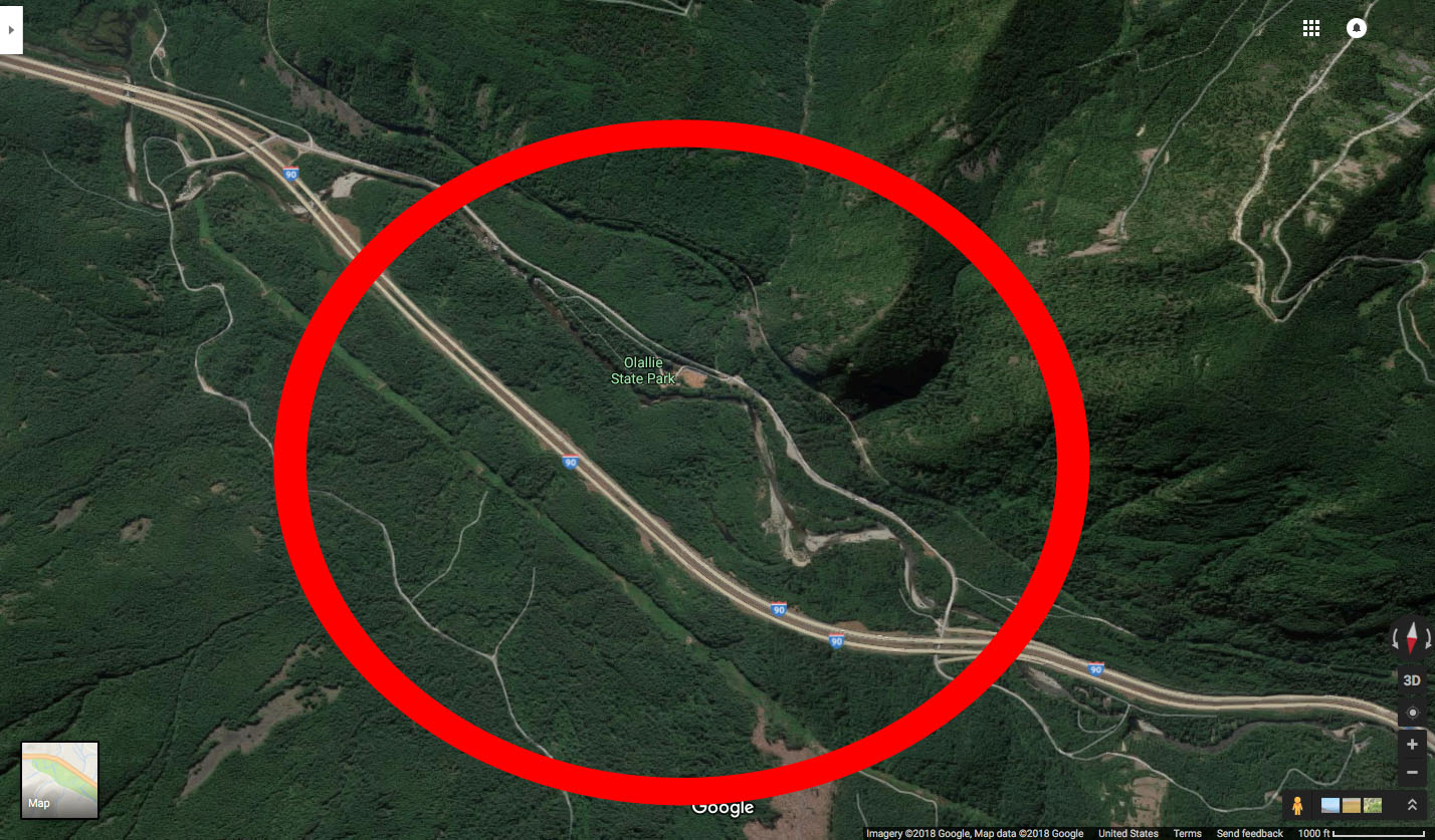
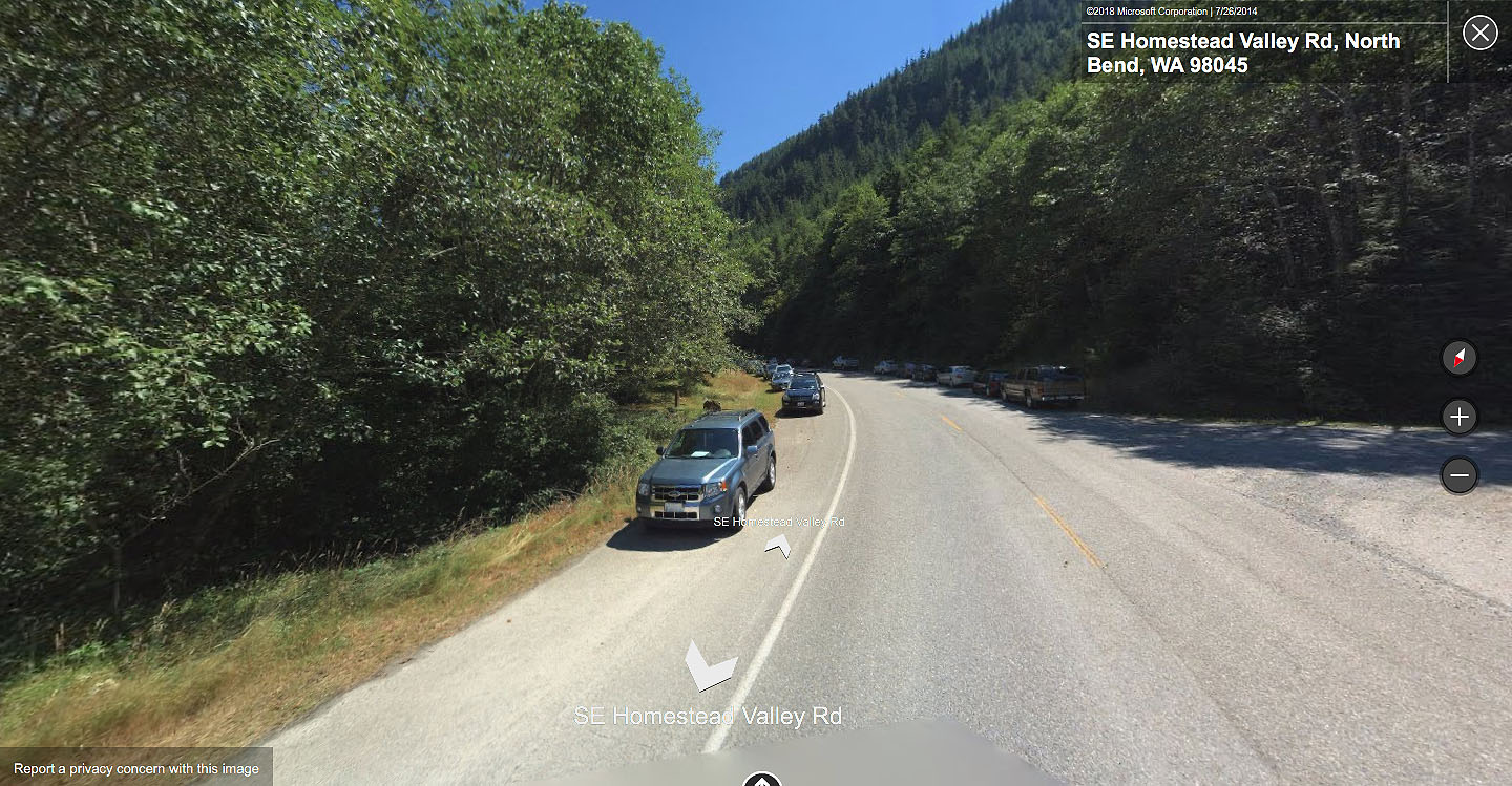
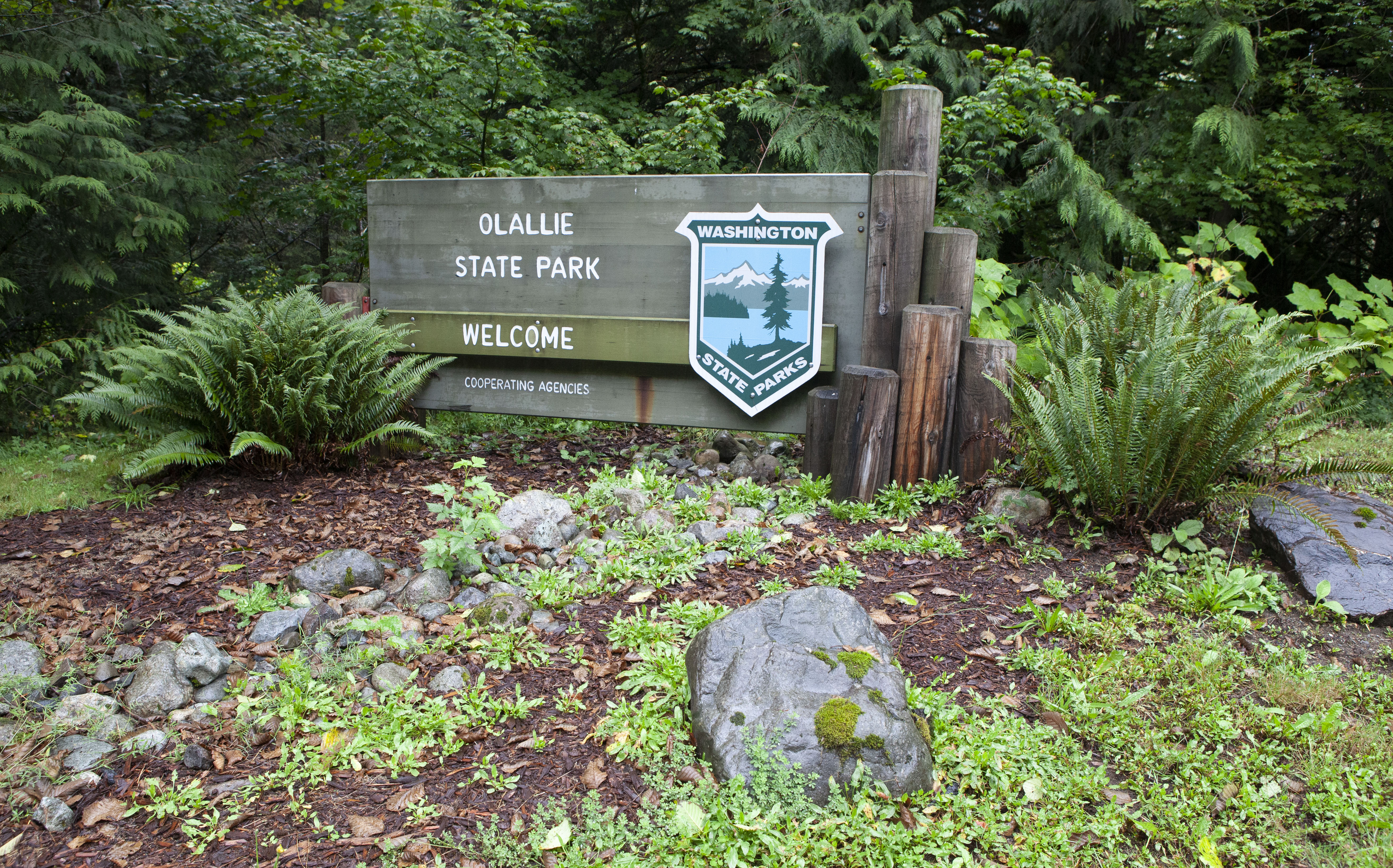
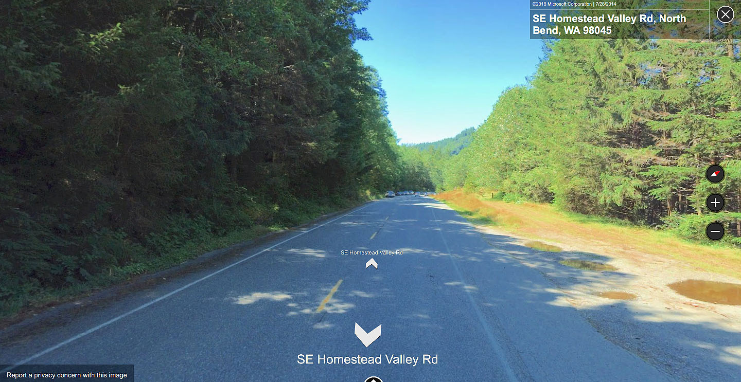
The driving sequence was mostly shot along SE Homestead Valley Road near Olallie State Park just outside North Bend, Washington. This park is home to many film locations in Lynch’s feature film (Deer Meadow Sheriff’s Station, Wind River) and in Season 3 on Showtime.
Southeast Homestead Valley Road is part of Old Sunset Highway Heritage Corridor in King County, Washington.
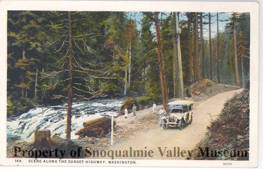
In the mid-1800s, the U.S. Government wanted a road over Snoqualmie Pass to encourage migration through the Columbia River Gorge. By 1867, the first rough wagon road was completed from Seattle to Ellensburg (about 107 miles).
Seattle and Walla Walla Trail and Wagon Road Co. operated the road as a toll road in 1883. As the railroad lines grew in the region, the road fell into disrepair. David Denny contracted with King County in 1899 to repair and improve the road. Shortly after, the first automobiles began traveling this old wagon road in 1905, thus launching a new era in travel in the Pacific Northwest.
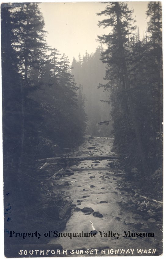
Automobile traffic grew dramatically in the early 1900s. In 1912, local auto groups partnered with Washington State Good Roads Association, a national advocacy group that worked to improve road systems. Together they encourage politicians to build three highways in Washington state, with being the “Sunset Highway.” This road would run “west from the Idaho line, over Snoqualmie Pass and down into Fall City.” It would then continue south around Lake Washington and into Seattle.
In March 1914, the State Highway Board accepted bids for road construction that would encompass about 23.4 miles of the Sunset Highway between North Bend and Cle Elum. At the road’s dedication in 1915, Governor Ernest Lister said the Sunset Highway was the “first passable route between east and west sides of the mountains.”
Improvements would continue in the 1920s and 30s thanks to additional federal funds made available under the Federal Highway Act of 1921. By 1934, the highway was completely paved and it received official designations as State Road No. 2, Primary State Route No. 2, and U.S. Highway 10.
SHOOTING THE SCENE
This scene was most likely shot around mid-September 1991. The Deer Meadow Sheriff Station scenes (including the fight between Desmond and Sheriff Cable) took place on September 13 according to the Shooting Diary on Dugpa.com. It stands to reason the driving scene was shot either on or around that same day.
Like other driving scenes, such as Ray Monroe driving Mr. C in Part 8 or Driving to 430 Miles in Part 18, it appears scenes were edited out of order from how they were shot. Most likely they filmed a few passes and editor Mary Sweeney selected the best takes and reaction shots.
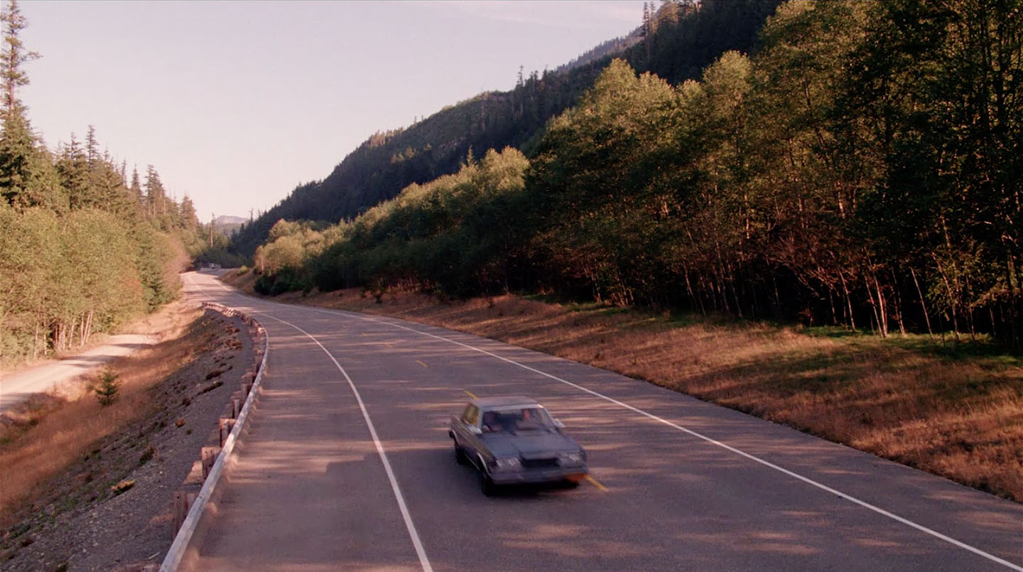
ESTABLISHING SHOT
EXT. HIGHWAY ON THE WAY TO DEER MEADOW – DAY
Desmond’s car on the highway.
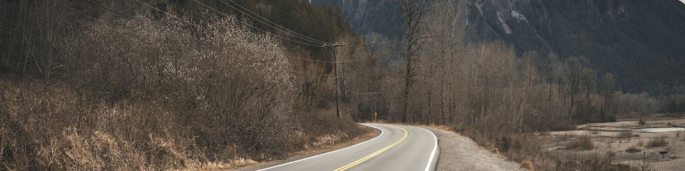
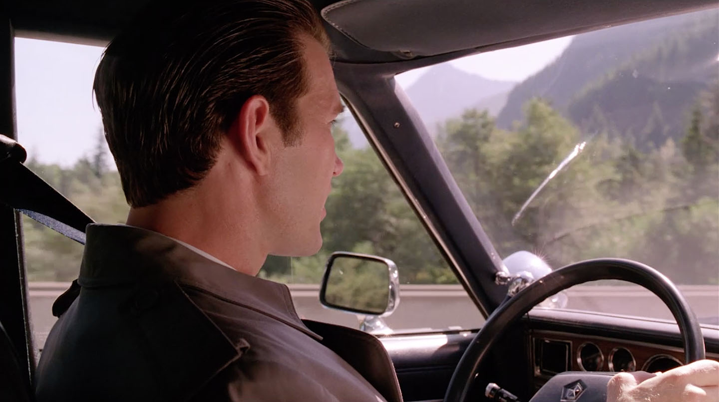
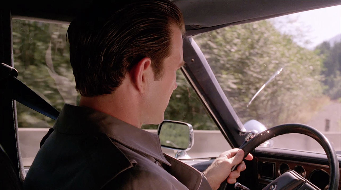
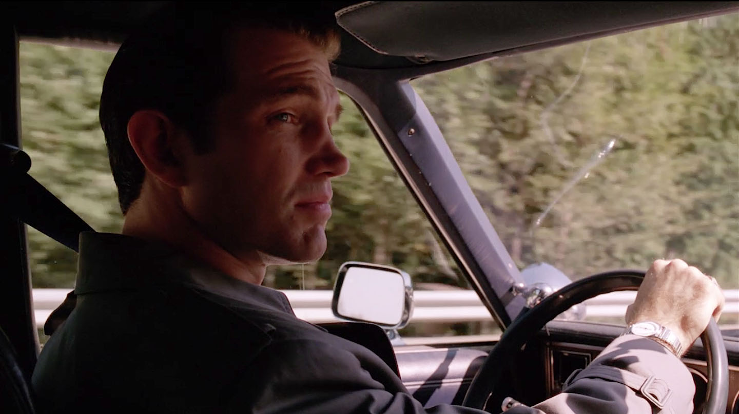
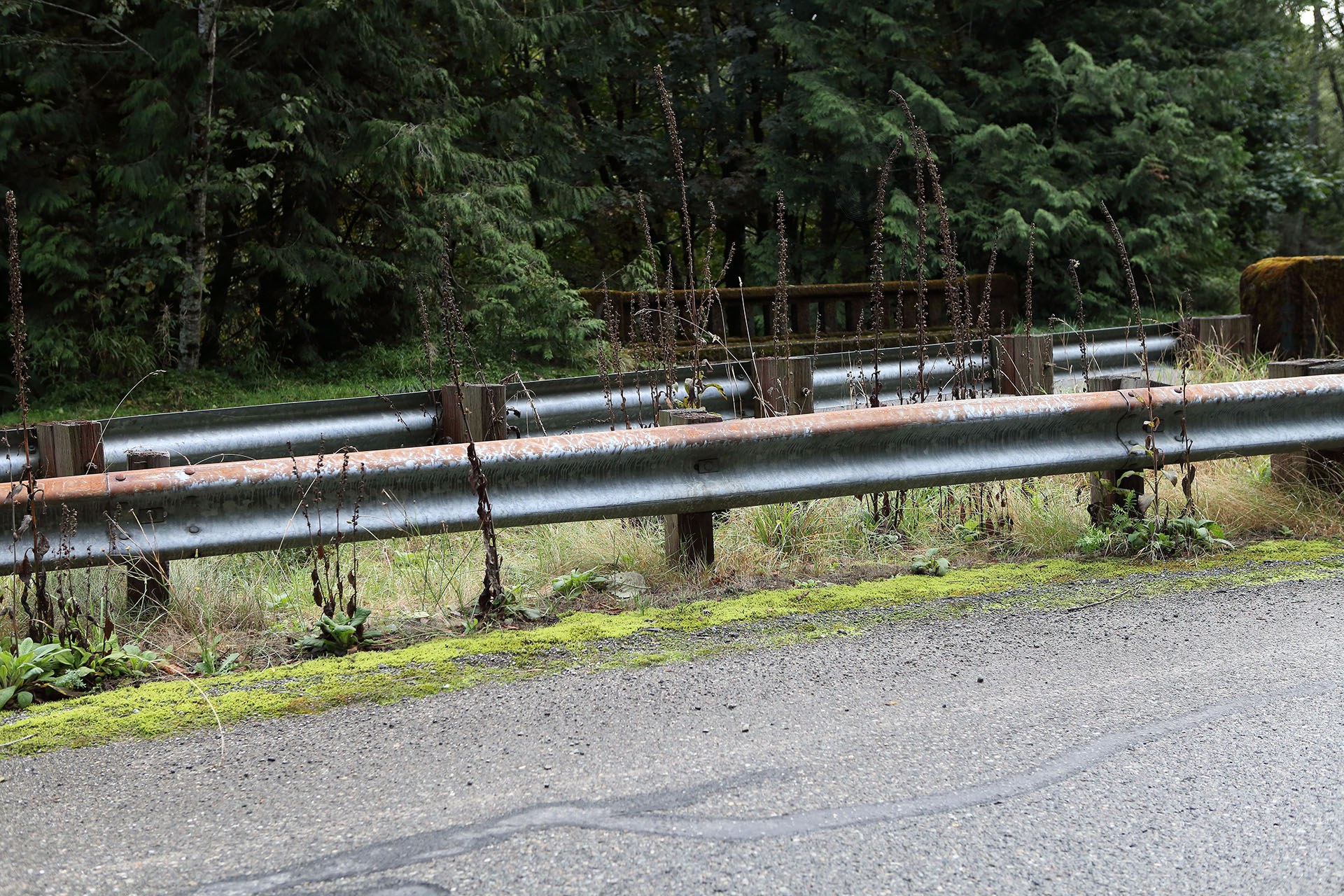
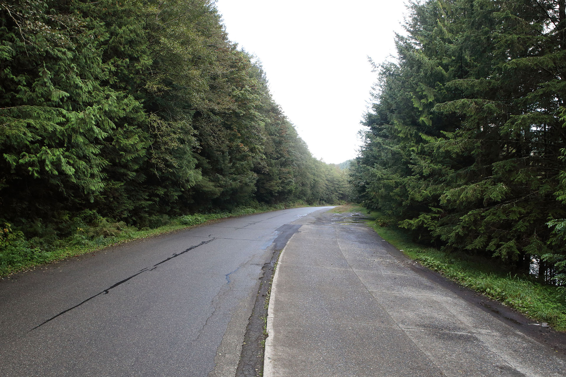
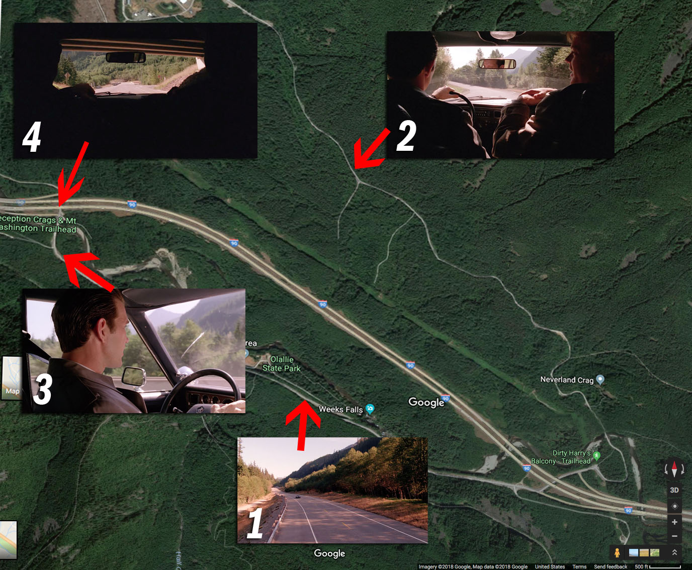
The scene opens with Agents Chet Desmond and Sam Stanley driving down an empty road, which is actually SE Homestead Valley Road.
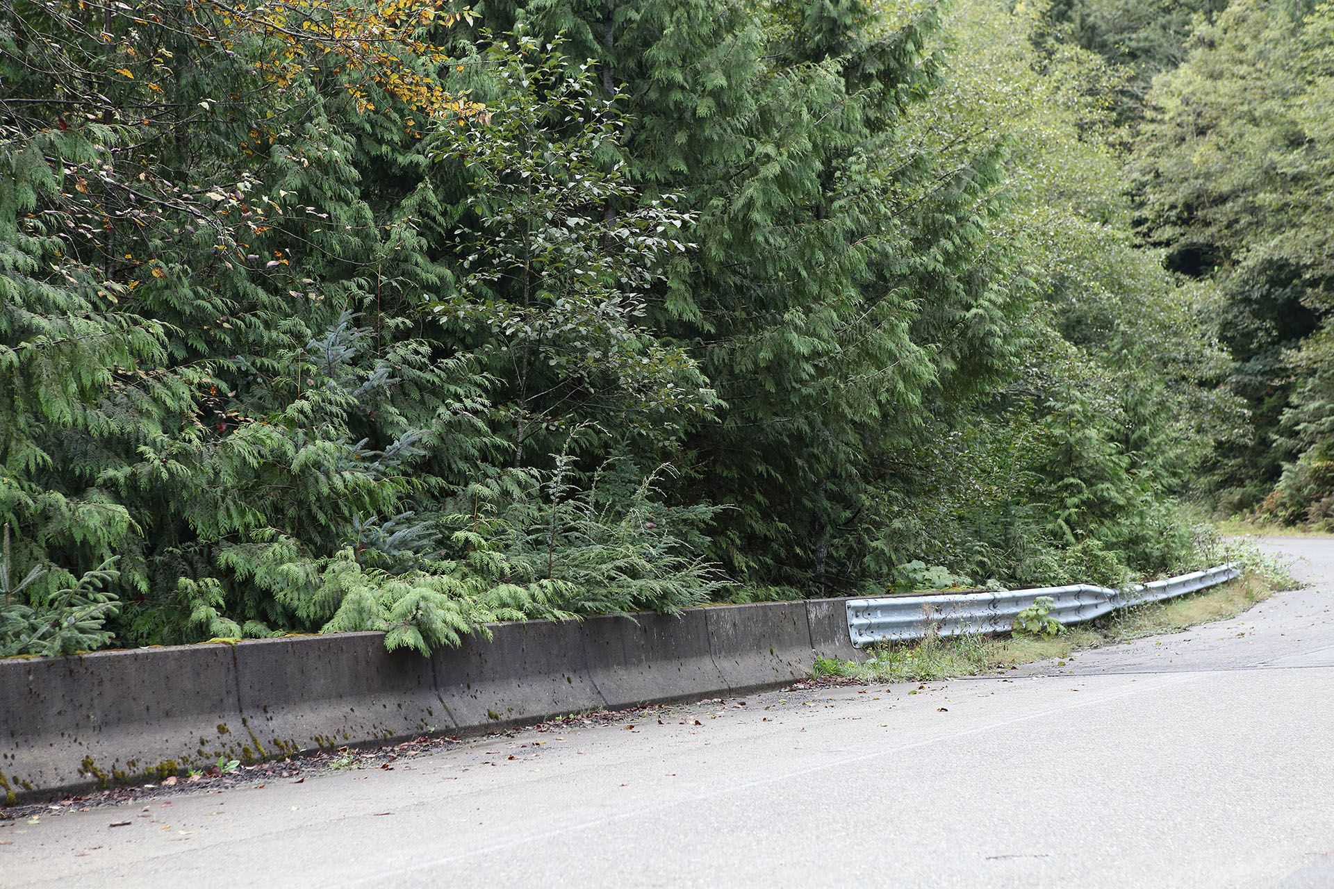
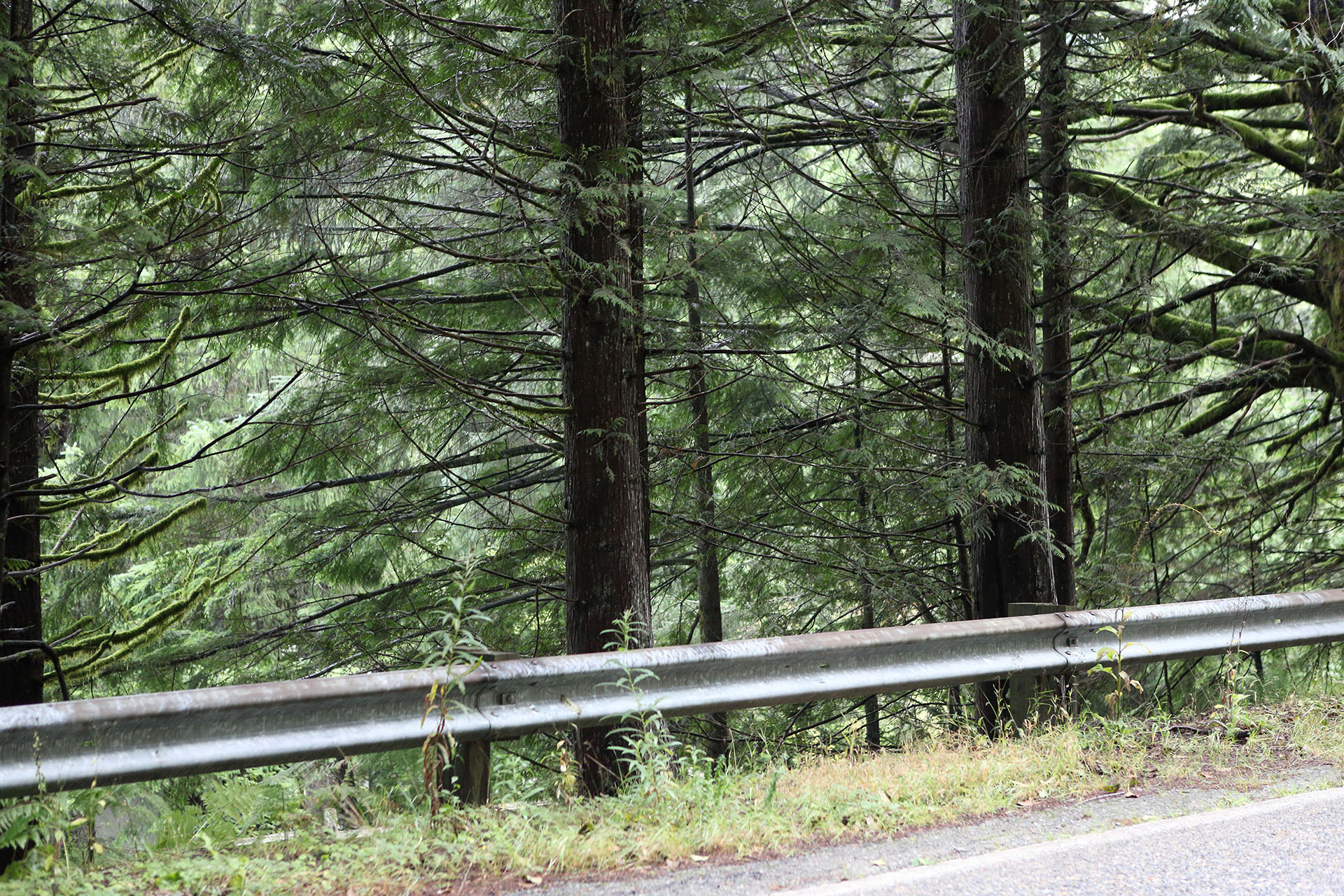
It was the guard rail on the left side of the image which helped me find the spot located at 51334 SE Homestead Valley Road , North Bend, Washington (47°25’58.8″N 121°38’52.2″W)
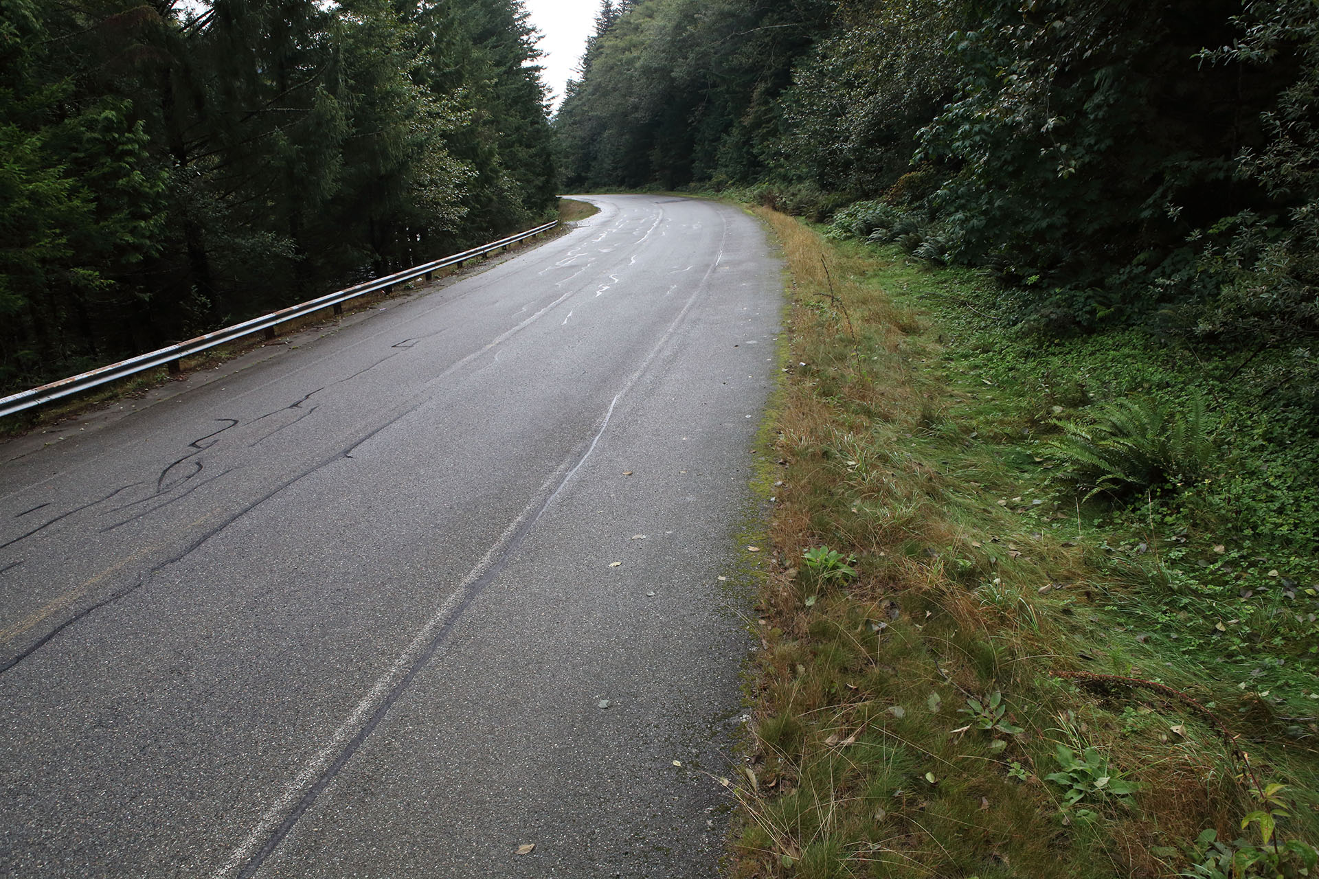
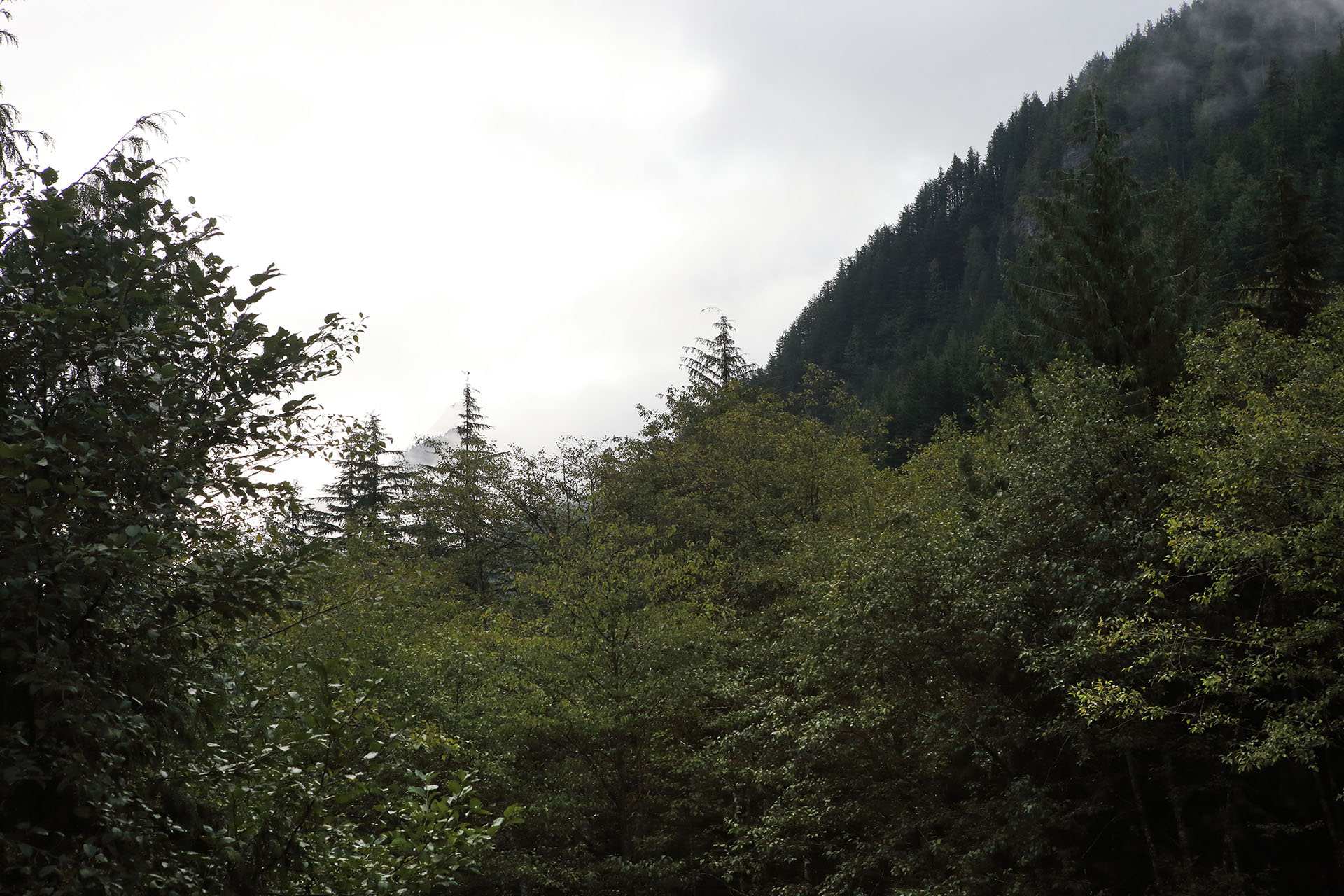
The shot of the Agent’s car was clearly captured using a crane or high-reach truck. I had neither when I visited in September 2019. Instead, I used a 10-second timer on my camera and raised my tripod as high as it would go.
GROUSE RIDGE ROAD
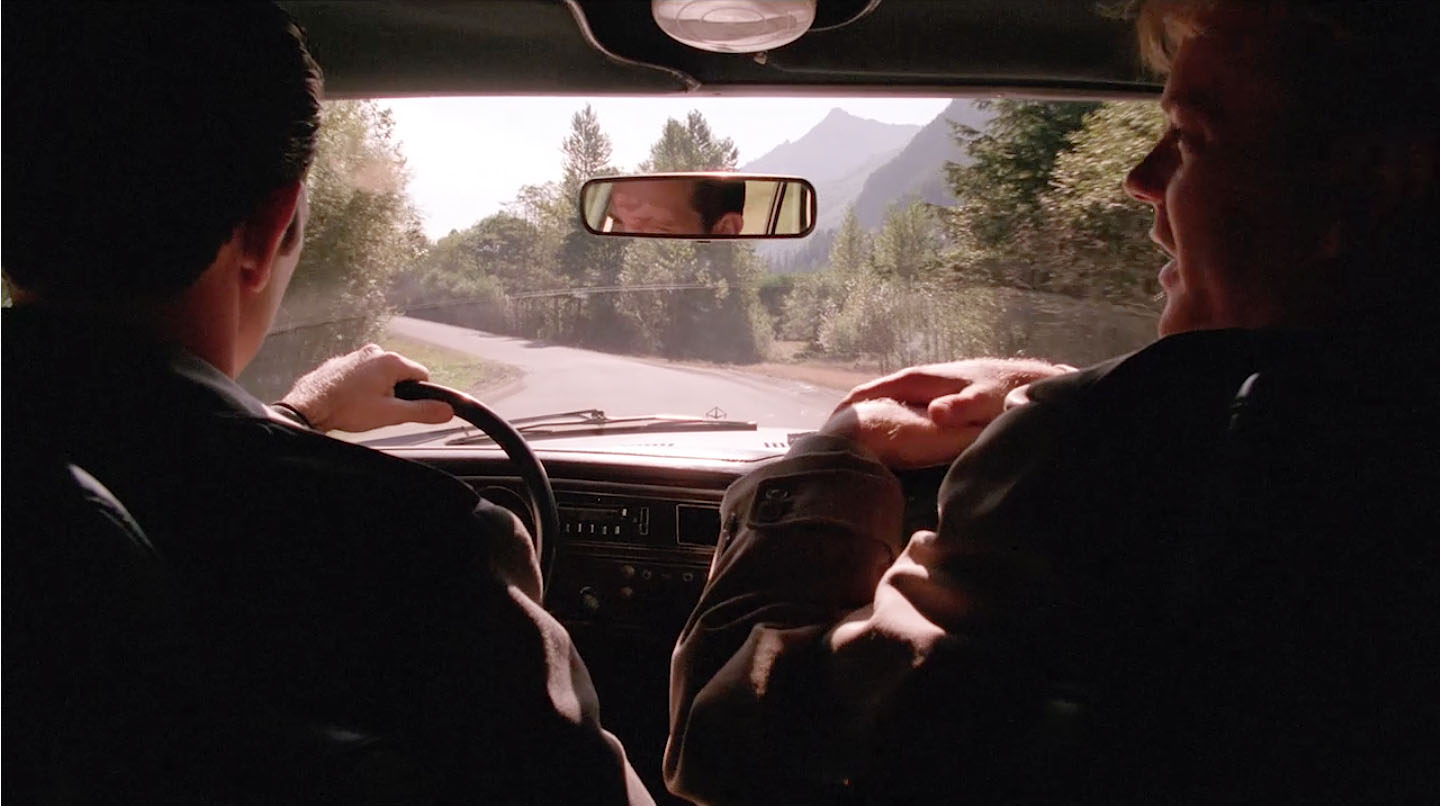
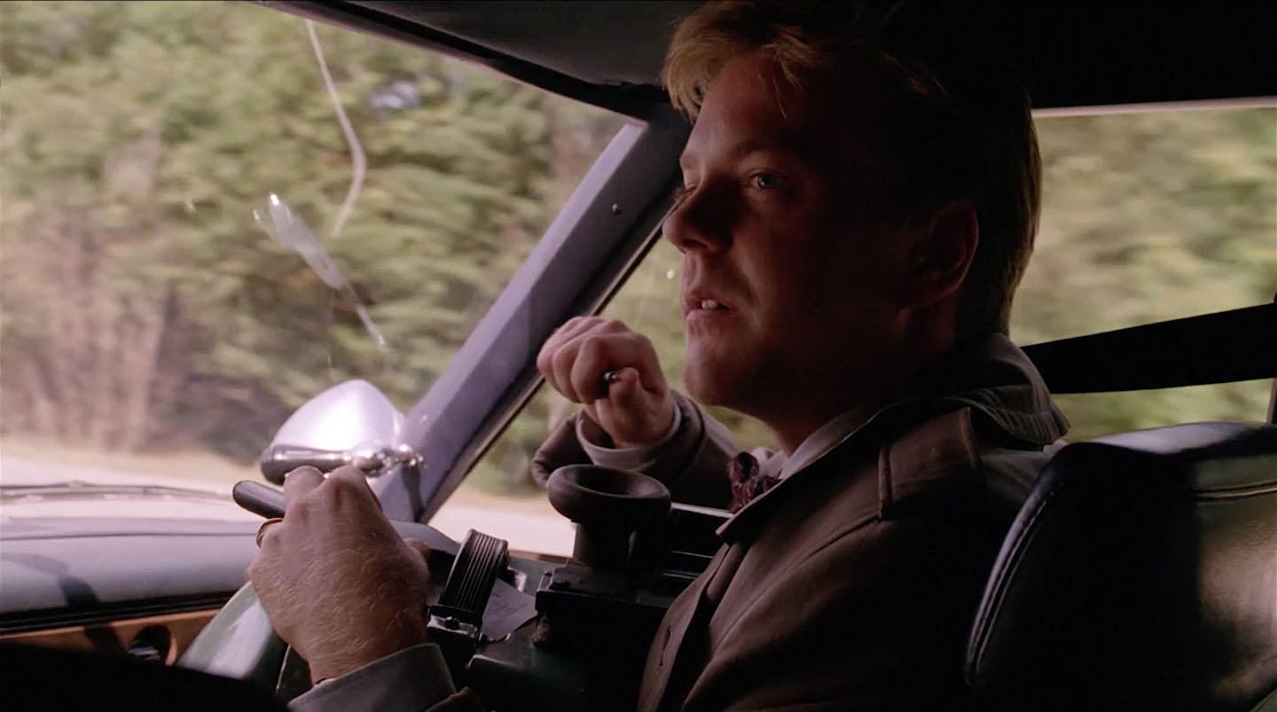
The scene cuts to an interior shot of the Agents discussing Gordon Cole’s code-filled dancer Lil.
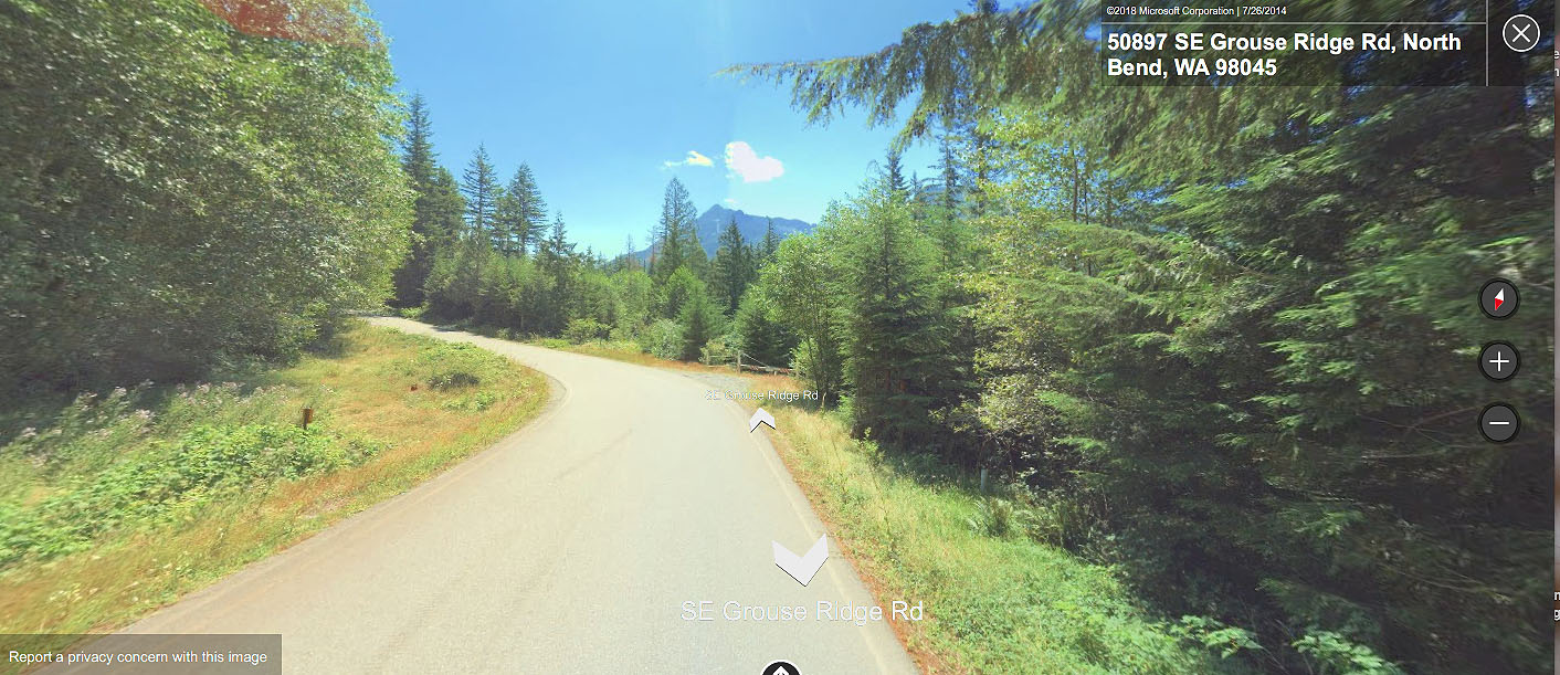
This shot was actually captured around 50897 SE Grouse Ridge Road, North Bend, Washington (47°27’01.0″N 121°40’28.5″W). It’s the only time this road was shown, so I’m guessing more footage from this sequence may exist.
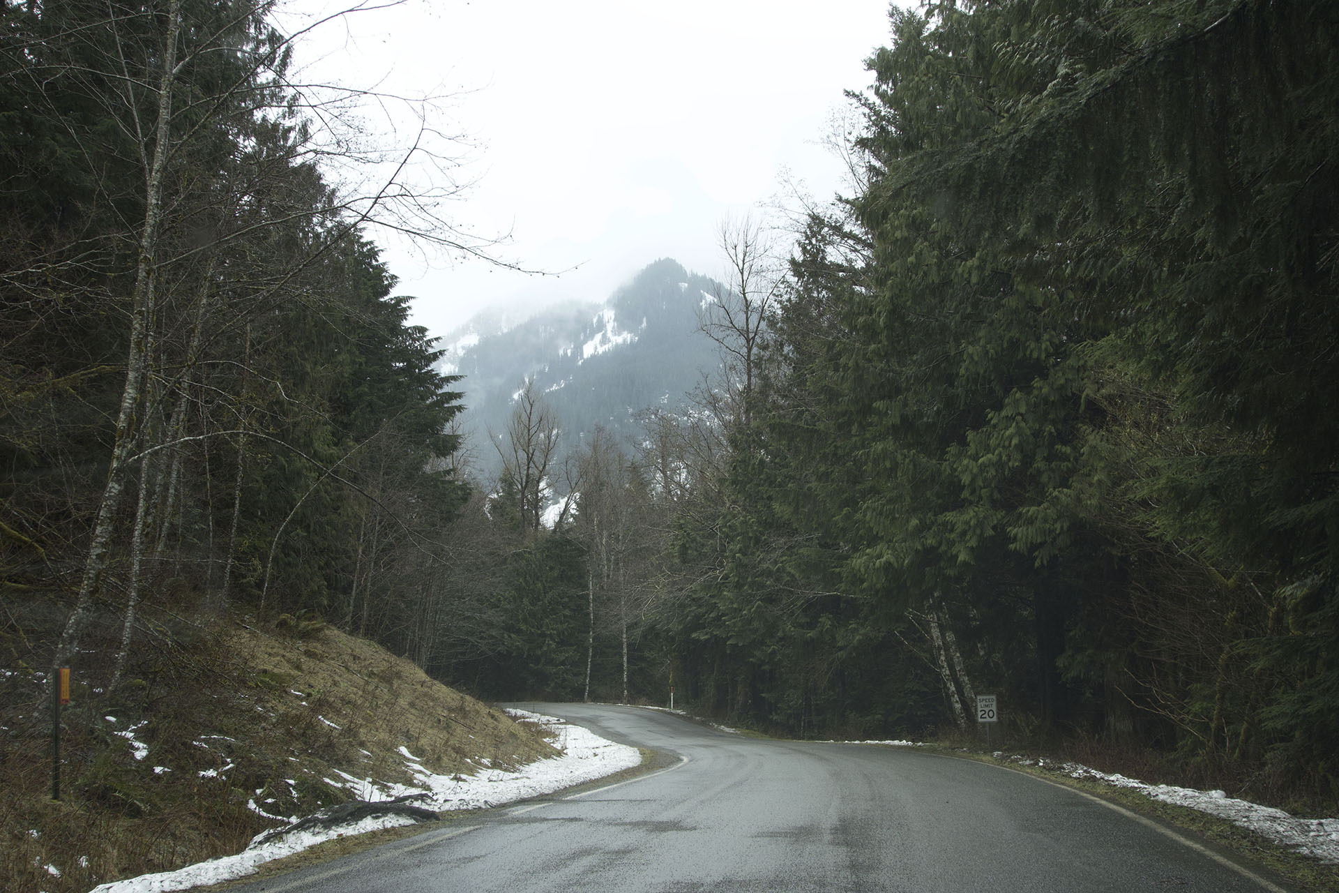
When I visited on January 24, 2020, the Grouse Ridge Road entrance near the Fire Training Academy was closed. I snapped this photo which sort of reminded me of the shot from the film.
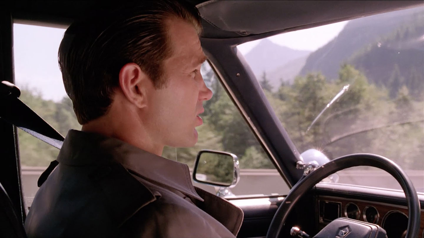
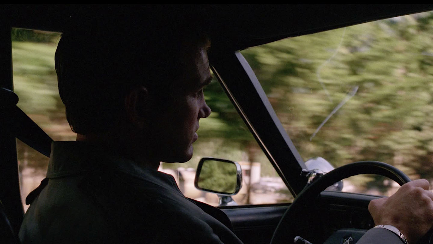
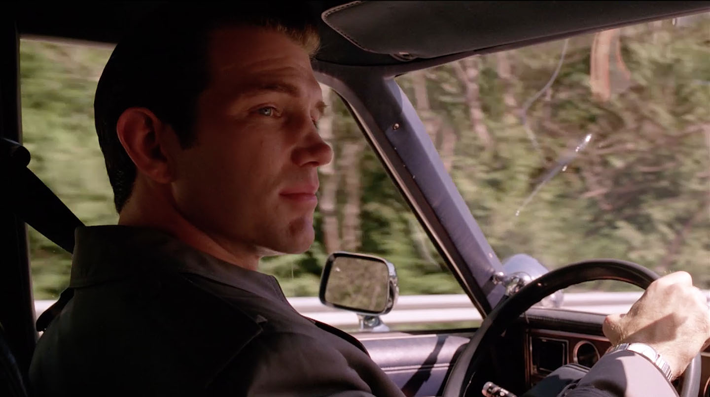
DESMOND DRIVES
The scene cuts to a close up of Agent Desmond driving and we are suddenly back on SE Homestead Valley Road (around 47°26’30.8″N 121°40’06.4″W). The clues were the giant mountain seen in the distance and the concrete barriers.
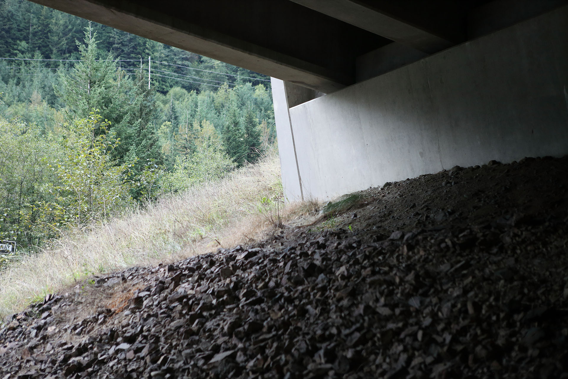
UNDER INTERSTATE 90
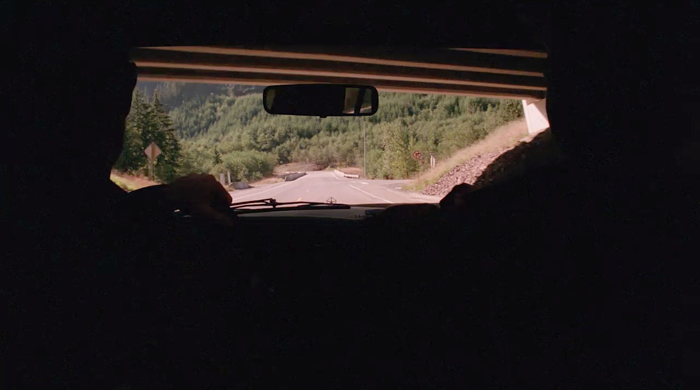
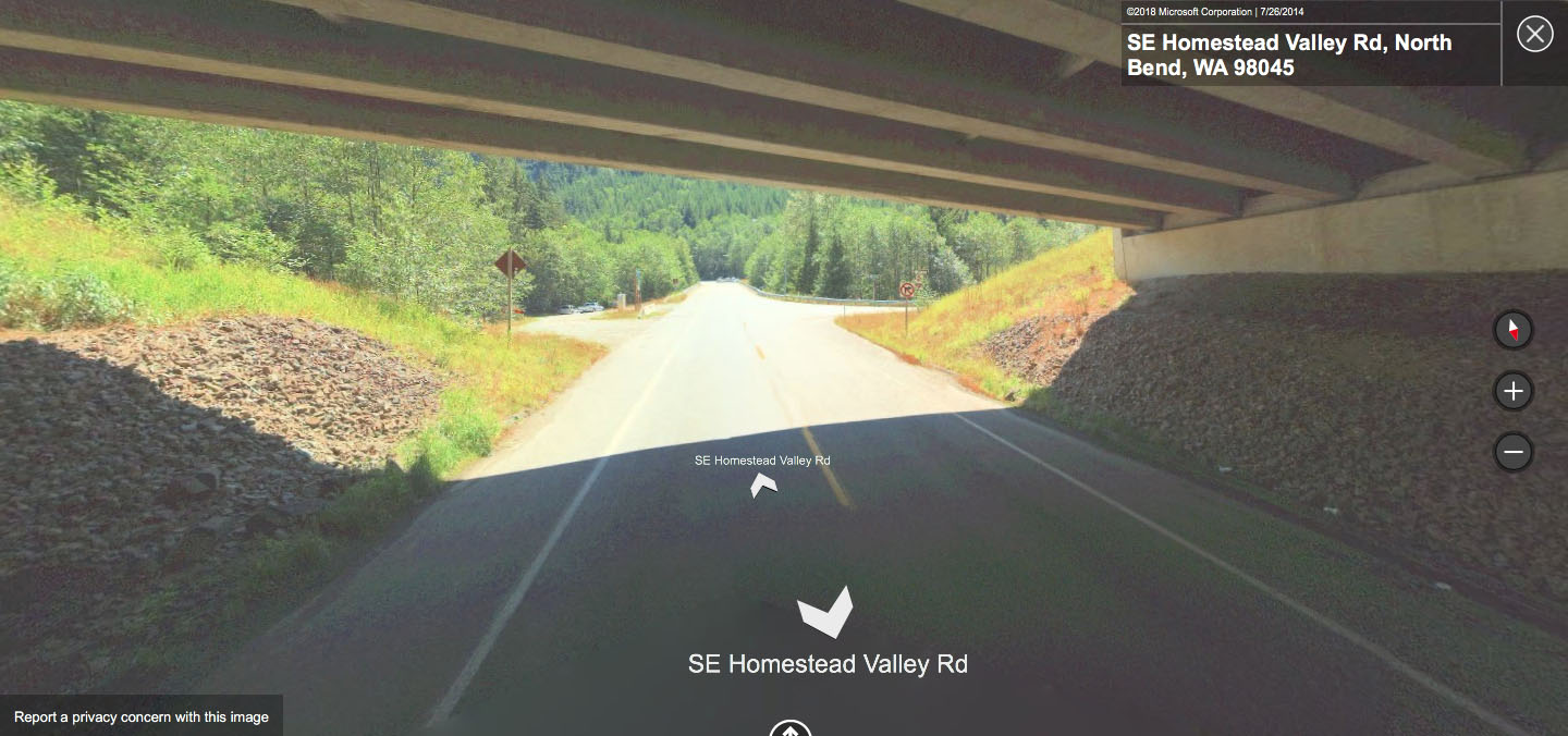
The scene cuts to an interior shot of the two Agents as they drive under an overpass, which is actually Interstate 90 (around 47°26’35.3″N 121°40’05.6″W).
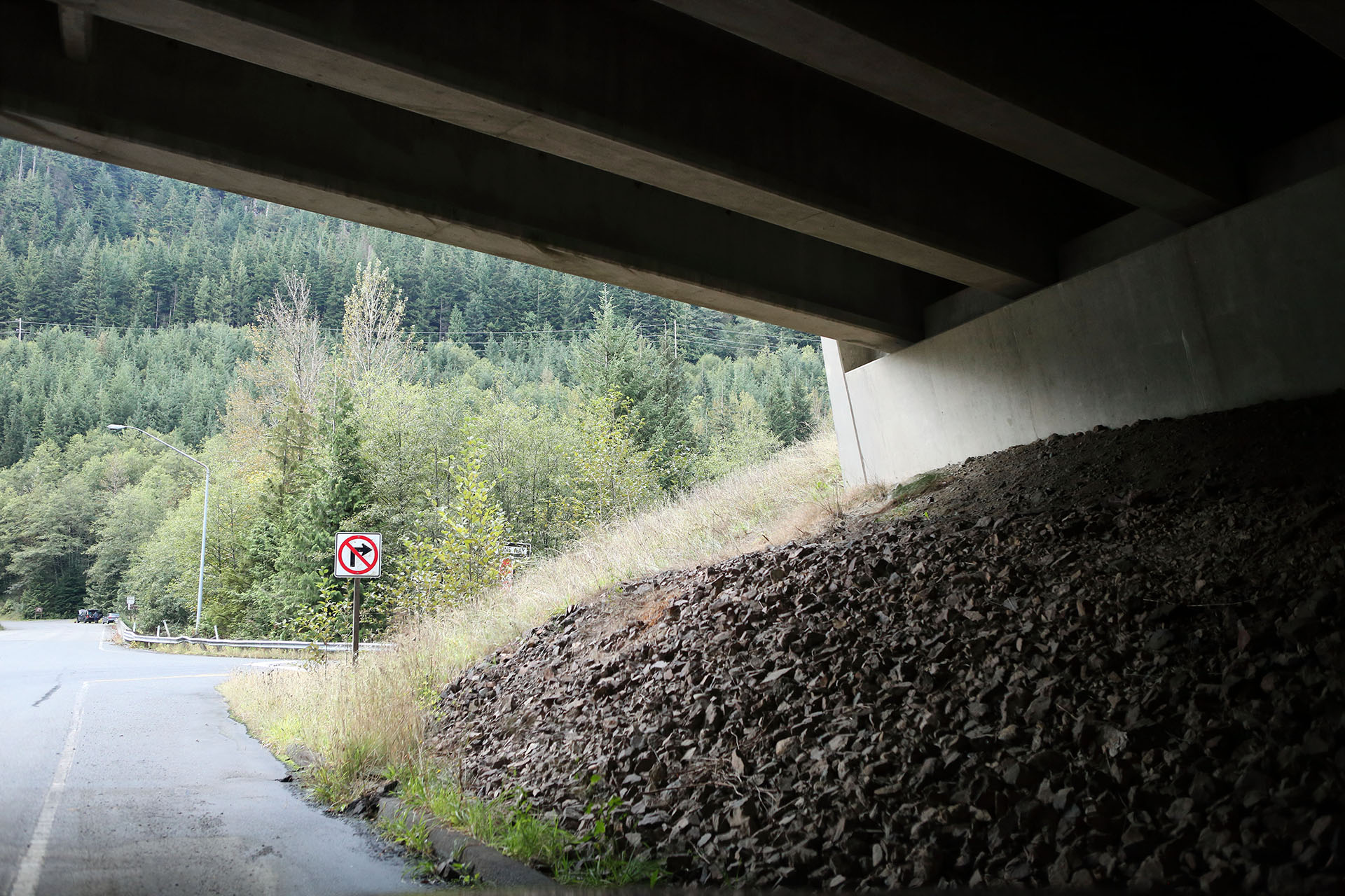
For whatever reason, I didn’t take the correct shot of the overpass. You can still see the “No Right Turn” sign.
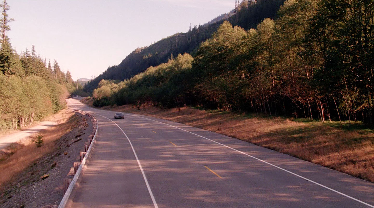
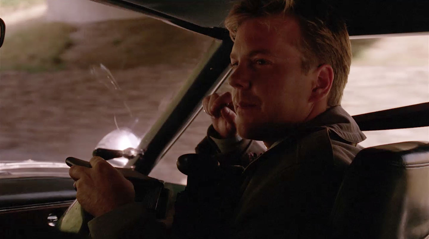
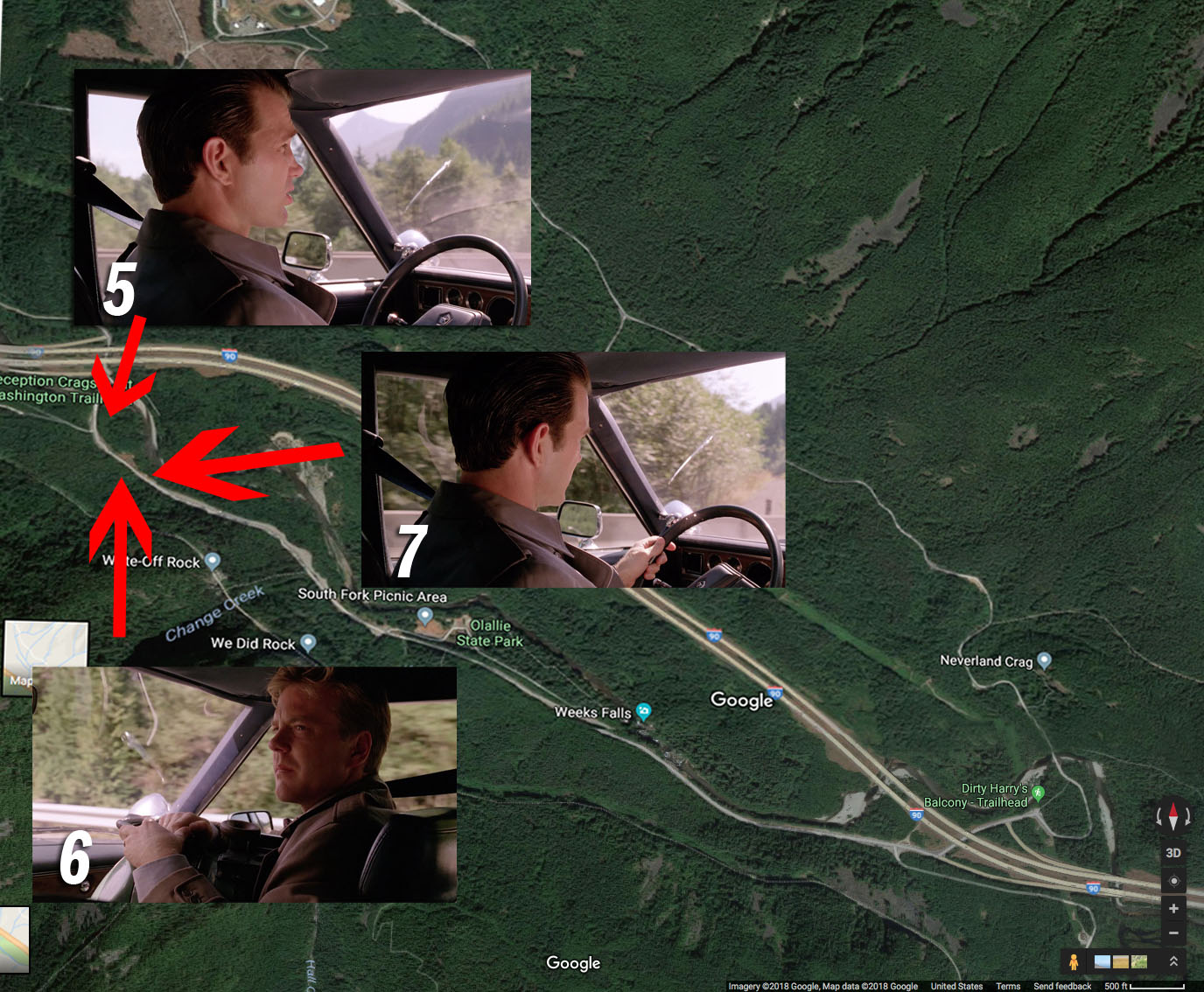
DESMOND AND STANLEY
The previous scene of Desmond driving takes place straight ahead in the Bing Maps image above. The edit also cuts back to Desmond driving (look at the mountain in the distance).
Reaction shot time with Agent Sam Stanley. Look at the guard rail in the background around 47°26’29.1″N 121°40’07.0″W. The scene continues along Homestead Valley Road.
MORE DRIVING
Notice the wooden marker on that appears above Desmond’s steering wheel. It helped me find the spot which has been covered with trees and grass since 1991 (around 47°26’28.7″N 121°40’06.8″W).
Headed toward that spot on September 18, 2019.
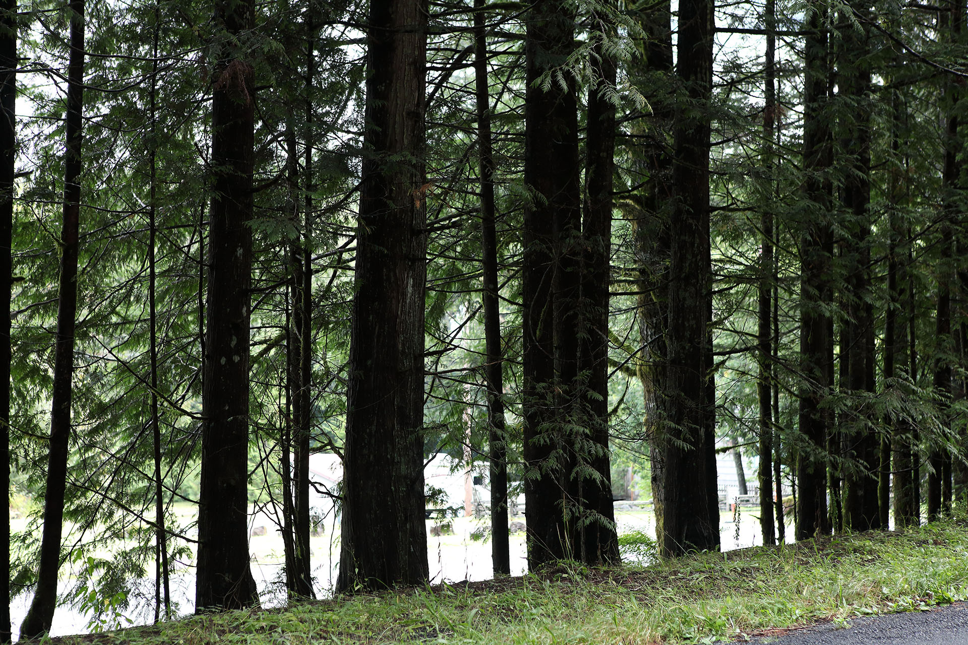
At first, I thought there were mobile homes outside the window but I soon realized they were vehicles parked at the entrance to Olallie State Park.
The scene was shot near these coordinates – 47°26’08.1″N 121°39’23.8″W.
The side road off SE Homestead Valley Road takes you to the entrance and parking for the South Fork Recreation Area and Weeks Falls Trail where many, many scenes were shot.
CONVERSATION CONTINUES
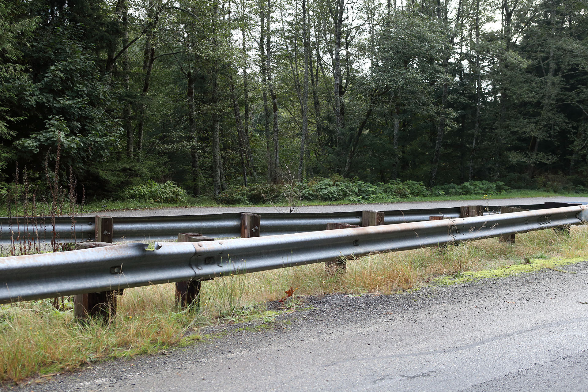
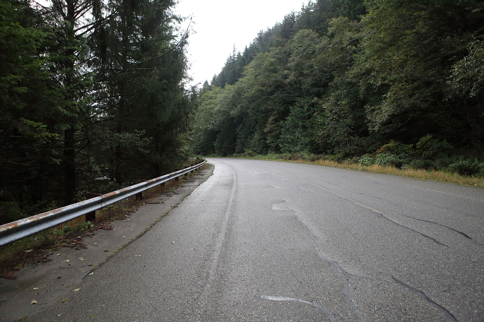
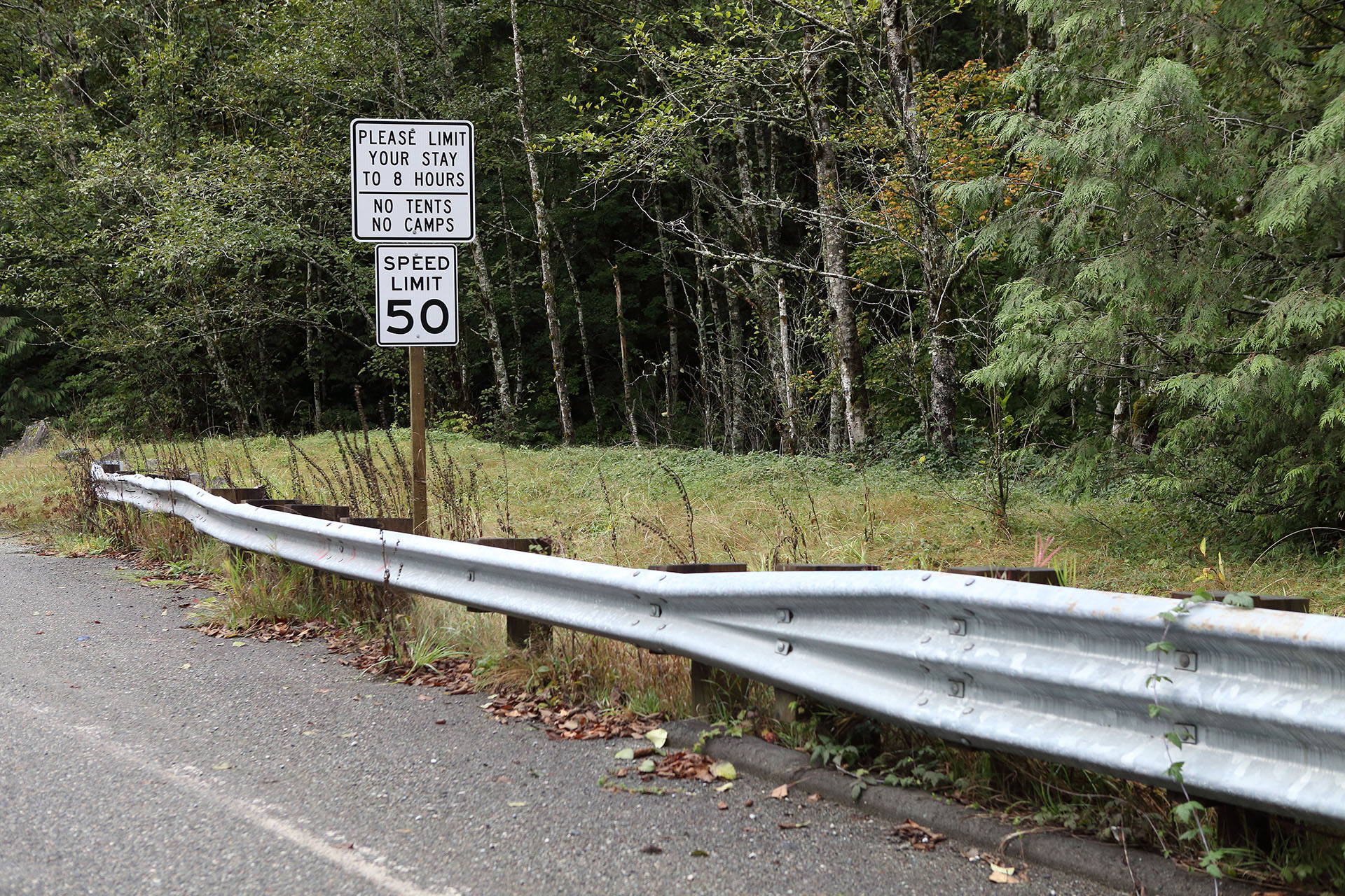
The conversation continues between the agents. You can see various guardrails out the window as they drive along.
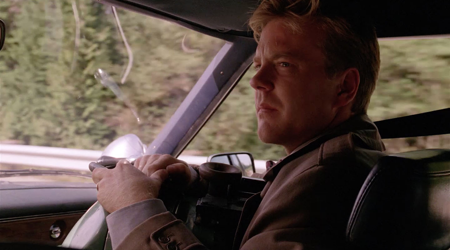
AGENT STANLEY’S REACTION
Suddenly, we see a reaction shot from Sam Stanley as they pass under I-90 again (around 47°26’34.4″N 121°40’06.0″W). Shortly after this shot, Agent Stanley mentions the “Blue Rose.”
I CAN’T TELL YOU ABOUT THAT
Agent Desmond remarked how Gordon said Sam was good, and this mostly closes out the reaction shots from inside the car. Shot happened around these coordinates – 47°26’07.5″N 121°39’20.4″W.
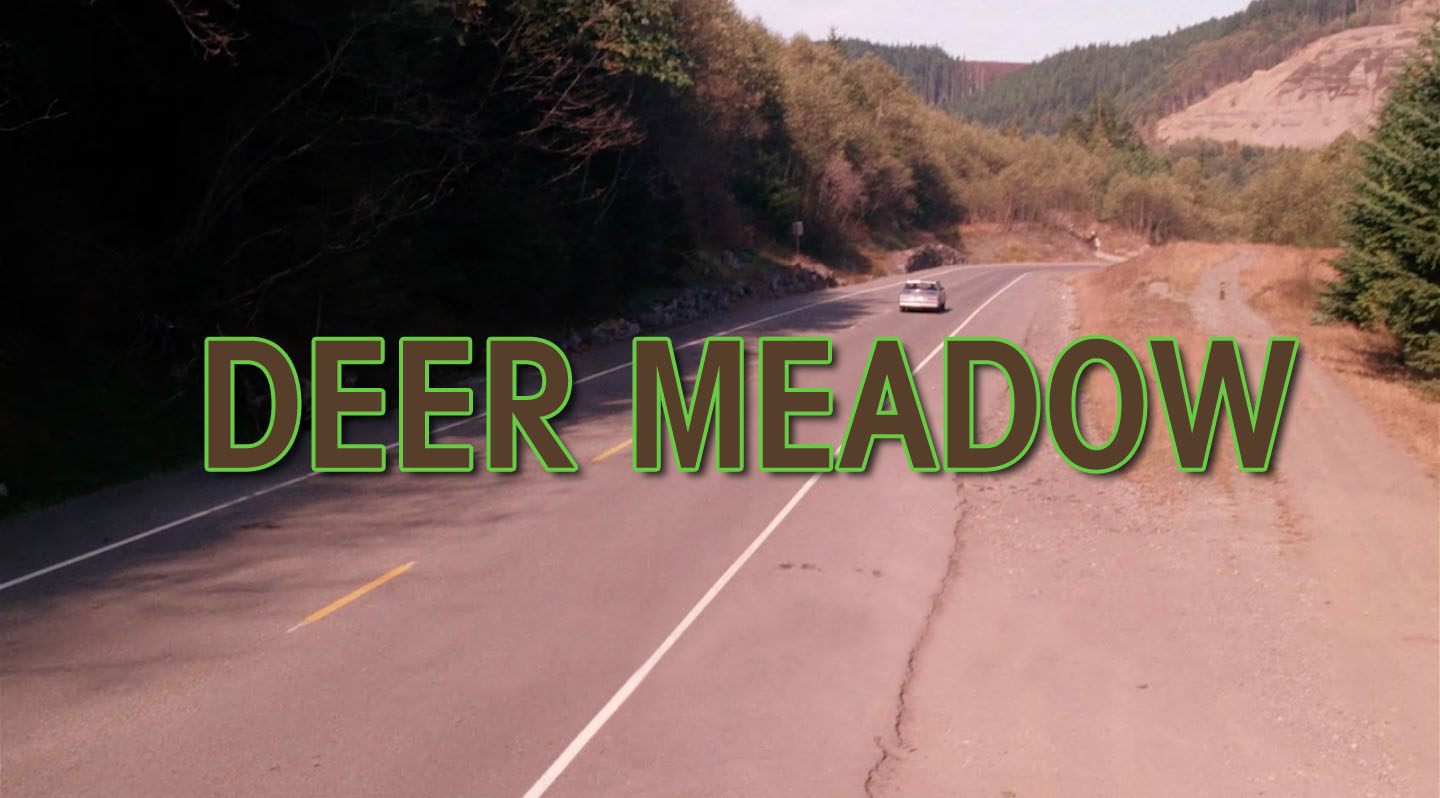
ENTERING DEER MEADOW
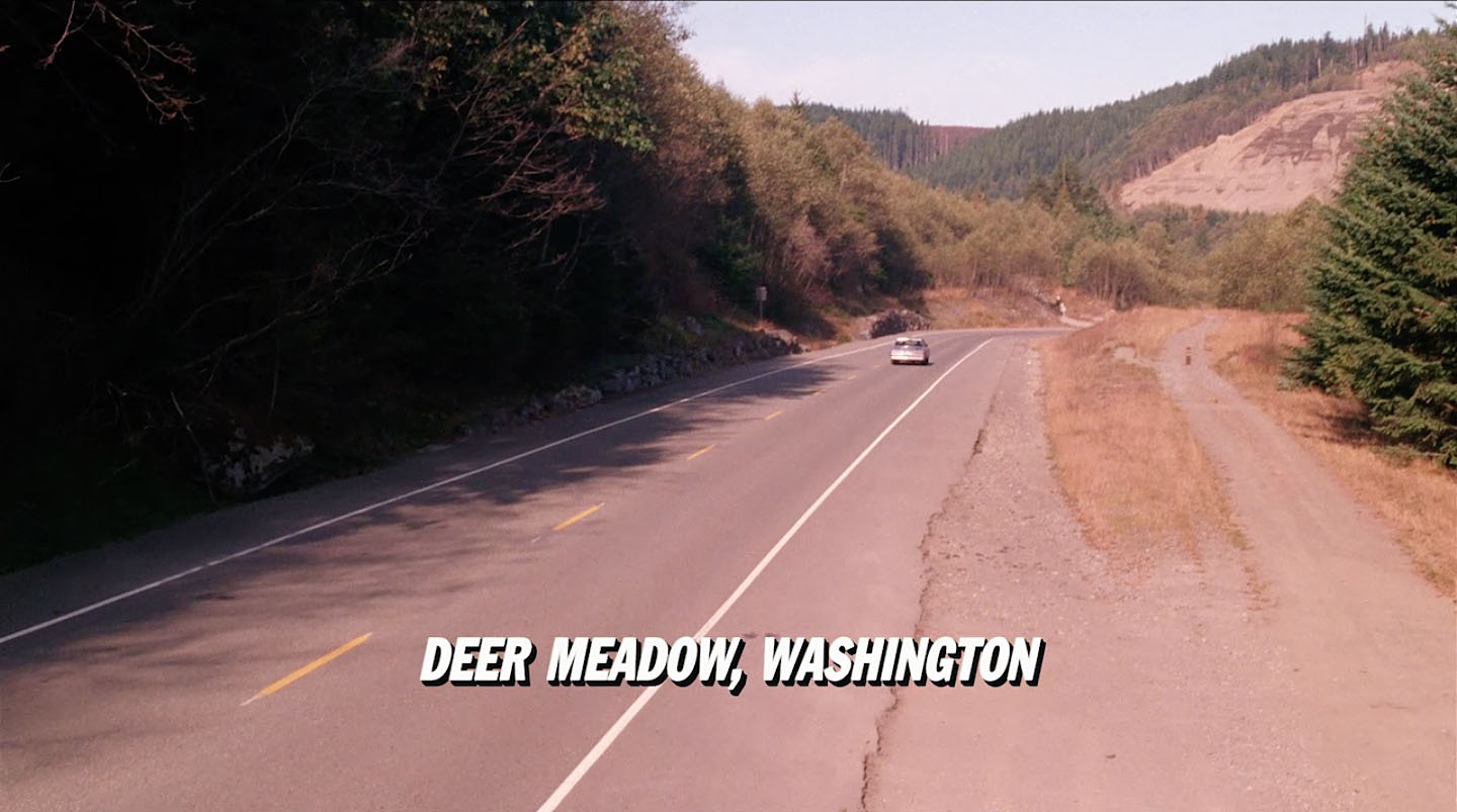
The scene closes with a shot of the Agents’ car passing by with “Deer Meadow, Washington” flashing on the screen. This scene was shot with the car driving in the opposite direction from all the previous interior shots. The wood post on the right side of the screen helped me identify the location.
Here is the tripod crane shot from my visit on September 18, 2019.
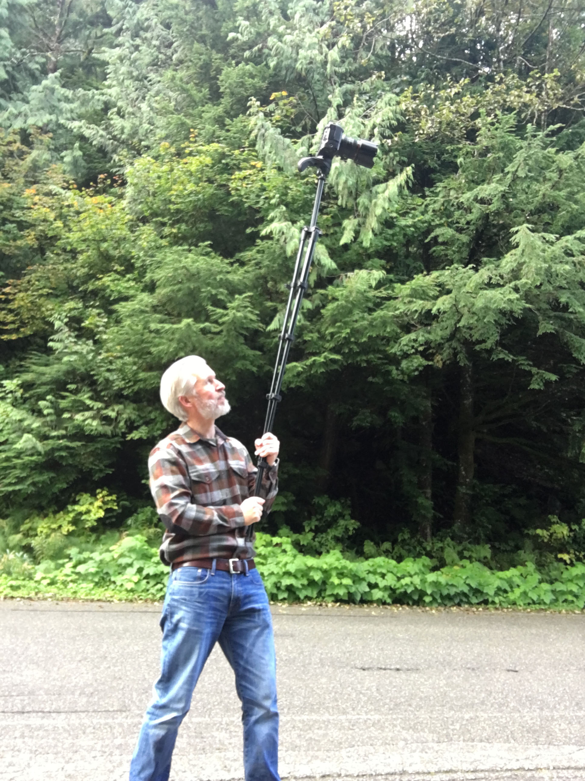
Here’s a behind-the-scenes shot of how I captured the image without a crane and high-reach vehicle.
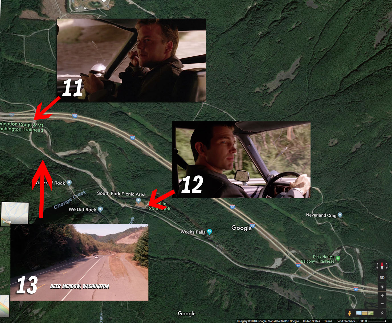
MAPS
Below are three images that show approximate locations where scenes took place. I added the scenes to an aerial view of the location from Google Maps.
I’m still anxiously awaiting the spinoff television series featuring these two. Wouldn’t that be something?!
Author
Discover more from TWIN PEAKS BLOG
Subscribe to get the latest posts sent to your email.